Salton Sea Tectonic Research

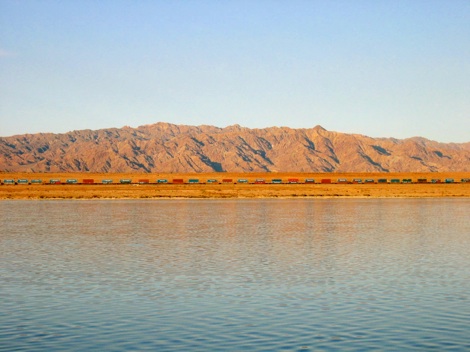
Salton Sea view looking east. Chocolate mountains are seen in the background.


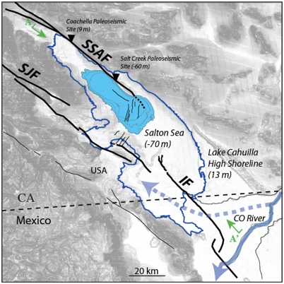
The Salton Sea is a large (~970 km2), shallow lake located in the central Salton Trough of Southern California. The lake covers the southernmost extension of the San Andreas Fault (SSAF), where the fault takes a southwestward step to the Imperial Fault (IF). The region around the SSAF is actively being stretched due to extensional deformation. Numerous faults, high levels of seismicity and a series of young volcanic buttes suggest this region may be a source for future geohazards.
Marine Paleoseismology
The Salton Sea offers an prime opportunity to perform marine paleoseismology along a section of the San Andreas Fault that is considered by many to be overdue for a large earthquake. Our goals are to define a detailed late-Holocene depositional framework and deformation history within the submerged portion of the San Andreas-Imperial Fault (SAF-IF) pull-apart basin (left). We examine coseismic deformation preserved in Lake Cahuilla sediments to obtain constraints on the earthquake history, slip-rates and sedimentation history using detailed analysis of >1,000 line-km of seismic CHIRP profiles. We also compare paleoearthquake records beneath the Salton Sea with those observed along onshore fault systems, namely the SAF.

Figure 1. Tectonic setting of the Salton Sea region. A topographic cross-section (A-A’) is shown below. Note the relative elevation between onshore paleoseismic sites and the Salton Sea, which is located at the basin depocenter.


