Hiking trips
2025: North Col and Gabbott Pass Loop
2025: Matterhorn Peak Climb
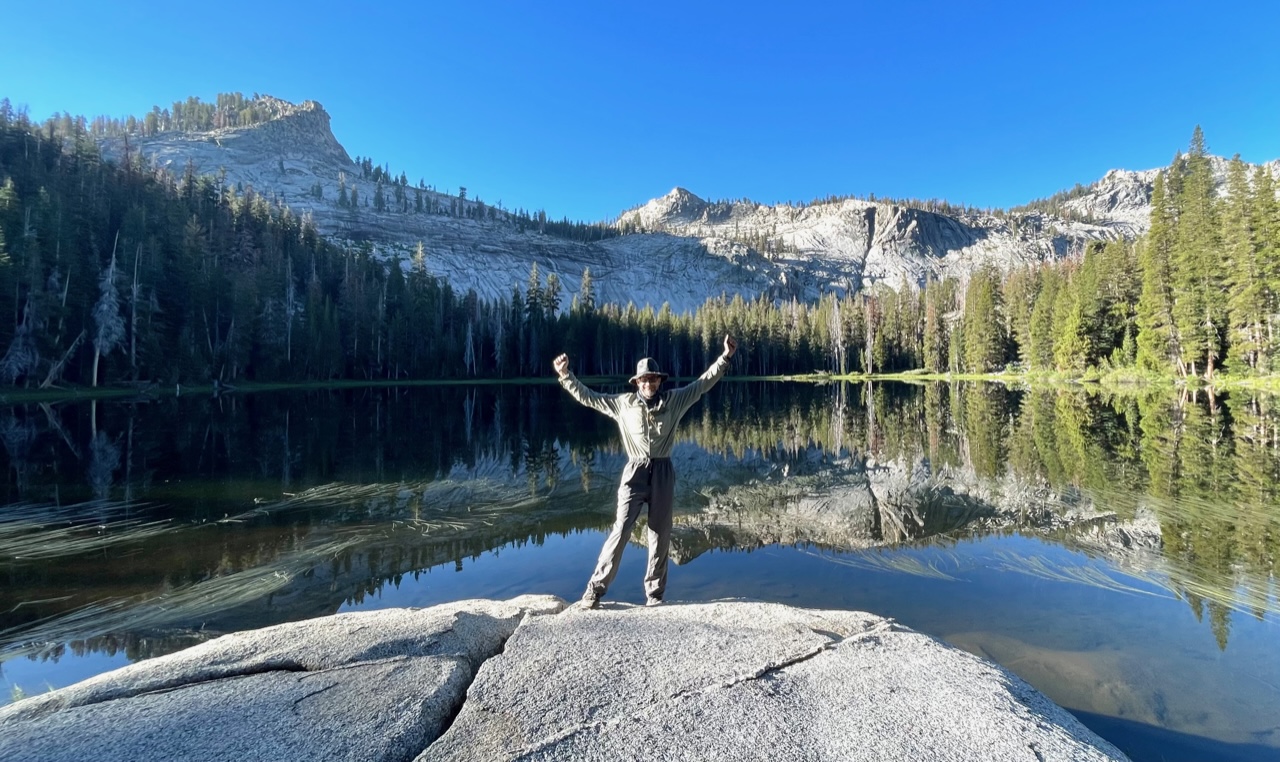
2025: Olympics Grand Valley
2024: Emigrant Wilderness
2023: Sequoia Elizabeth Pass Loop
2023: Desolation Wilderness
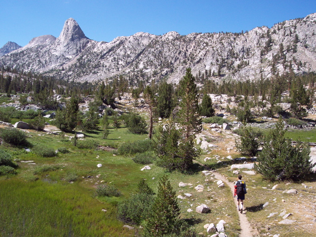
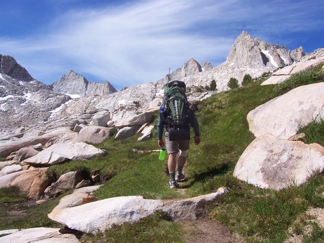
2022: Pine Valley to South Lake
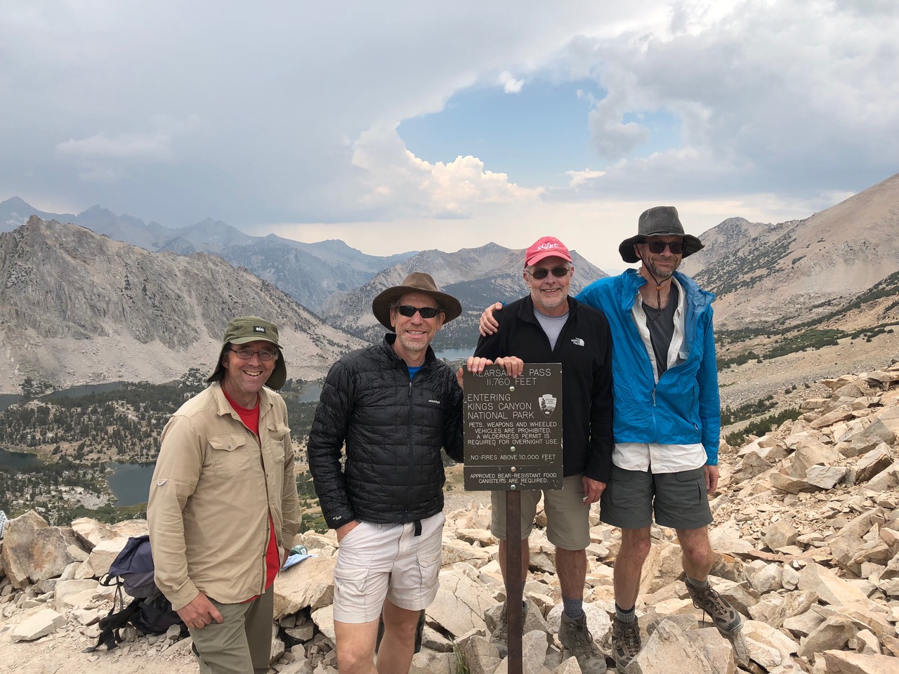
2022: Onion Valley to Taboose Creek
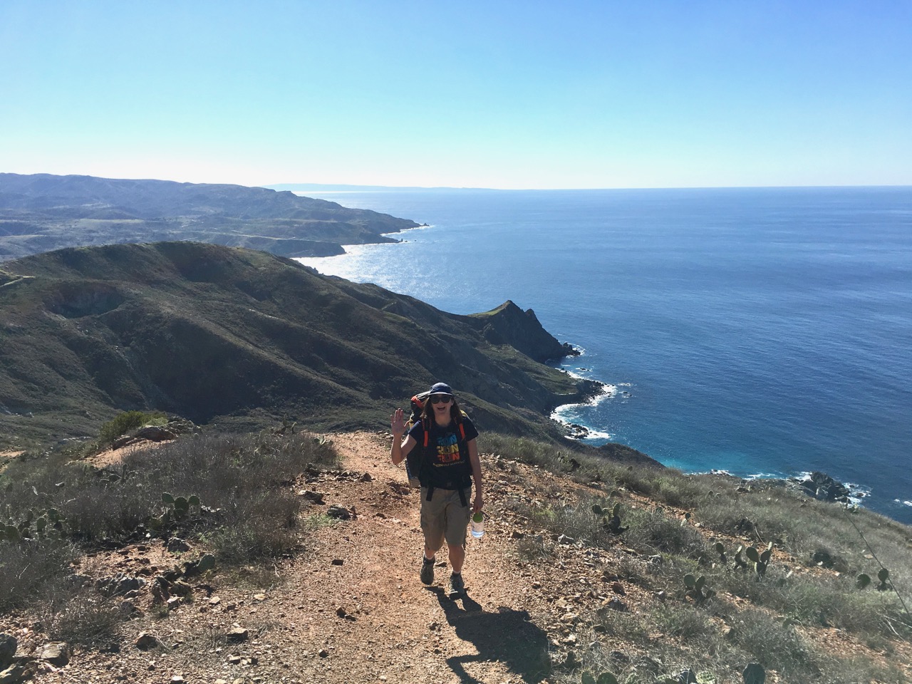
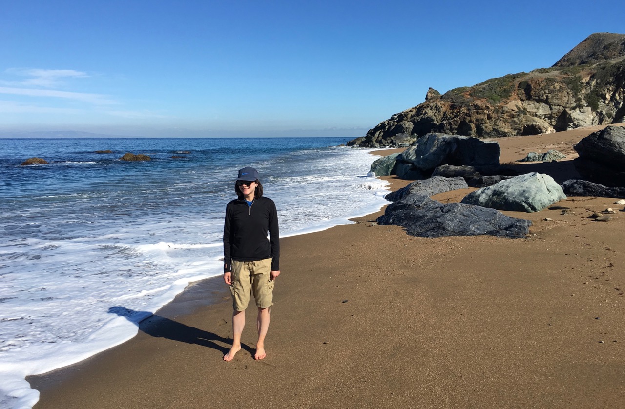
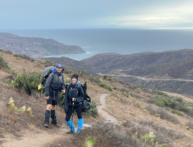
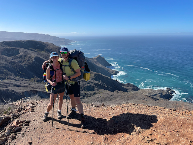
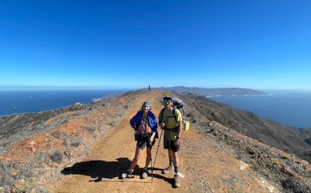
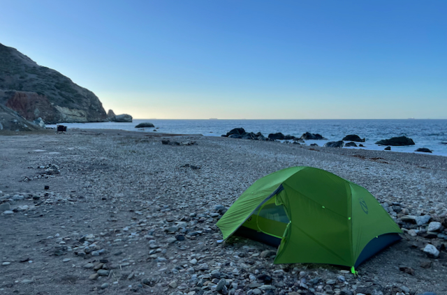
2021: Trans-Catalina Trail
2021: Hoover/Yosemite Loop
2021: Grand Canyon
2020: Northern Yosemite Semi-Loop
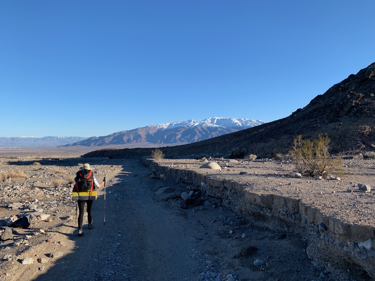
2019: Death Valley Cottonwood to Marble Canyon Loop
2019: Mid-Yosemite Semiloop
2018: Trans-Catalina Trail
2018: Onion Valley to Shepherd Pass
2018: Lost Coast
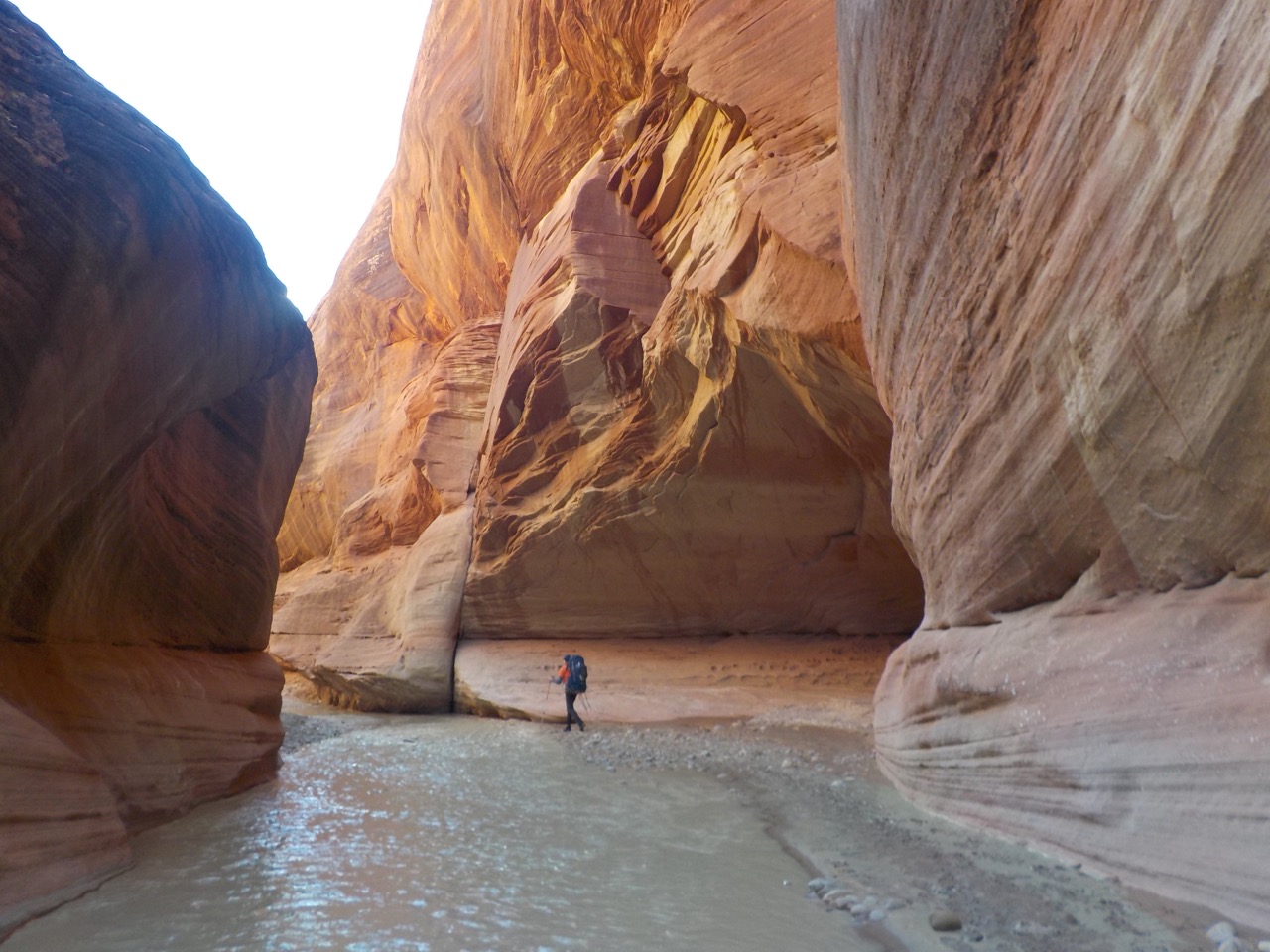
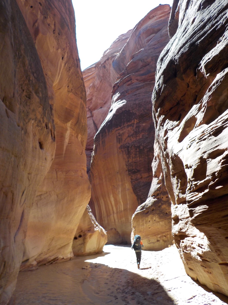
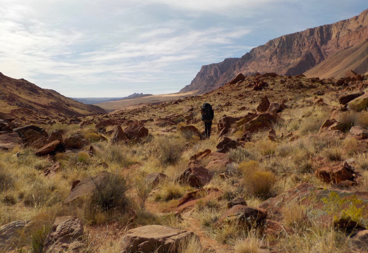
2018: Paria Canyon
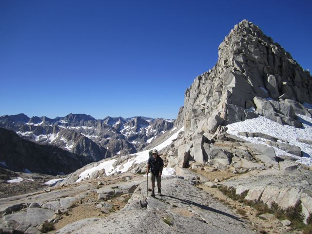
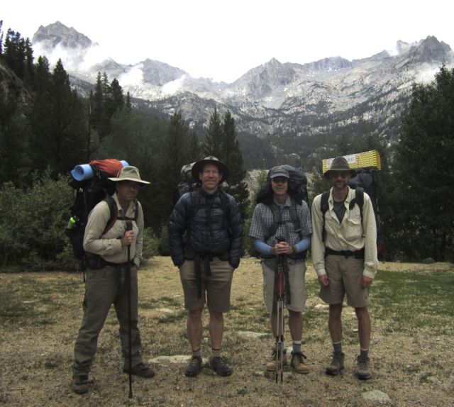
2017: Mammoth to Pine Creek
2016: Mineral King Northern Loop
2016: Cottonwood/New Army Pass Loop
2015: Northern Yosemite Loop
2014: South/North Lakes Loop
2014: Grand Canyon
2013: Pine Creek to North Lake
2011: Onion Valley to South Lake
2010: McGee Creek to Mosquito Flat
2009: Mt. Fuji
2009: Lake Italy
2008: Crabtree Pass/Miter Basin
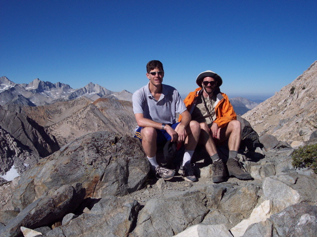
2007: Palisades Loop
2006: San Gorgonio
2005: Rae Lakes Loop
2004: Mineral King Loop
2003: Cottonwood Lakes Loop
1998: Onion Valley to Whitney
1997: South/North Lakes Loop
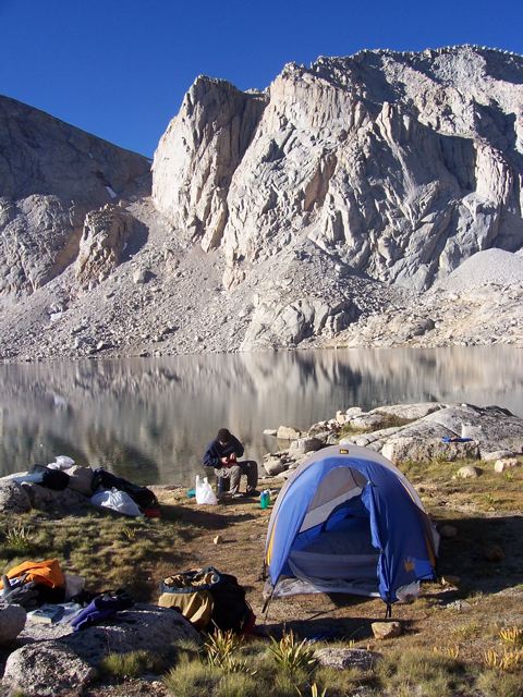
1995: Rae Lakes
Onion Valley to Rae Lakes, eastern Sierra
David Sandwell
and I spent 4 days in September, 1995, hiking from Onion Valley to Rae Lakes. We camped for two nights at Rae Lakes and tried to climb Clarence King as a day hike. We got to the saddle just south of the summit but had to turn back for lack of time.
 The view of Fin Dome from our tent.
 David hiking up to Glen Pass from north on final day.
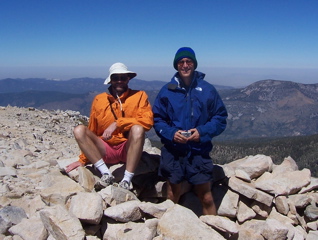
South Lake to North Lake loop, eastern Sierra
David Sandwell
and I spent a week in September, 1997,
hiking the loop from South Lake to North Lake through the
Evolution Valley region. Highlights including climbing Black Giant and Mt.
Darwin and getting snowed on when we camped at
Evolution Lake.
 On Mt. Darwin, elev. 13,830 (no, we didn't climb the exposed summit pinnacle behind us!)
 David hiking with Mt. Humphrey's in background.
Onion Valley to Whitney Portal, eastern Sierra
In mid-September, 1998,
David Sandwell and I hiked
from Onion Valley over Kearsage Pass and then south
over Forester Pass and then over Mt. Whitney. We
had good weather on this trip, except it wasn't cold
enough yet to have killed the mosquitoes. Climbing
Mt. Whitney on the final day was the high point of
the trip. This is a good way to climb Whitney as by
this time we were used to the altitude. Most of the
people we saw on the Whitney trail looked pretty
miserable!
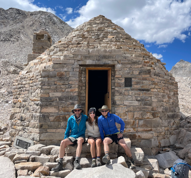
 At Forester Pass, the highest pass on the John Muir Trail
(13,200 ft.)
At Forester Pass, the highest pass on the John Muir Trail
(13,200 ft.)
 David atop Mt. Whitney, Owens valley in background.
Cottonwood Lakes loop, eastern Sierra
In August, 2003,
David Sandwell and I hiked
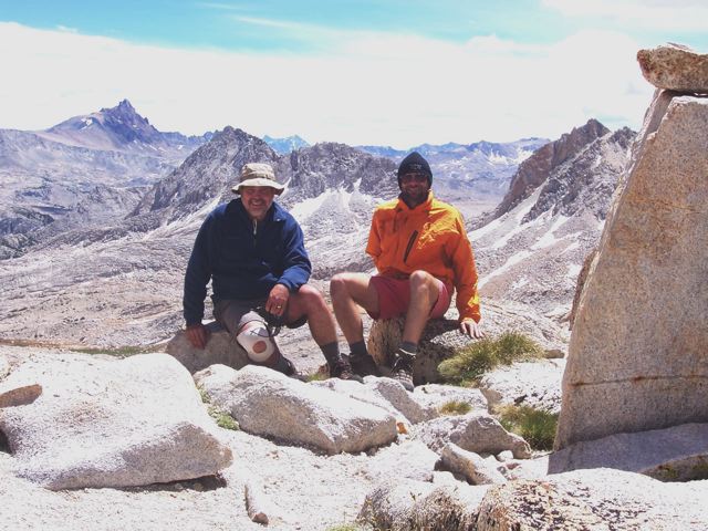
over Cottonwood Pass to Rocky Basin Lakes and then cross-country north to upper Rock Creek and returning back over New Army Pass. We bagged Johnson Peak and Mt. Langley along the way. Weather was great. Someday I'd like to try doing a loop out of Cottonwook Lakes that would go up Mitre Basin and then connect to Crabtree Ranger Station.
 David atop Mt. Langley (14,027 ft.)
 That's me, on the trail down from the east side of New Army Pass.
Mineral King loop
In August, 2004,
John Vidale and I did a three-night trip out of Mineral King in Kings Canyon National Park. We went east over Franklin Pass and then back over Sawtooth Pass. A very nice trip although the road to Mineral King is pretty tedious to drive.
 John and me atop Florence Peak (12,432 ft.) near Franklin Pass.
 Sunset at Sawtooth Peak and Lake.
Rae Lakes Loop
In August, 2005,
John Vidale and I hiked the Rae Lakes loop (Kings Canyon National Park) from the west side. The mosquitos were really bad but the scenery was beautiful. We got car-fever at the end and hiked the 20 miles from Rae Lakes in a single day--my calves hurt for a week afterward.
 John hiking up toward Fin Dome and Rae Lakes from the north.
 John and me atop Glen pass (11,978 ft.).
San Gorgonio
This summer (2006) I did not manage to schedule a backback trip, but since I turned 50 in July, I wanted to do something to mark the occasion, even if only for a day. I had never hiked up San Gorgonia (the highest mountain in southern California) so this seemed like a good goal. Fortunately, my friend Mark Burnett (a youthful 47) was easily persuaded to join me. On September 16, we got on the Vivian Creek trail at about 7 am and made it back to the car at 6 pm. Up over a vertical mile in about 8 miles of trail (and then back down again). Not bad for an old man.
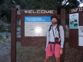 Me at the trailhead.
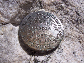 The USGS benchmark.
 Me and Mark on the summit.
Palisades Loop
In August, 2007,
David Sandwell,
his son Nick, and I hiked for 6 days out of South Lake. We went over Bishop Pass into Dusy Basin, then descended to the John Muir Trail and hiked south to Palisade Lakes. We returned to Dusy Basin via three Class 2-3 passes: Cirque, Potluck and Knapsack, just west of the Palisades crest. We had good weather and no mosquitos! There was some smoke the first couple of days from a fire near Santa Barbara.
 Me hiking in Dusy Basin.
 At camp beneath North Palisade.
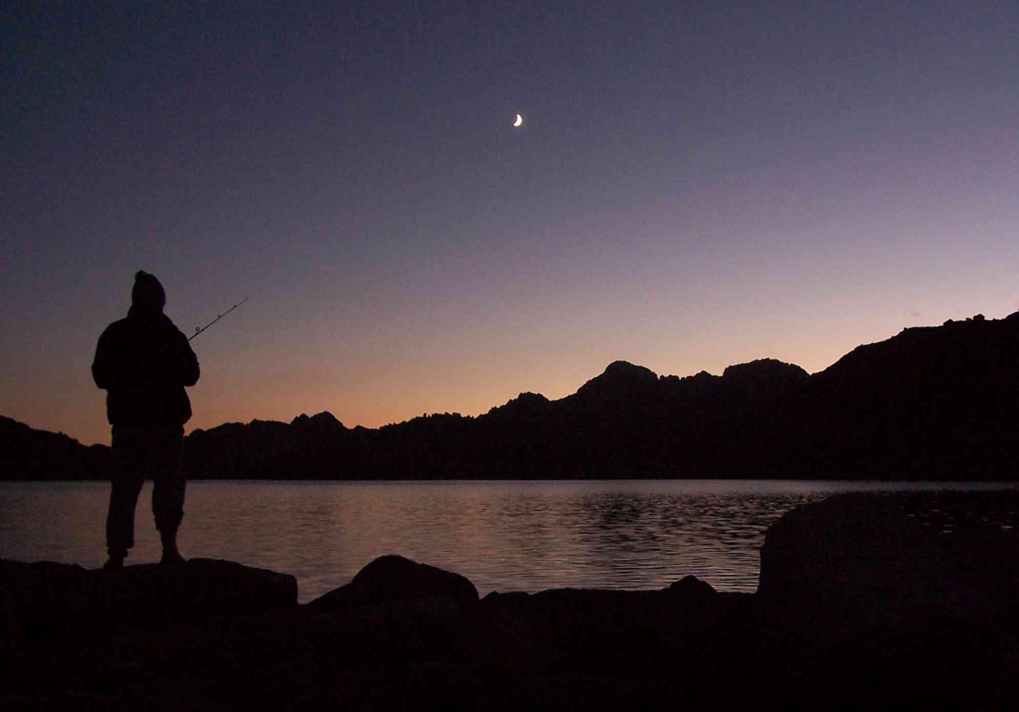 David fishing at dusk.
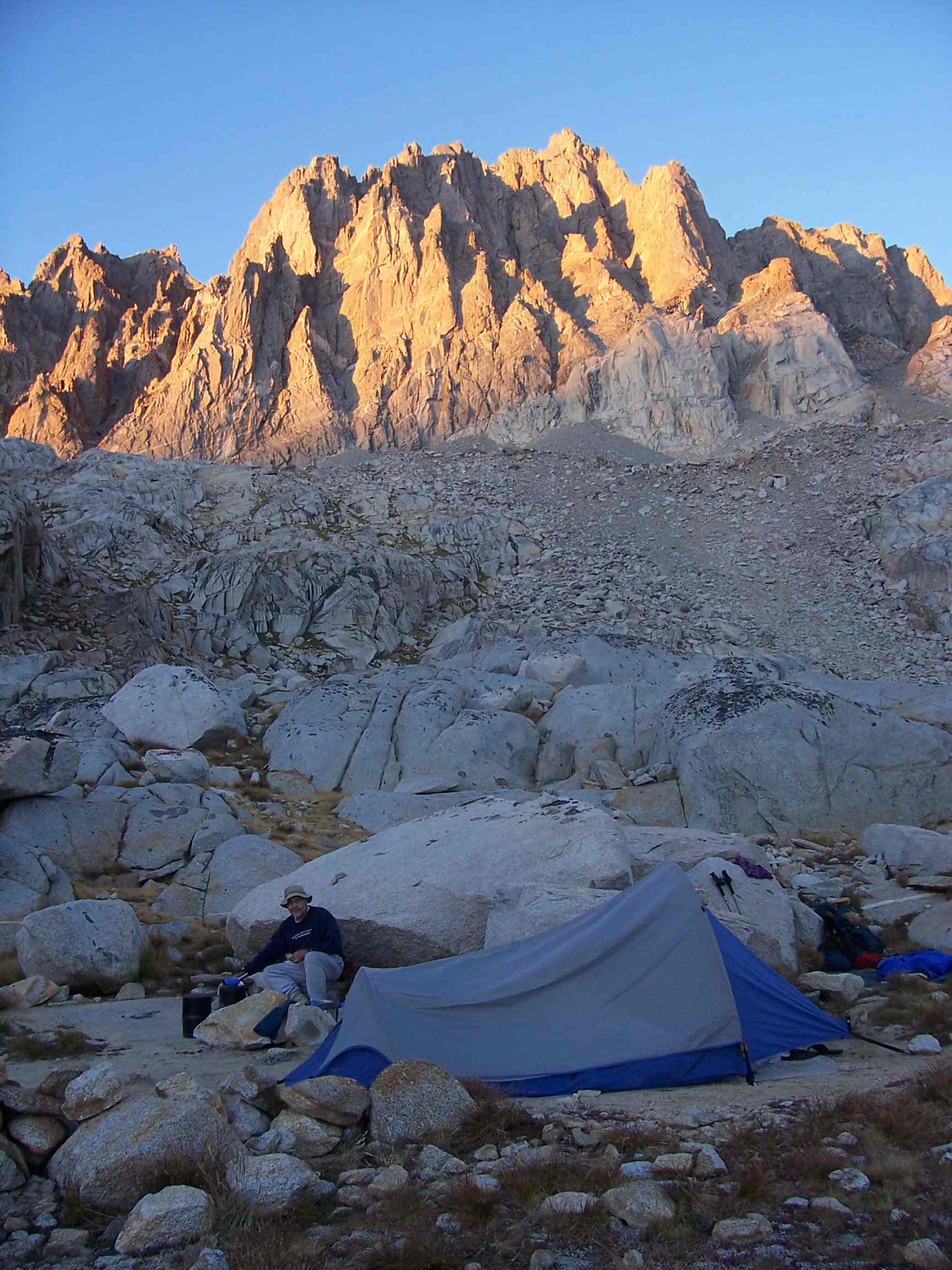
Crabtree Pass/Miter Basin
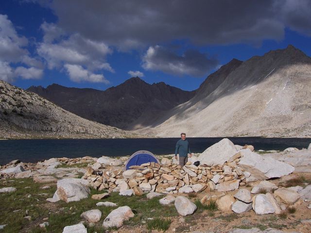
From August 29 to Sept. 3, 2008,
David Sandwell and I hiked for 6 days out of the Cottonwood Pass trailhead. We camped at Chickenspring Lake the first night, Rock Creek, Crabtree Lake, Sky Blue Lake, and Chickenspring Lake again on the way out. This was a semi-loop trip using Class 2 Crabtree pass to get into Miter Basin on the way back. We had excellent weather, no mosquitoes, and no real problems other than mild altitude sickness the first night or two. My left knee gave out on during day 5 on a big down step, which worried me, but it was much better the next morning. The entire Miter basin area is exceptionally beautiful. We did a day hike to Iridescent lake from Sky Blue Lake.
 Camping near upper Crabtree Lake.
 David hiking above Crabtree Lakes.
 David and me atop Crabtree Pass.
 Me in Miter Basin.
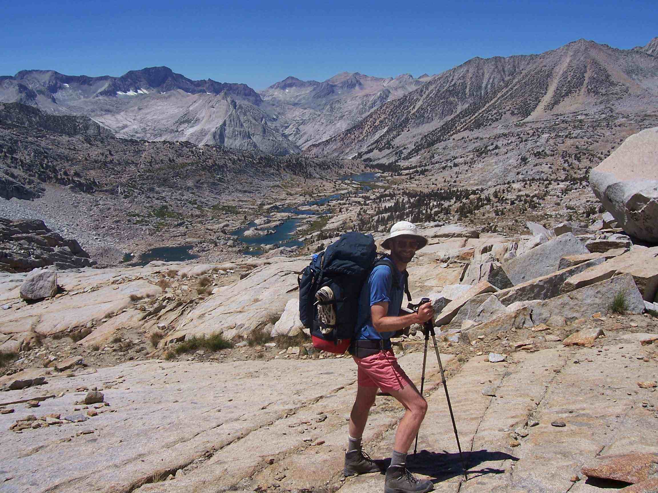
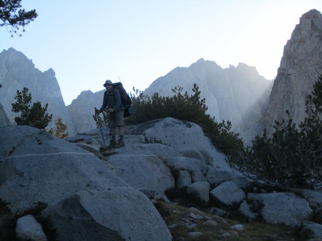
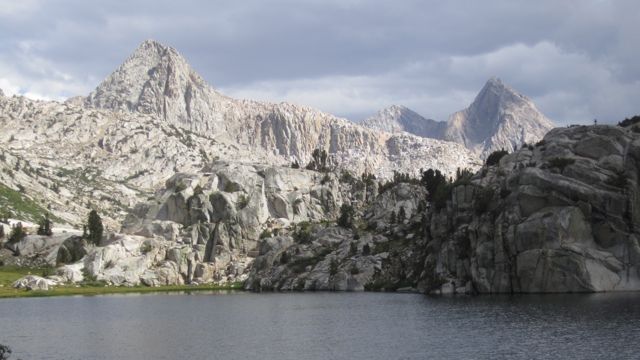
Lake Italy
From August 3 to 7, 2009,
David Sandwell and I hiked for 5 days out of the Pine Creek trailhead. We camped at Lower Pine Lake the first night, Lake Italy for nights 2 and 3, and Granite Park on night 4. This was an out-and-back trip over Italy Pass to get to Lake Italy.
We had strange weather for August--a cold front blew through and it was very windy at Lake Italy. It was 26 degrees the morning of our last night in Granite Park.
 David hiking in Granite Park.
 David and me atop Italy Pass, Mt. Humphreys at back left.
 Our camp at Lake Italy. The stone wall helped with the wind.
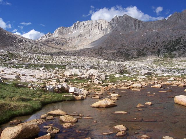 Mt. Abbott from Toe Lake.
Mt. Fuji
On August 29/30, 2009, I climbed Mt. Fuji with my daughter Rachel,
ERI's
Satoko Oki (who arranged the trip) and Sawako Miyabayashi.
It was quite an experience, not a wilderness experience
(you don't climb Fuji during the July/August climbing season for that),
but an experience in taking part in a shared, almost ritualized,
communal climb with thousands of other people. We left on Saturday
from Kawaguchiko 5th Station (2300 m, ~7500 ft) at about 1 pm and
arrived at our hut at the Yoshidaguchi 8th station (3350 m, ~11,000 feet)
at nearly 7 pm. After sleeping for a few hours, our group started
out again at 1 am and reached the summit (3776 m, 12,388 ft)
before dawn and had time to walk around the crater. The sunrise
from the top was spectacular. The knee-grinding descent was
more tiring than the ascent because we had to meet our bus at 9:30 am.
But the payoff was going to a Japanese bathhouse to get cleaned up
before having lunch on the way back to Tokyo.
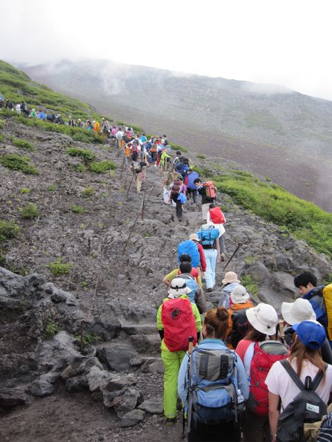 The crowd ascends. It was this density all the way up.
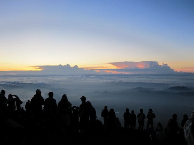 Sunrise from the summit.
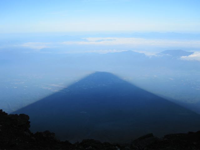 Looking west just after sunrise, you can see the shadow of Mt. Fuji.
McGee Creek to Mosquito Flat
From August 11 to 16, 2010,
David Sandwell and I hiked for 6 days from the McGee Creek trailhead. We crossed McGee pass, Grinnell pass (aka
Pace Col), and Mono Pass, exiting at Mosquito Flat. We camped at McGee creek, Tully Lake, Grinnell Lake, the Second Recess and Fourth Recess Lake.
Donna Blackman joined us the last night and gave us a ride back to our car. A highlight was seeing the Perseid meteor shower early Friday
morning--lots of bright ones! The weather was good but we suffered from more mosquitoes than usual--perhaps a result of a wet spring.
 David and me atop Grinnell Pass (Pace Col).
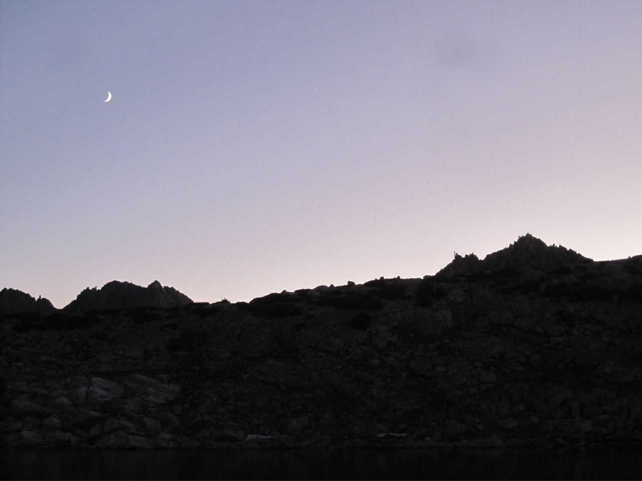 The setting Moon and Venus from Grinnell Lake. Does anyone know what the amazingly skinny pinnacle is called on the skyline? From our campsite, Venus set exactly in the narrow notch to the right of the pinnacle!
 Red and White Mountain from Laurel Creek.
 Fourth Recess Lake at dusk.
 Donna, me, and David atop Mono Pass.
Onion Valley to South Lake
From August 23 to 30, 2011,
David Sandwell and I hiked for 8 days out of Onion Valley. We crossed eight passes, including
Kearsage, Glenn, Pinchot, Mather, Cirque, Potluck, Knapsack and Bishop. We hiked about 55 miles with
our packs, and an additional 10 miles in day hikes. We arranged a car shuttle the first day so that
we could leave our car at South Lake for our return. The weather was good, excepting one afternoon thunderstorm with some hail, and
the temperature never dropped below 36 degrees even for our camps above 11,000 feet. A highlight was the fishing at Bench Lake and
climbing Mt. Sill (14,153 ft), which has an exceptional view. On our trips we have now seen the entire John Muir Trail south of
Piute Canyon. We met a lot of JMT through hikers on this trip.
 David and me in Upper Basin.
 David atop Mt. Sill, looking north.
 David and me atop Mt. Sill, looking southwest.
 Showing some exhurbence on the way down from Mt. Sill.
 David atop Potluck Pass.
 David in Dusy Basin.
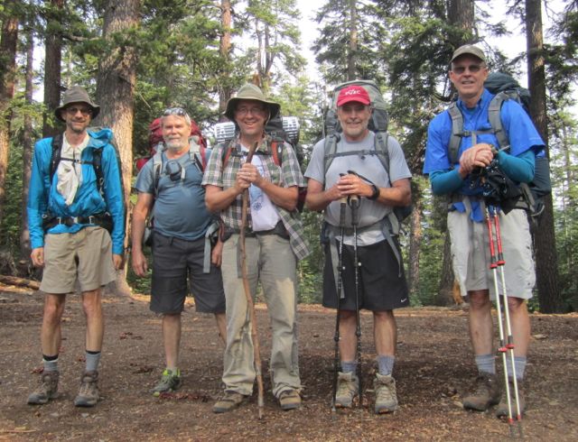
Pine Creek to North Lake
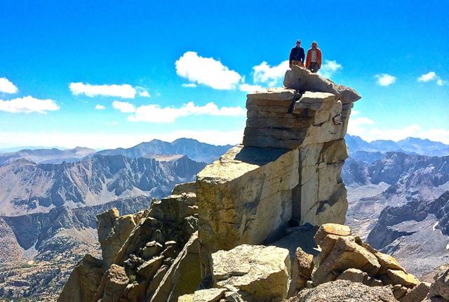
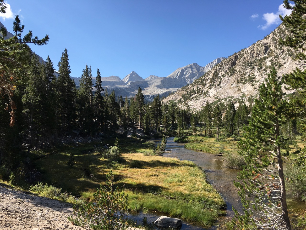
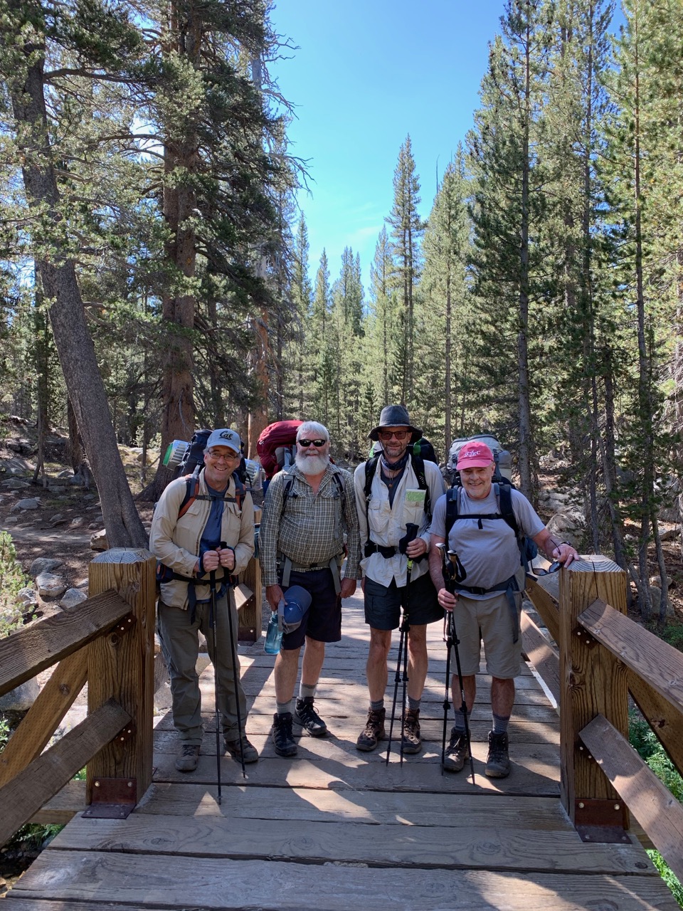
Following a backpacking hiatus in 2012 (owing to unfortunate timing in buying a house), from August 2 to 8, 2013, I joined David Sandwell, Rick Aster, Tim Parker and Rob Mellors on a 7 day trip out of Pine Creek. We camped at Honeymoon Lake, Royce Lakes, Steelhead Lake, lower Humphrey's Lake (2 nights) and Muriel Lake. We left a car at North Lake, so this was a one-way trip. The weather was good except for some moderate smoke from the Aspen fire the first few days. Most of the trip was cross-country, including Royce Pass and a pass south of Star Lake. I don't know exactly how far we hiked because my GPS ran out of batteries. Highlights were the fishing, which was good at most of the lakes, and climbing Mt. Humphreys (13,986 ft).
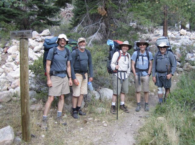 Me, Tim, Rob, Rick and David at the start.
 Mt. Merriam from our tent at Royce Lakes.
 Hiking near Desolation Lake, Mt. Humphreys in distance.
 Atop Mt. Humphreys.
 Rick starting rappel off Mt. Humphrey summit.
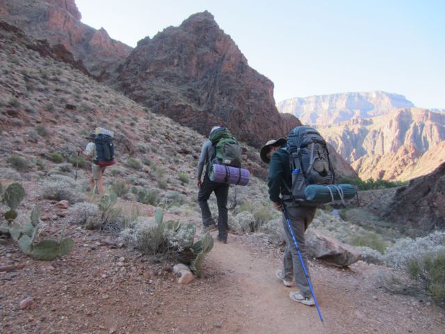
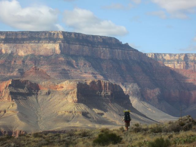
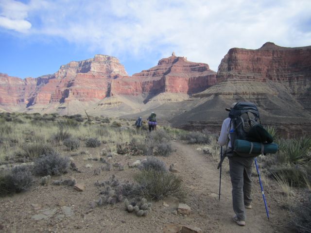
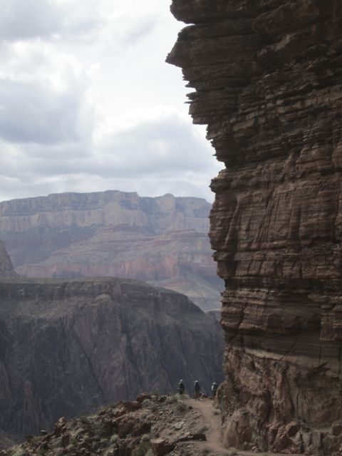
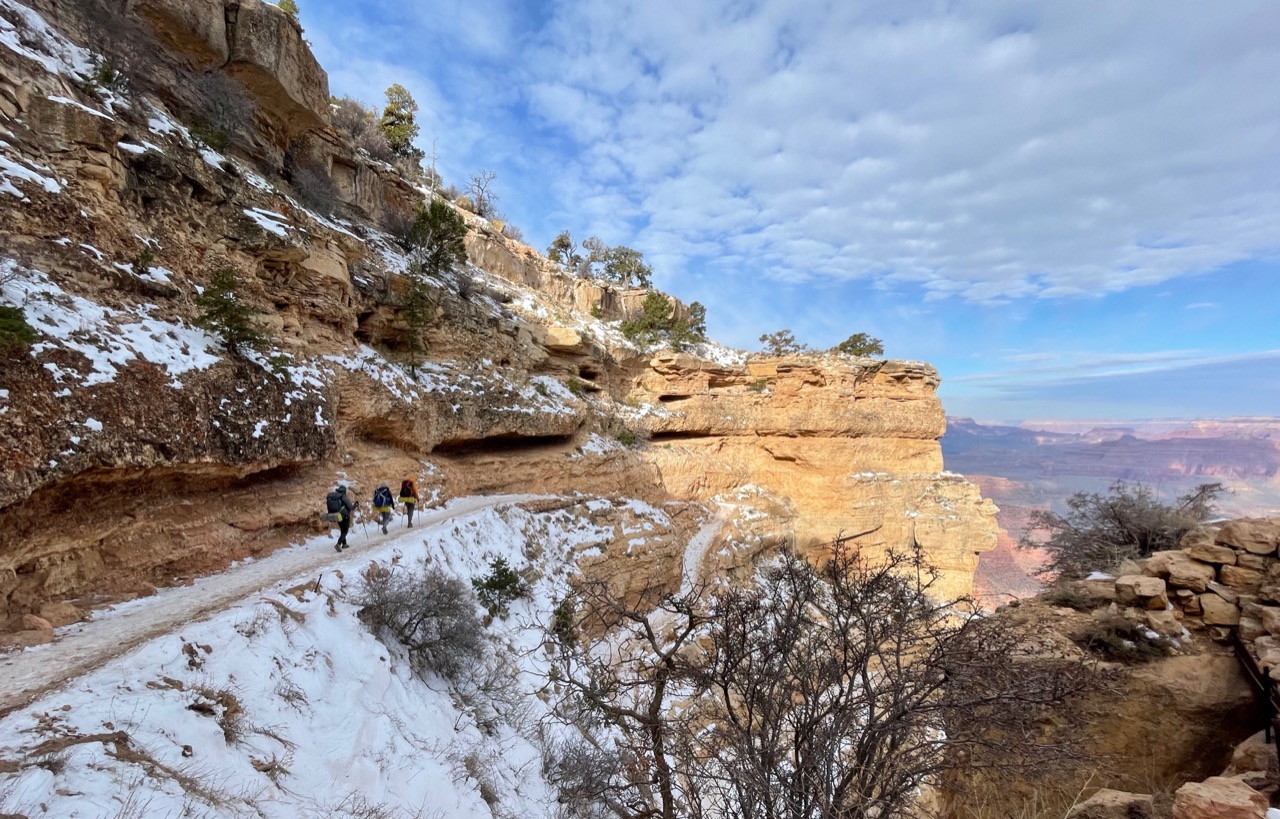
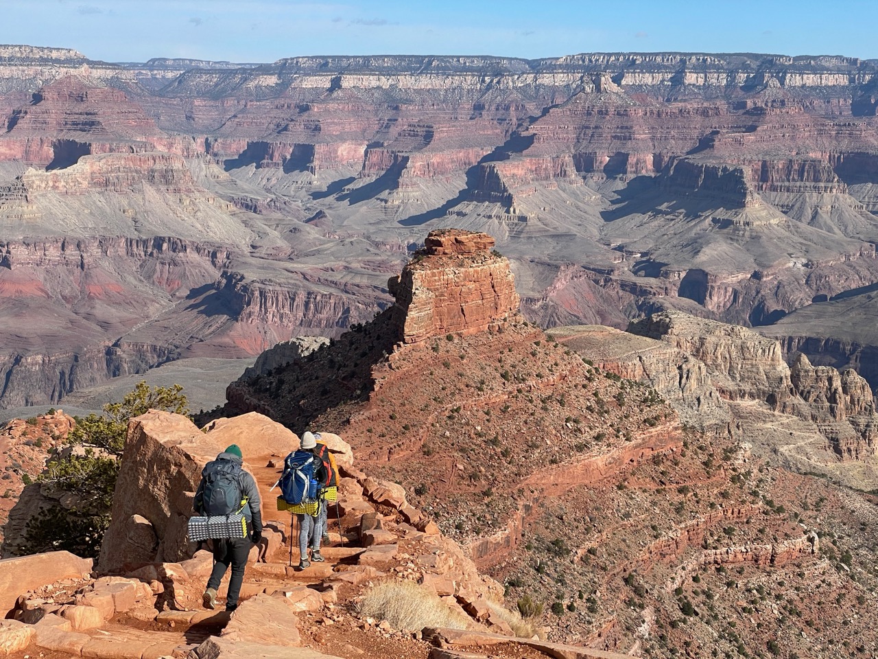
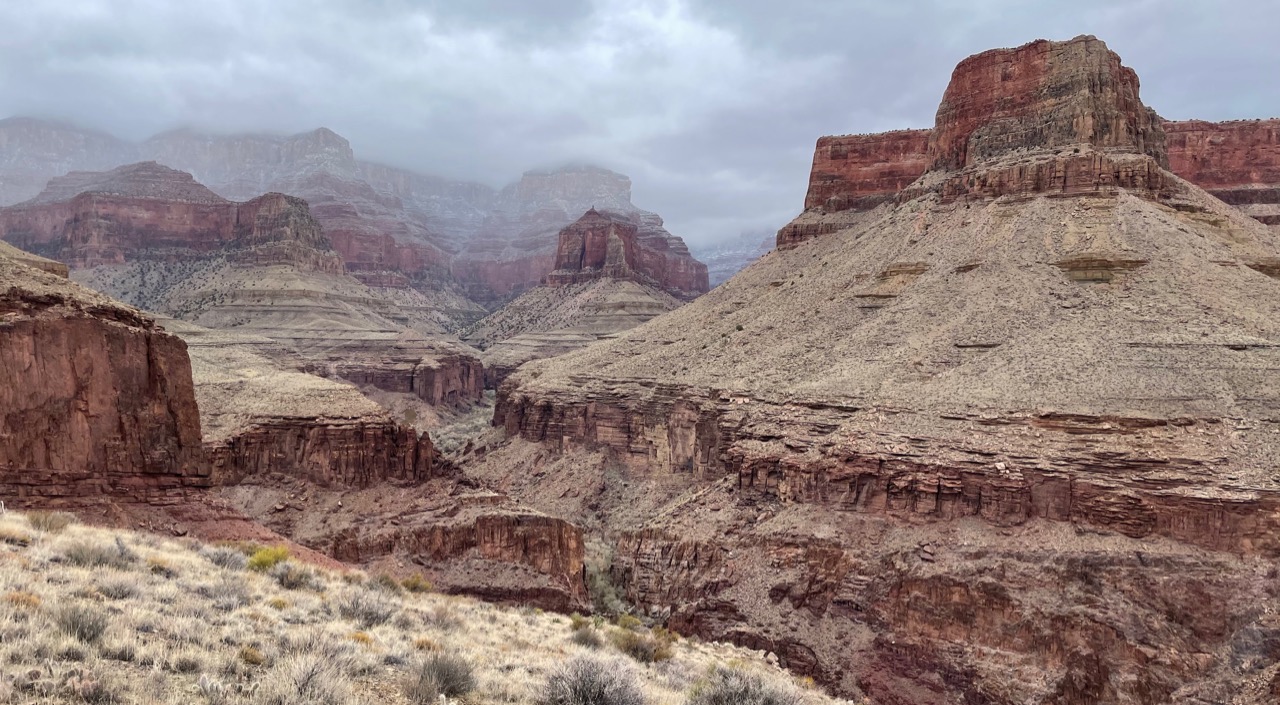
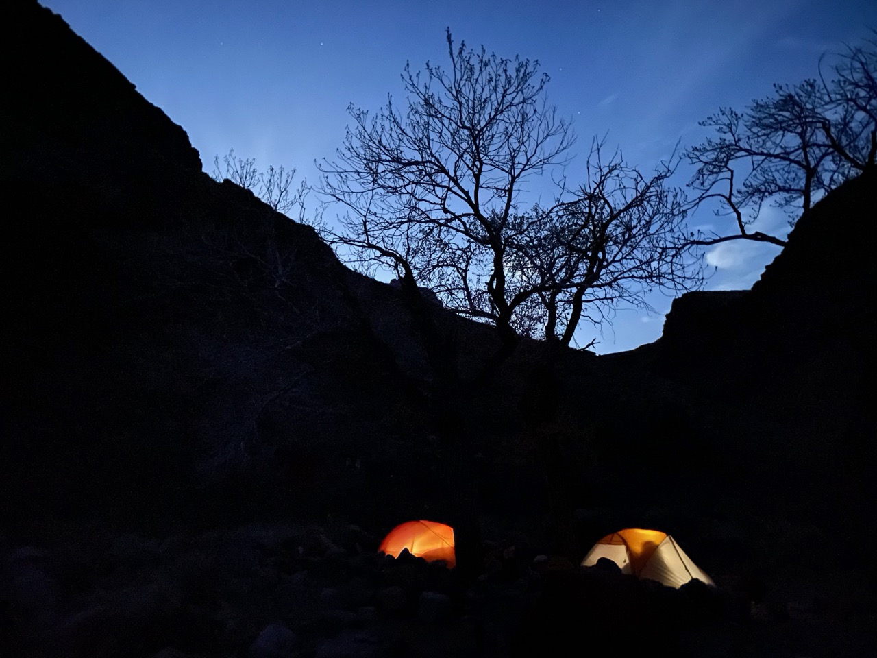
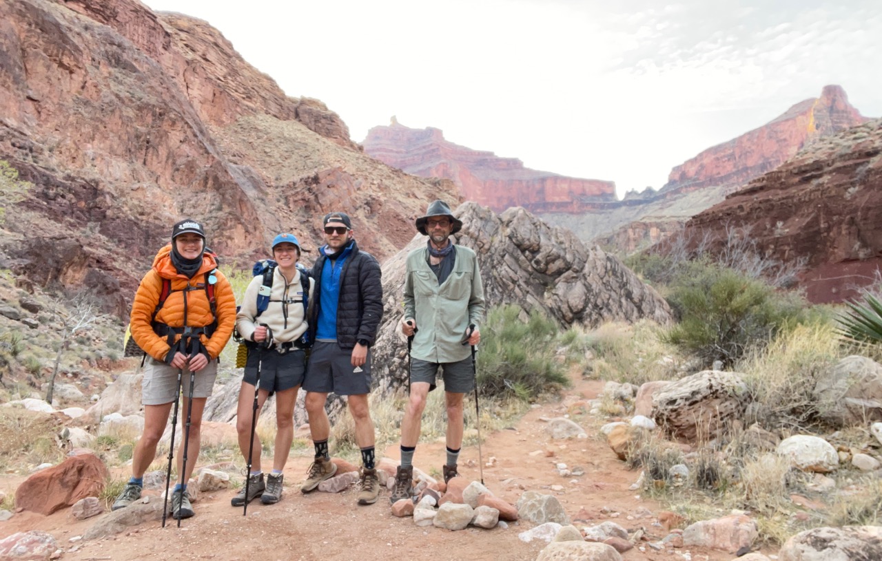
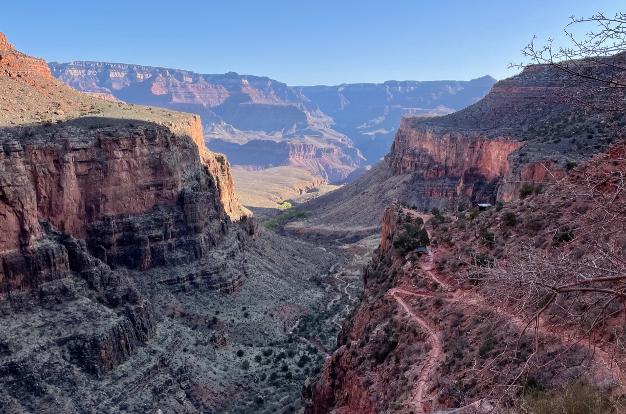
Grand Canyon
From March 24 to 28, 2014,
David Sandwell, Tim Parker, and Greg Harwell, and I hiked for five days in the Grand Canyon. We descended the South Kaibab Trail and spent our first night at the Bright Angel Campground. We then hiked to Clear Creek and stayed two nights, doing a day hike up Clear Creek on our rest day. We then hiked back to Bright Angel Campground for our final night, and climbed back to the rim on the Bright Angel Trail on Friday. My GPS said we did 48 total miles, but I noticed the GPS mileages were about 10% more than the trail posted mileages. The weather was a little warm the first two days, but then a cold front came through (very windy on Wednesday afternoon), which made for cooler conditions for the final two days, including the ascent to the rim. Highlights included finding a site with ruins of Anasazi cliff pueblos and having a beer at the Phantom Canyon Ranch.
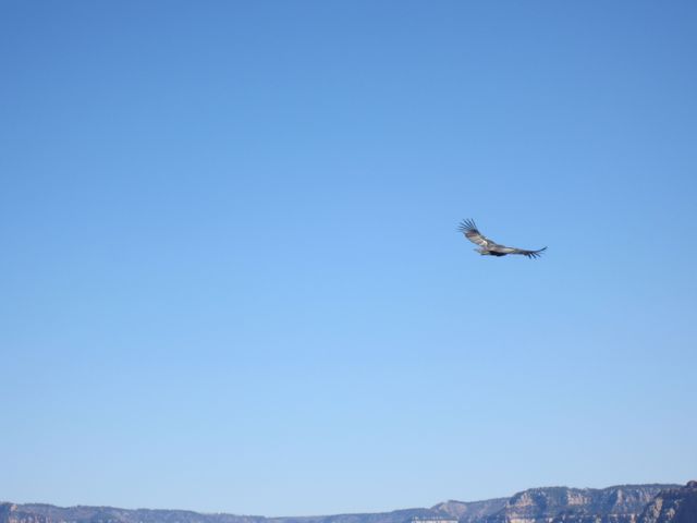 California Condor seen from South Kaibab Trail.
 Heading up the Clear Creek Trail from Bright Angel Campground.
 Heading back on the Clear Creek Trail.
 Halfway back on the Clear Creek Trail.
 Nearly back to Bright Angel Campground on the Clear Creek Trail.
South Lake to North Lake loop, eastern Sierra
From August 4 to 10, 2014, Jeff Gee, Rick Aster, Rob Mellors, and I hiked for seven days doing the classic South Lake to North Lake loop, which I had previously done in 1997 with David Sandwell. This was my wettest Sierra backpack ever, as it rained or hailed almost every afternoon for an hour or two. Usually (but not always!) we made camp before the rain started, so it wasn't too bad. As on my previous trip, we camped two nights at Evolution Lake and climbed Mt. Darwin
(more details)
This time we brought a rope so we could ascend the summit block. On the final night, we met David Sandwell just west of Piute Pass during a late afternoon hail storm. Total mileage (excluding the Darwin day trip) was just over 50 miles according to my GPS.
 At the starting trailhead (Rob, Rick, Jeff, me).
 The hut at Muir Pass (Rick, me, Jeff, Rob).
 Jeff and me on the Mt. Darwin summit block.
 Evolution Lake.
 Evolution Lake panorama (photo by Rick Aster).
 I didn't tighten the rainfly enough!
 At Piute Pass (David, Jeff, Rick, Rob, me).
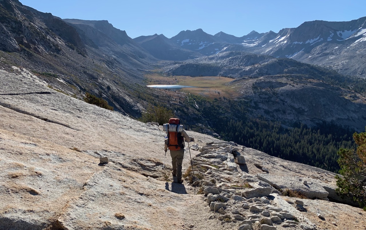
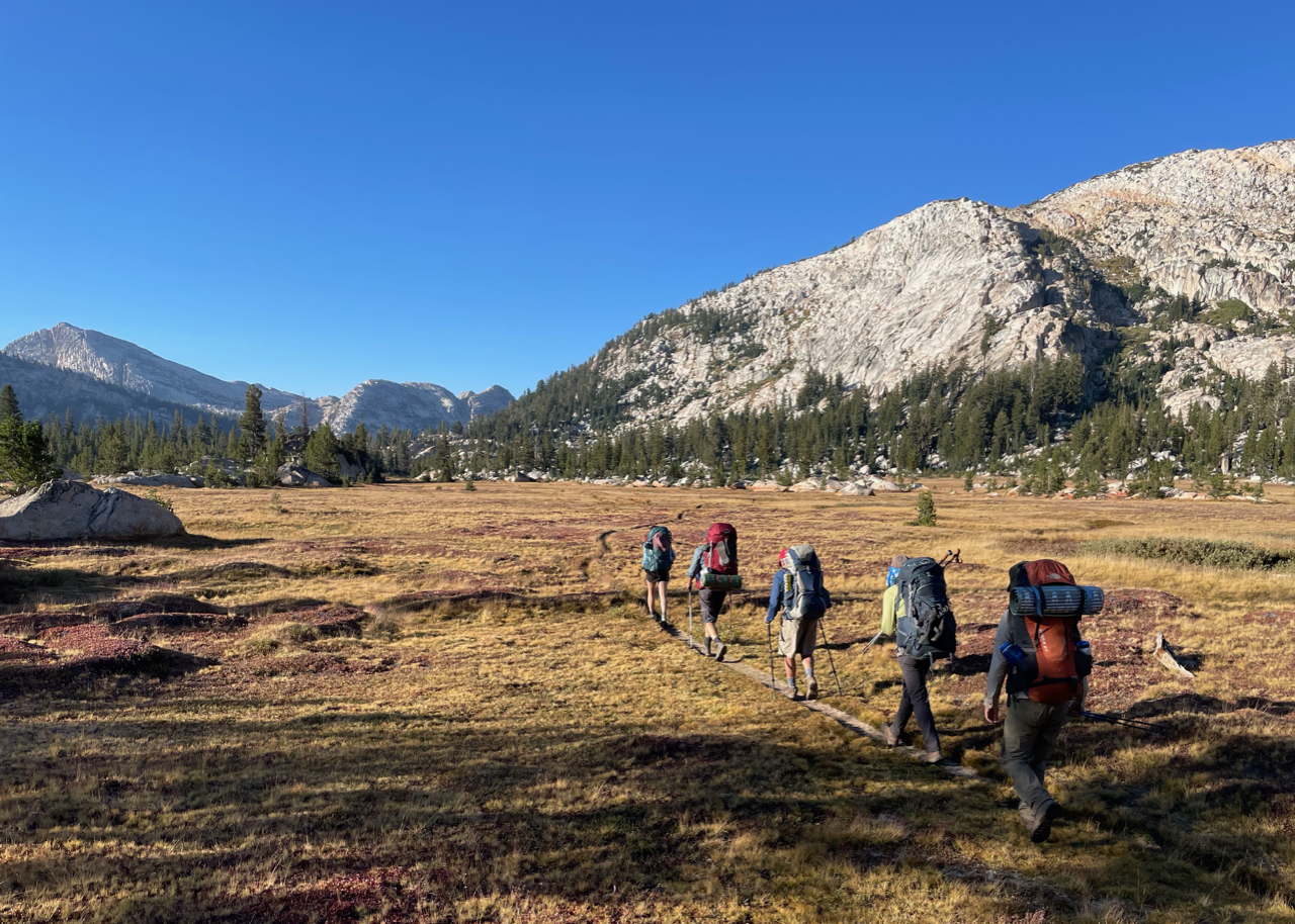
Northern Yosemite loop
From August 17 to 22, 2015, Jeff Gee, Rob Mellors and I hiked for six days in northern Yosemite. Starting at Tuolumne Meadows, we went past Glen Aulin the first day to camp in Cold Canyon, then camped two nights at a site about 3 miles up Spiller Canyon, climbing Whorl Mountain as a day hike. We then continued to camp at Upper McCabe Lake and then Upper Young Lake on the final night. The weather was perfect and we lucked out and had very little smoke from the many fires, although we could often see haze in the distance. We hiked about 40 miles with our backpacks, plus another 8 on the Whorl Mountain day climb. The drought resulted in virtually no mosquitos and no water running in Cold Canyon, although fortunately we found a few pools for our camp.
 On the way to Whorl Mountain.
 Jeff and me atop Whorl Mountain.
 Me, Rob, and Jeff atop "Dont Be a Smart Pass" between upper McCabe and Roosevelt Lakes.
 The descent to Roosevelt Lake.
 Hiking with Mount Conness in the background.
Cottonwood/New Army Pass loop
From August 16 to 19, 2016, my daughter Sarah and I hiked for four days in the southern Sierra, entering over Cottonwood Pass and exiting over New Army Pass. We camped at Chicken Springs Lake, Soldier Lake, and South Fork Lake. We hiked about 24 miles with packs, with another 9 miles for day hikes into Miter Basin and up Mt. Langley (from Army Pass). Excepting some haze from distant fires, the weather and scenery were perfect.
 Soldier Lake.
 Me ascending Mt. Langley.
 Sarah atop Mt. Langley (14,026 ft.), Mt. Whitney in background.
 Sarah descending from New Army pass.
Mineral King Northern loop
From August 21 to 27, 2016, Jeff Gee, Rob Mellors, David Sandwell, and Tim Parker, and I hiked for seven days out of Mineral King. We camped between Timber Gap and Cliff Creek the first night, then at Bearpaw Meadows, Nine Lakes Basin (two nights), Little Five Lakes, and Spring Lake, exiting over Glacier Pass. We covered some spectacular scenery, most notably the awesome section of the High Sierra Trail that ascends through Valhalla (Angel Wings) to Kaweah Gap. From Nine Lakes Basin, Jeff, Rob and I ascended Mt. Stewart as a day hike; we are still debating whether the east or west peak is higher. Total backpacking mileage was about 43 miles.
 Me, Tim, Rob, David, and Jeff in Redwood Meadow.
 Domes above Bearpaw Meadow.
 Angel Wings, the largest granite face in Sequoia/Kings Canyon Park.
 The ascent to Kaweah Gap.
 Flowers and mountains in Nine Lakes Basin.
 The Kaweah Range from Little Five Lake.
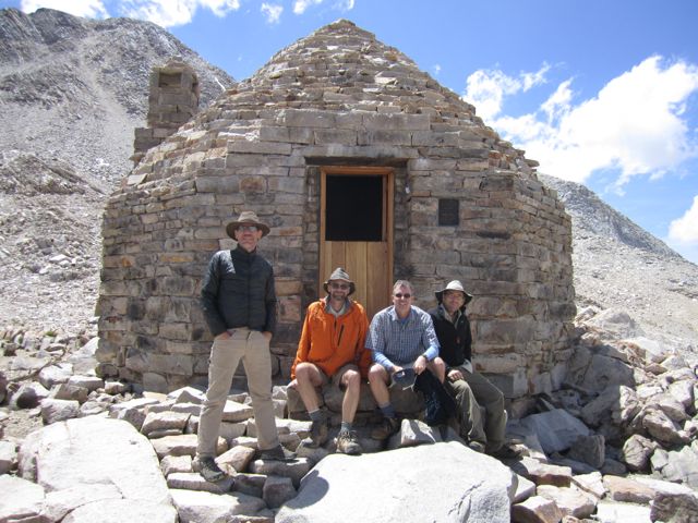
Mammoth to Pine Creek
From September 2 to 9, 2017, Rob Mellors, David Sandwell, and I hiked for seven days from Mammoth Lakes to Pine Creek. We camped at Purple Lake the first night, then Silver Pass Lake, the JMT near Bear Creek, Sandpiper Lake, Vee Lake, and just above Honeymoon Lake. We met Rick Aster at Vee Lake, who joined us for the last 3 days. Because of the heavy snow year, there was still considerable snow at high elevation, most notably around some of the passes, which made the cross-country route from Sandpiper Lake to Pine Creek trickier than normal. The whole trip was great (few mosquitos!) but the area around Vee Lake is particularly spectacular. Total backpacking distance was about 60 miles.
 David, Rob, and me at the trailhead at Coldwater campground.
 Rock and mountains near Silver Pass Lake.
 Rob descending the pass from Sandpiper Lake to Seven Gables Lakes.
 Rob, David, and Rick at Vee Lake camp, Seven Gables in background.
 Hiking above Vee Lake.
 Rick, me, David, and Rob at Italy Pass, Mt. Humphreys in distance.
Paria Canyon
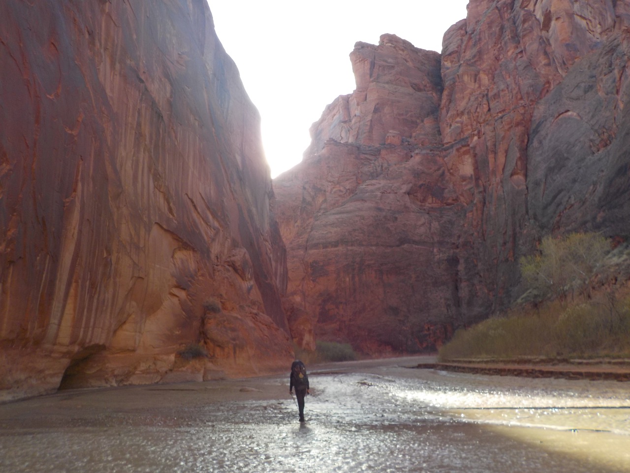
From March 26 to 29, 2018, Jeff Gee and I hiked for four days down the Paria River (Utah/Arizona) from White House to Lees Ferry. We camped near the confluence with Buckskin Canyon the first night and day hiked about 3 miles up Buckskin the next morning (getting past the "boulder jam" with the aid of a short rope). On the third day, we day hiked up Wrather Canyon to see Wrather Arch. But most of the trip was walking and wading down the Paria River. We had good weather and no bugs in a beautiful sandstone canyon. Total backpacking distance was 38 miles. The only negative was our feet were really hurting by the 4th day, as our Keen water sandals lacked ankle support and tended to fill up with gravel. I think running shoes would have worked better.
 Jeff.
Jeff.
 Jeff.
Jeff.
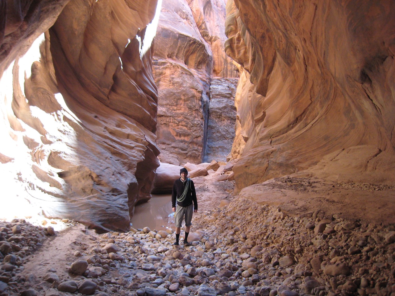 Me in Buckskin Canyon.
 Jeff.
Jeff.
 Jeff on last day, heading to Lees Ferry.
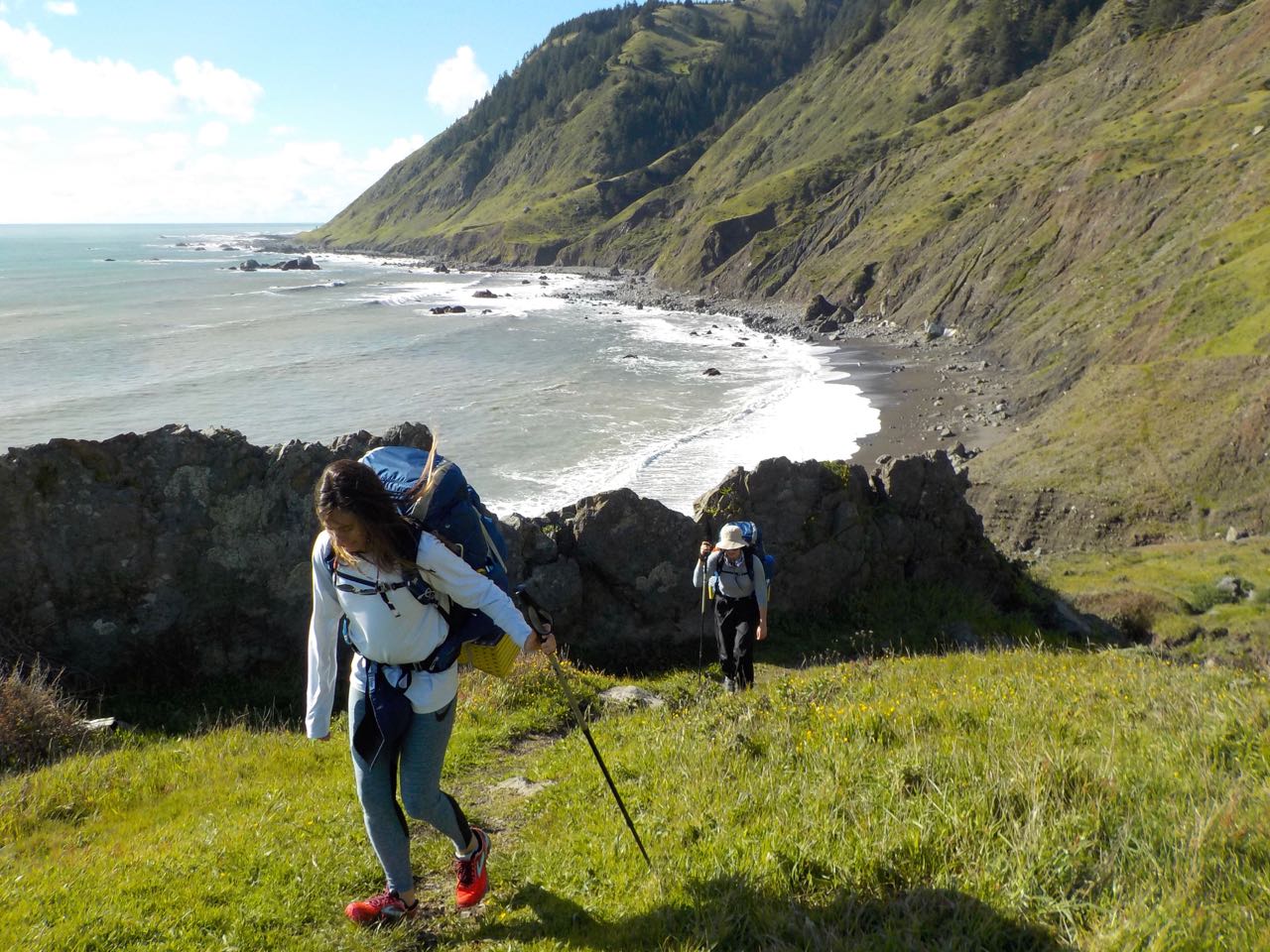
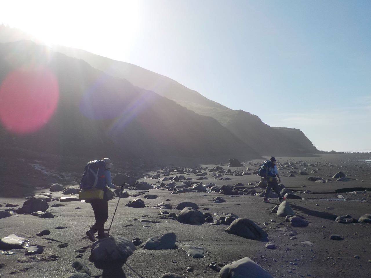
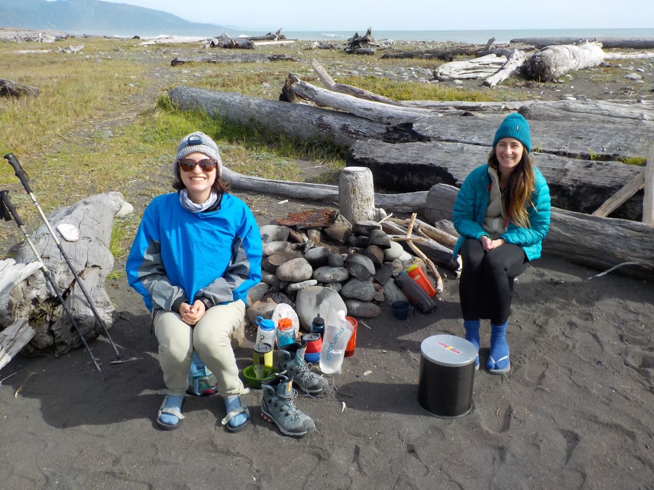
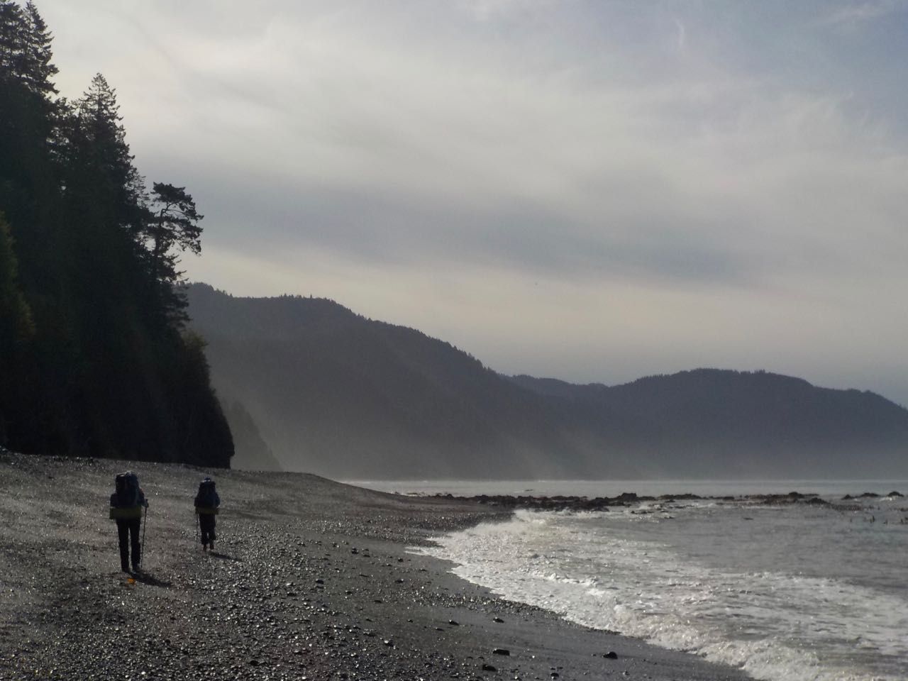
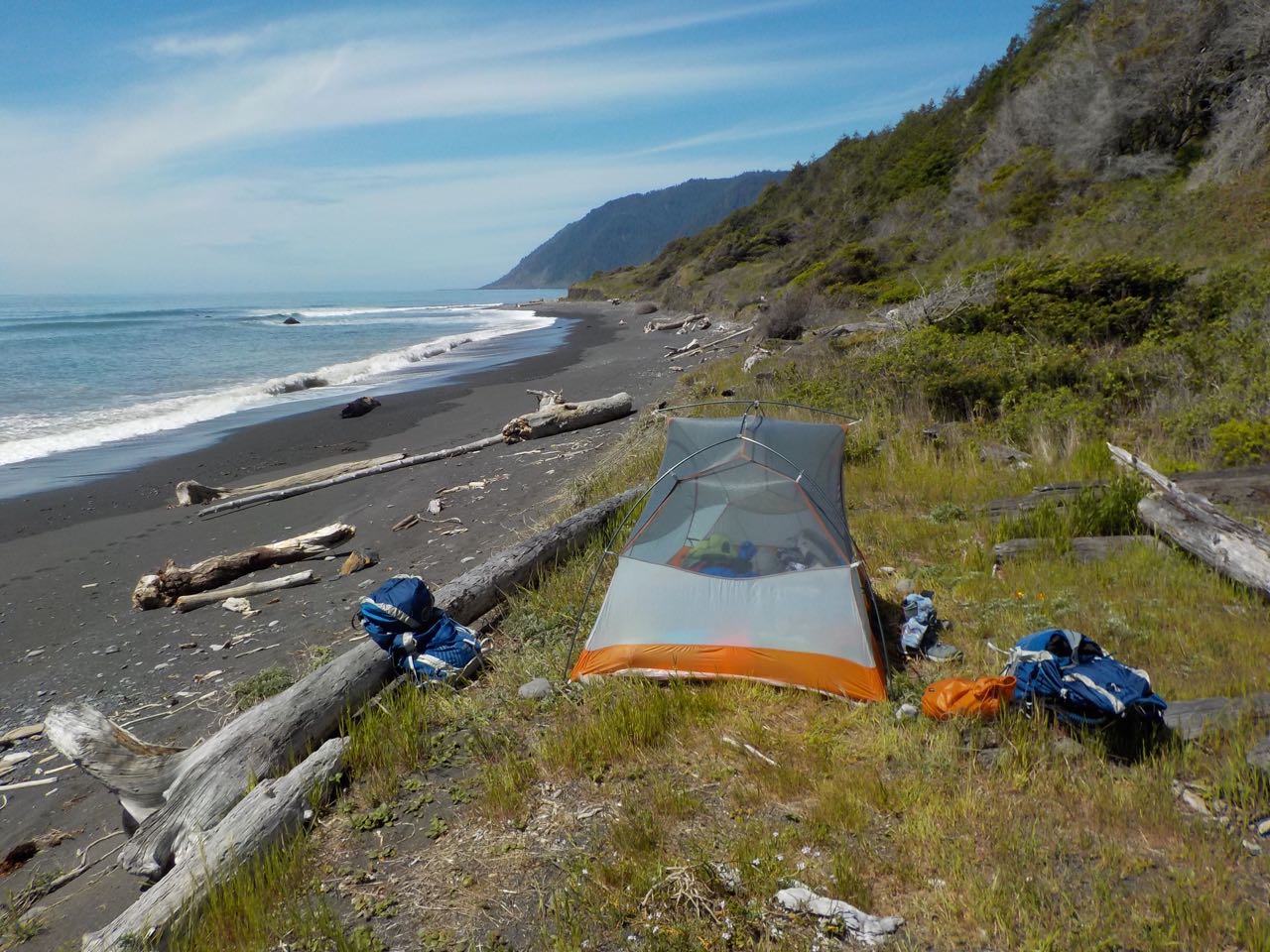
Lost Coast
From April 16 to 19, 2018, my daughters Rachel and Sarah joined me for a four-day backpack trip along Northern California's "Lost Coast" between Mattole Beach and Shelter Cove. We lucked out on the weather, as rain had been forecast, which likely kept people away, but ultimately there were only a few scattered showers. It was a magical trip---a beautiful, unspoiled coastline and lots of wildlife, including otters and whales.
 Sarah and Rachel ascending to bypass cliffs just south of Sea Lion Gulch.
 Sand, rock, and mountains.
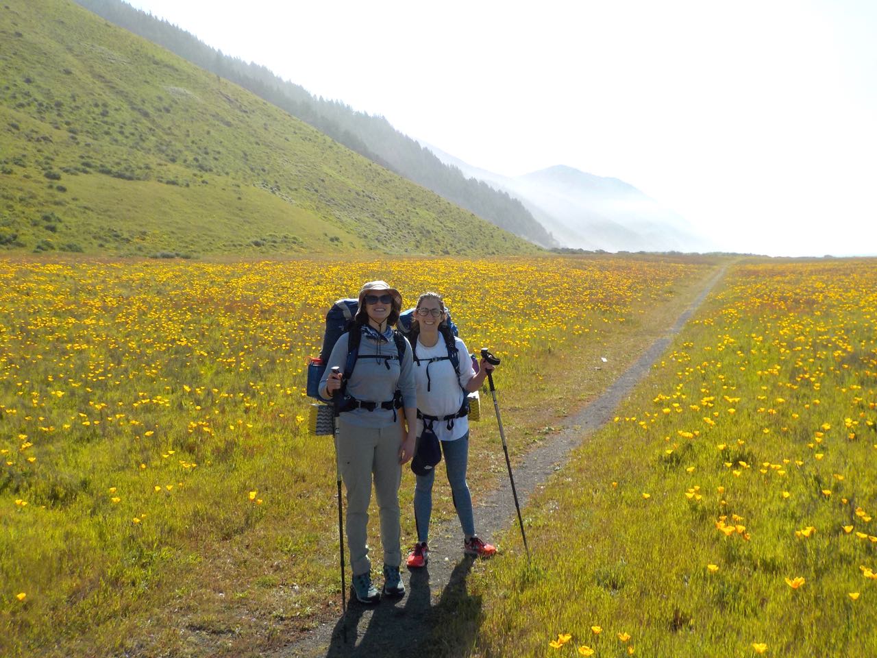 Rachel and Sarah in poppy field.
 Camping in the driftwood at Big Flat.
 Trying to find the firmest sand for walking.
 California beach camping without the crowds.
Onion Valley to Shepherd Pass
From August 13 to 18, 2018, Rob Mellors, David Sandwell, Rick Aster, and I hiked for six days from Onion Valley to the Shepherd Pass trailhead. We camped at Vidette Meadow the first night, just north of Forester Pass the second night, then two nights at Wright Lakes, and our final night at Anvil camp. We had (mostly) good weather with very few mosquitoes. Highlights included seeing Perseid meteors the first couple of nights and getting caught in a thunderstorm with hail while returning from a day hike to Wallace Lake. Total backpacking distance was about 41 miles.
 Looking up Bubbs creek toward Forester Pass.
 The long slog up Forester Pass.
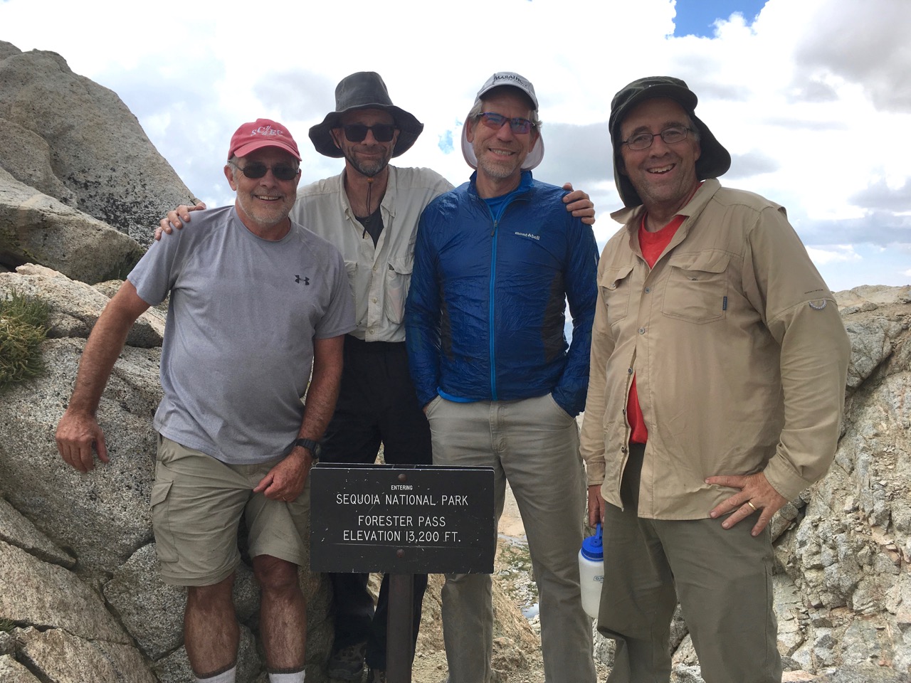 David, me, Rick and Rob at Forester Pass.
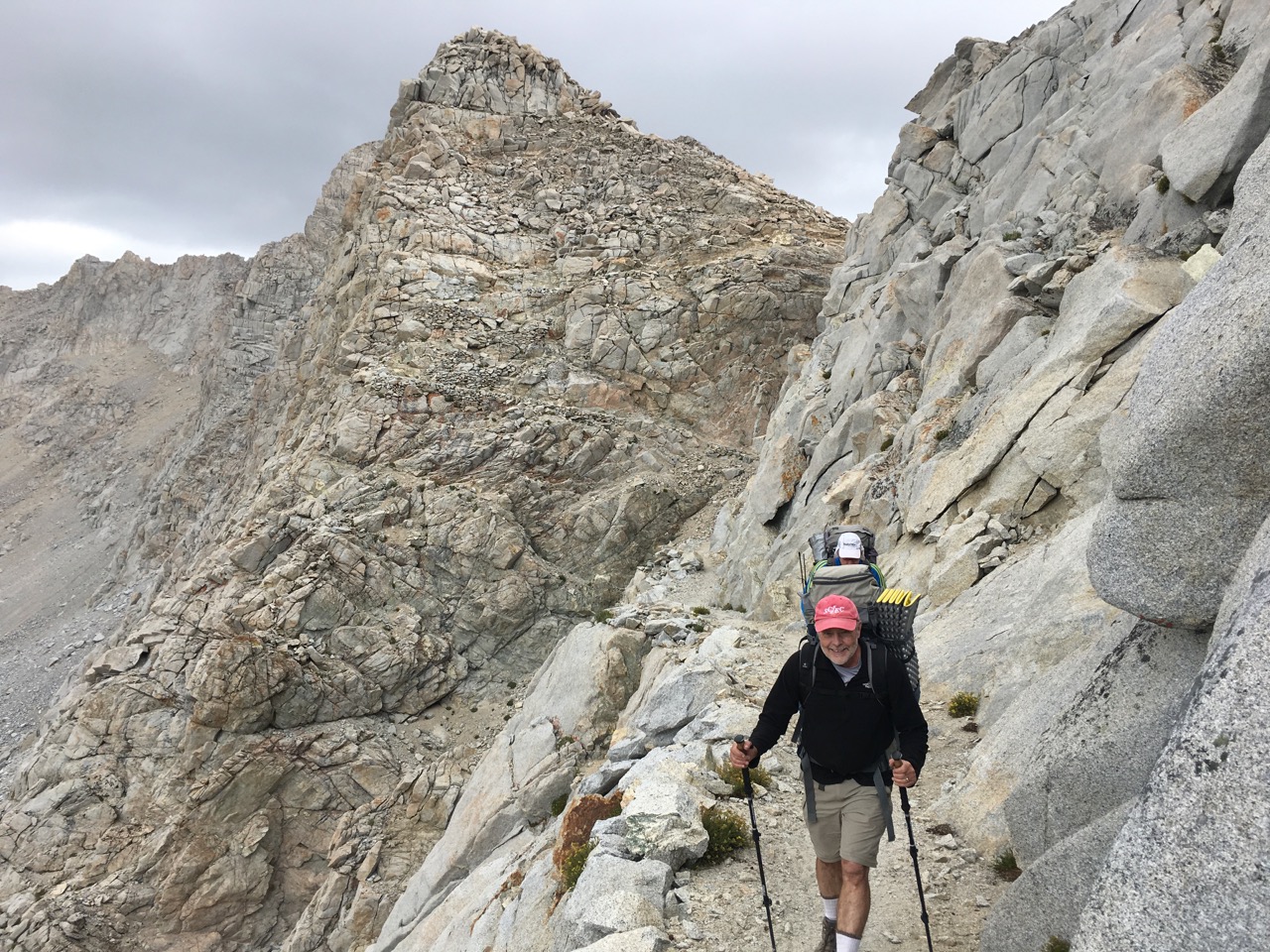 Descending the north side Forester Pass. Look for the trail on the slope behind Dave!
 Me at Lake Wallace outlet.
 Rob, Rick, David and me at Shepherd Pass.
Trans-Catalina Trail
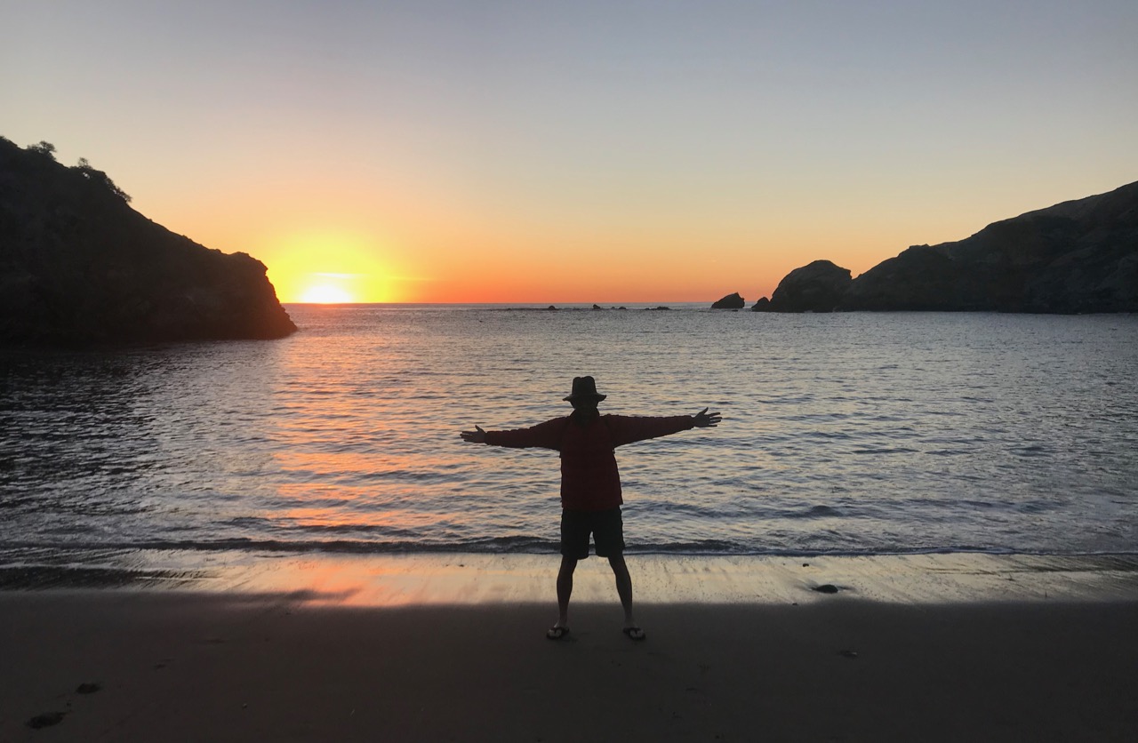
From December 27 to 30, 2018, my daughter Hannah and I hiked the Trans-Catalina Trail on Catalina Island, starting in Avalon and ending in Two Harbors. We camped the first night at Black Jack, then Little Harbor, and then two nights at Two Harbors. Because we were unable to get a camping reservation at Parsons Landing, we did the 14-mile loop in the western part of the island as a day hike---just as well, as there were some disturbingly steep sections on old jeep roads. We lucked out on the weather---no rain, and beautiful sunny days with views of ocean in many directions and the snowcapped peaks behind LA in the distance. We saw many bison and one Catalina Island Fox! Plus many dolphins on the ferry trips to/from the mainsland. Total hiking distance was about 40 miles.
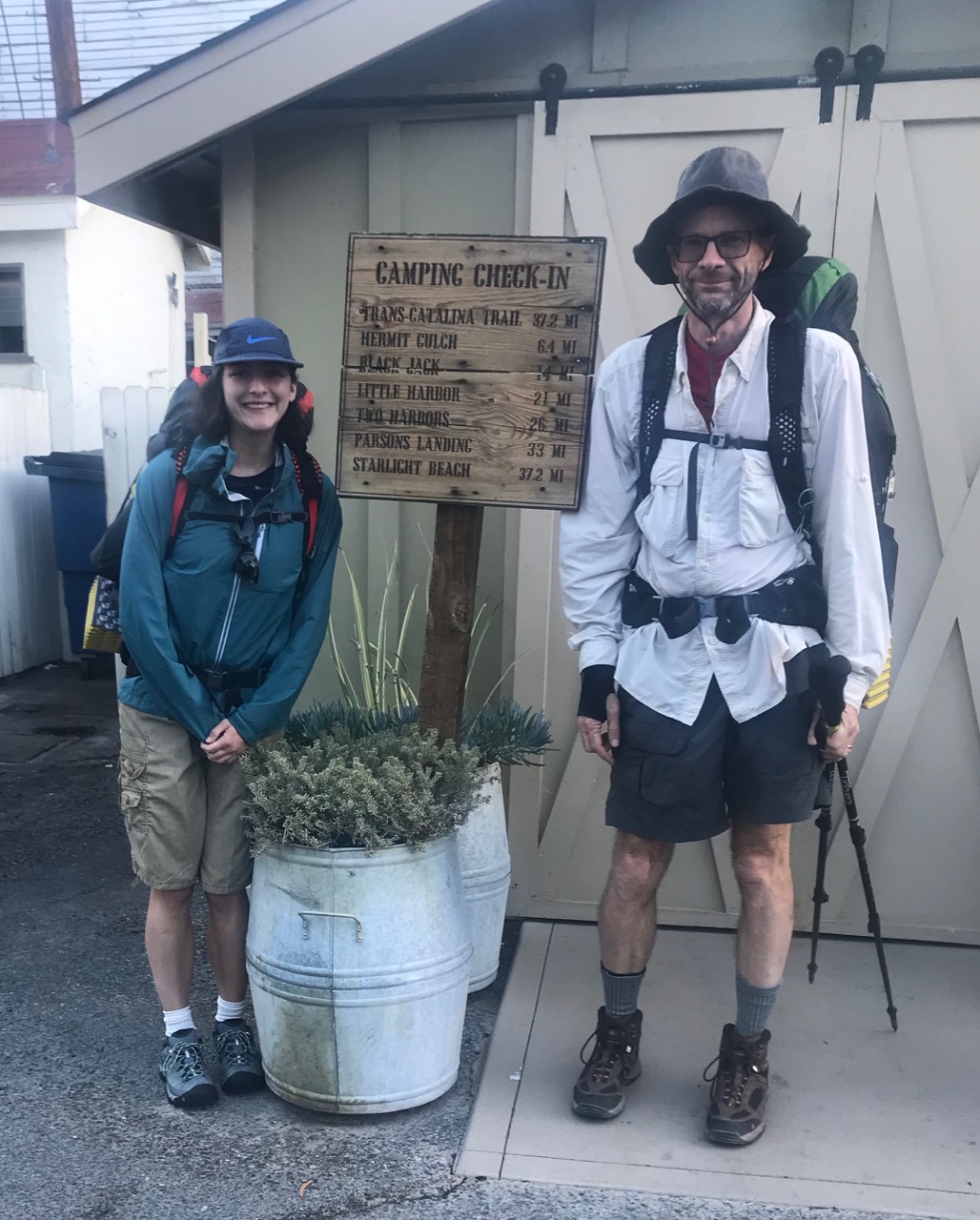 Hannah at me at the trailhead in Avalon. The sign describes an older version of the Trans-Catalina Trail that ended at Starlight Beach rather than the current trail that ends in Two Harbors.
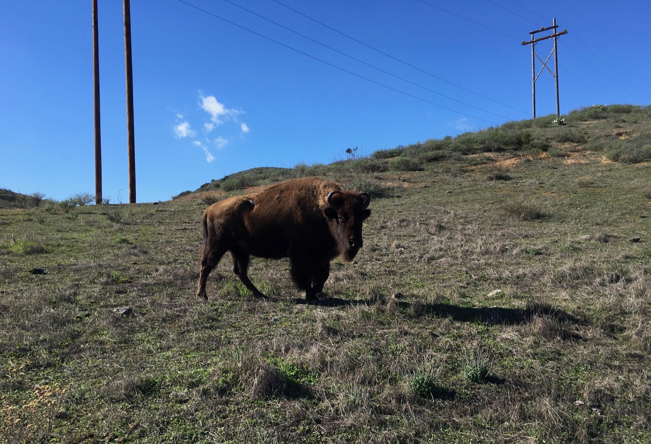 This bison was scarily close to the trail and necessitated a brief detour.
 Sunset at the Little Harbor beach.
 Ascending the trail toward Two Harbors from Little Harbor.
 The beach at Parsons Landing. We arrived in time for lunch and were surprised and pleased to find no people there at all!
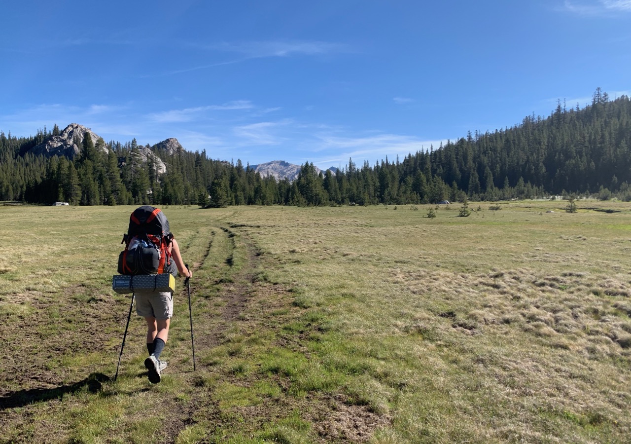
Mid-Yosemite Semiloop
From September 13-18, 2019, Rob Mellors, David Sandwell, Tim Parker, and I hiked for six days south from Tuolomne Meadows. We camped at Vogelsang the first night, then at a creek south of Cony Crags, then at the lake just west of Isberg Peak, then at Washburn Lake, and finally at Emeric Lake. We had cool fall weather with just one brief rain shower, virtually no mosquitoes, and uncrowded trails. Total backpacking distance was about 50 miles.
 Rob, Tim, me, and Dave near the trailhead.
 Descending south from Volelsang Pass.
 Camp at lake near Isberg Peak and Pass.
 Dawn view of Clark Range, from near Isberg Pass.
 Heading back to Tuolomne Meadows, Fletcher and Vogelsang Peaks in background.
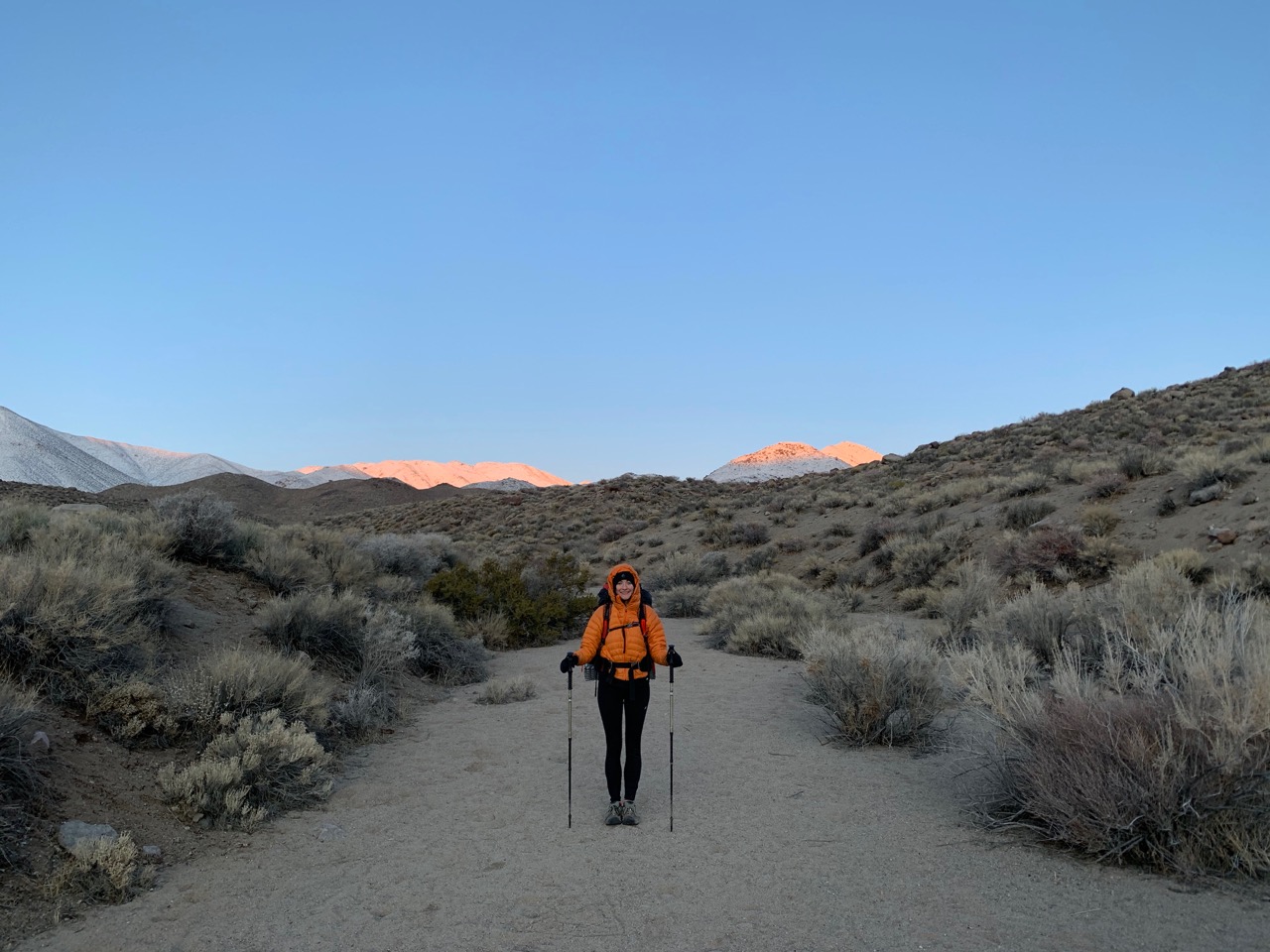
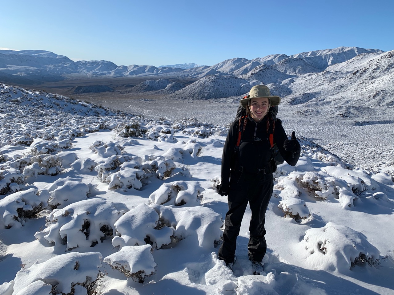
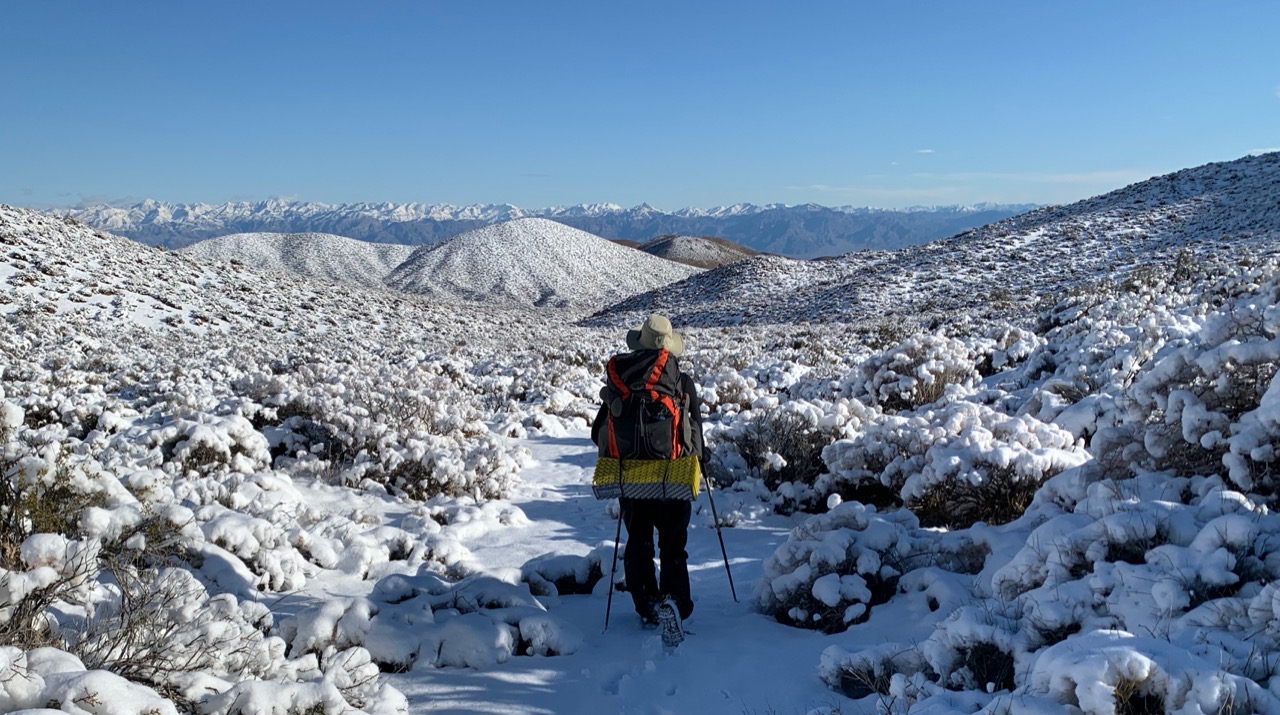
Death Valley Cottonwood to Marble Canyon Loop
From December 25-27, 2019, my daughter Hannah and I hiked the Cottonwood-Marble Canyon loop near Stovepipe Wells, Death Valley. We saw a tarantula the first day and camped just above Cottonwood Spring for two nights---longer than planned, as it rained the entire 2nd day, so we stayed in the tent reading and playing cards. Our reward on day 3 was sunny skies, beautiful fresh snow over the pass, and a long hike out. It's a great trip, but be sure to read carefully the online descriptions of how to navigate the passes (GPS is a good idea). Also, be aware that Cottonwood "Spring" has flowing water, but the area has been degraded by wild horses (burros?) who have left abundant dung. Bring a filter and plan to carry enough water from the stream to camp at a nicer location. Total backpacking distance was about 32 miles.
 Dawn light on mountains from near Cottonwood Springs.
 Hannah heading out on 3rd day.
 The view back toward Cottonwood Springs from the first pass.
 Descending toward Dead Horse Canyon.
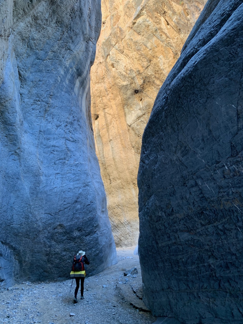 Marble Canyon Second Narrows.
 Almost back to the car!
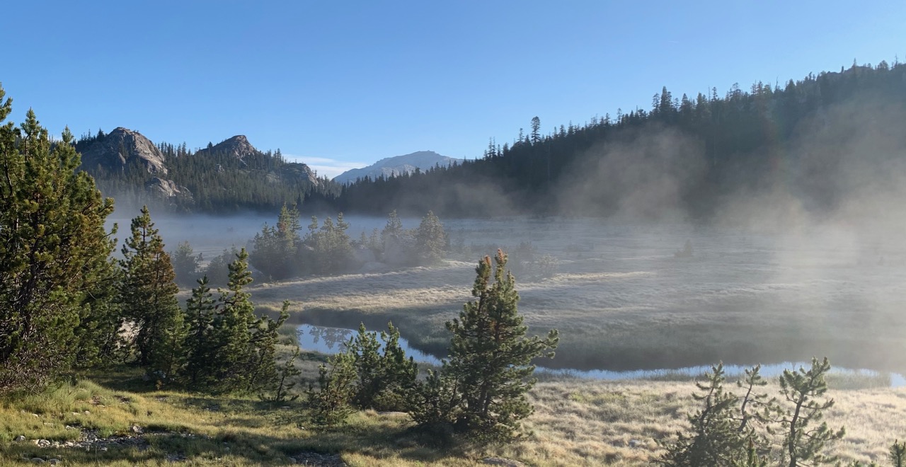
Northern Yosemite Semi-Loop to Matterhorn Canyon
From June 20-25, 2020, my daughter Hannah and I hiked in northern Yosemite. We left from Tuolumne Meadows, hiked to Glen Aulin, then north through Cold Canyon, then cross-country up Spiller Creek, crossing over Matterhorn Pass to join the trail down Matterhorn Canyon, then taking the PCT back to Tuolumne. Highlights included seeing a bear in Matterhorn Canyon and getting hailed on at Miller Lake. Mostly good weather but lots of mosquitoes. Total backpacking distance was about 50 miles.
 Meadow in Cold Canyon.
 Camp in Spiller Canyon, Whorl Mountain at upper left.
 Atop Matterhorn Pass, elevation 11,360 ft.
 Descending from Matterhorn Pass.
 Upper Matterhorn Creek, north side of Whorl Mountain in background.
 Early morning mist in Cold Canyon.
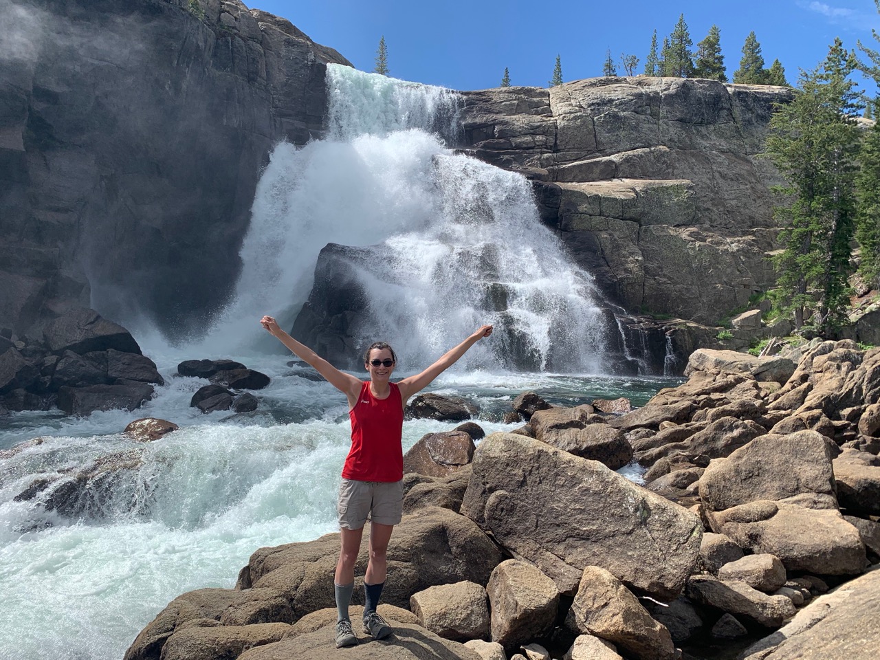 Tuolumne Falls.
Grand Canyon redux
From March 15-19, 2021, my daughter's Hannah and Sarah (with husband Jared), and I hiked for five days in the Grand Canyon. This was a repeat of a 2014 trip to Clear Creek (see above) except we camped the final night at Indian Garden instead of Bright Angel Campground. The weather was colder than last time, with some ice on the trails near the rim (boot traction devices were helpful). But we were prepared and had a great time. Highlights included backpacker bocce during cocktail hour and Pad Thai night (sampling 4 different freeze dried versions of the classic dish). Day 4 was the most strenuous with a 15-mile slog from Clear Creek to Indian Garden, but worth it to avoid a 4500 foot ascent on the final day.
 Starting descent of South Kaibab Trail.
 Half-way down South Kaibab Trail.
 Lingering clouds on cliffs as seen from trail to Clear Creek on day 2.
 Clear Creek campsite.
 Ready to leave Clear Creek campsite.
 Last day view back down Bright Angel Trail toward Indian Garden.
Hoover/Yosemite Loop
From September 6-11, 2021, I hiked with Jeff Gee, Rob Mellors, Tim Parker and his daughter Cassie, and David Sandwell for six days through the Hoover Wilderness and northern Yosemite. The trip almost didn't happen owing to fire-related closures, but Yosemite remained open and we enjoyed a great trip with no smoke and almost no people. We started at Robinson Creek and camped at Peeler Lake the first night, then Benson Lake, Smedberg Lake, Matterhorn Canyon, and Crown Lake. We had some thunder and rain the 4th night and then pleasantly cool temperatures for the last two days. Highlights included beach camping at Benson Lake and a day hike up Volunteer Peak. Total backpacking distance was about 50 miles.
 Heading south from Peeler Lake.
 Sawtooth Range from Matterhorn Canyon.
 Ascending toward Burro Pass.
 Rob, Jeff, Tim, Cassie, David, and me atop Burro Pass.
 Descending from Mule Pass.
 Sunset at Crown Lake.
Trans-Catalina Trail
From October 25-27, 2021, I hiked with my daughter Sarah and her husband Jared for three days on Catalina Island. Because we only had limited time, we took the ferry to Avalon and then took a shuttle to the airport. We then hiked to Little Harbor, getting lost briefly in a rain storm, but making it to camp in time to enjoy some sunshine. It was worth the wet start because the next two days were sunny and inspiring. We hiked to beautiful Parsons beach the next day (unlike my 2018 trip, we managed to get a reservation there) and then to Two Harbors in time to catch the 11:45 am ferry. Total hiking distance was about 25 miles and included the most scenic parts of the full TCT.
 Jared and Sarah after the worst of the rain, Little Harbor in background.
 Leaving Little Harbor.
 Walking along the spine of the island.
 Our camp at Parsons Beach.
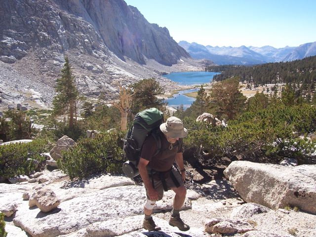
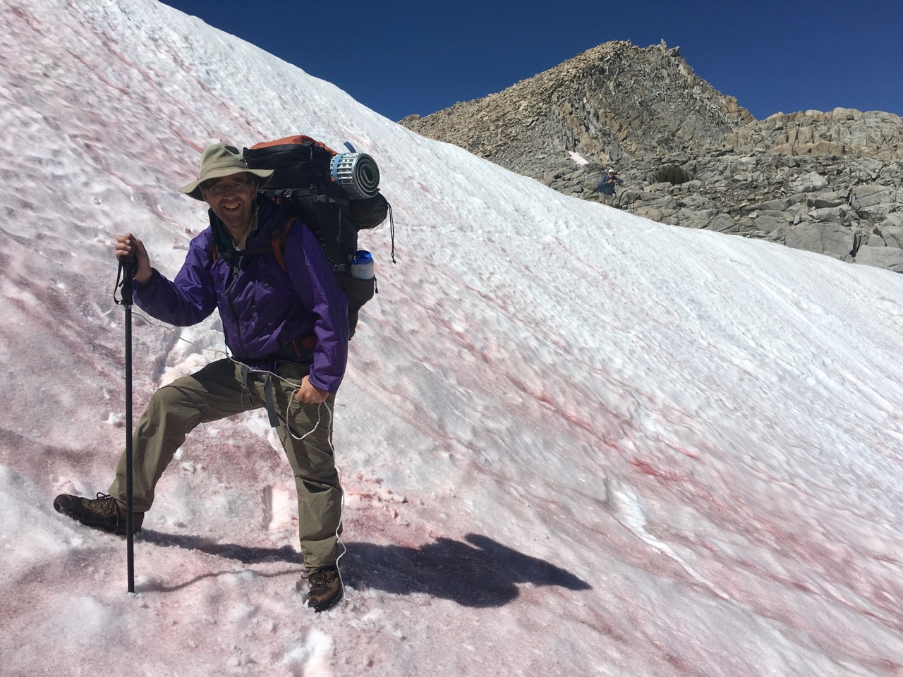
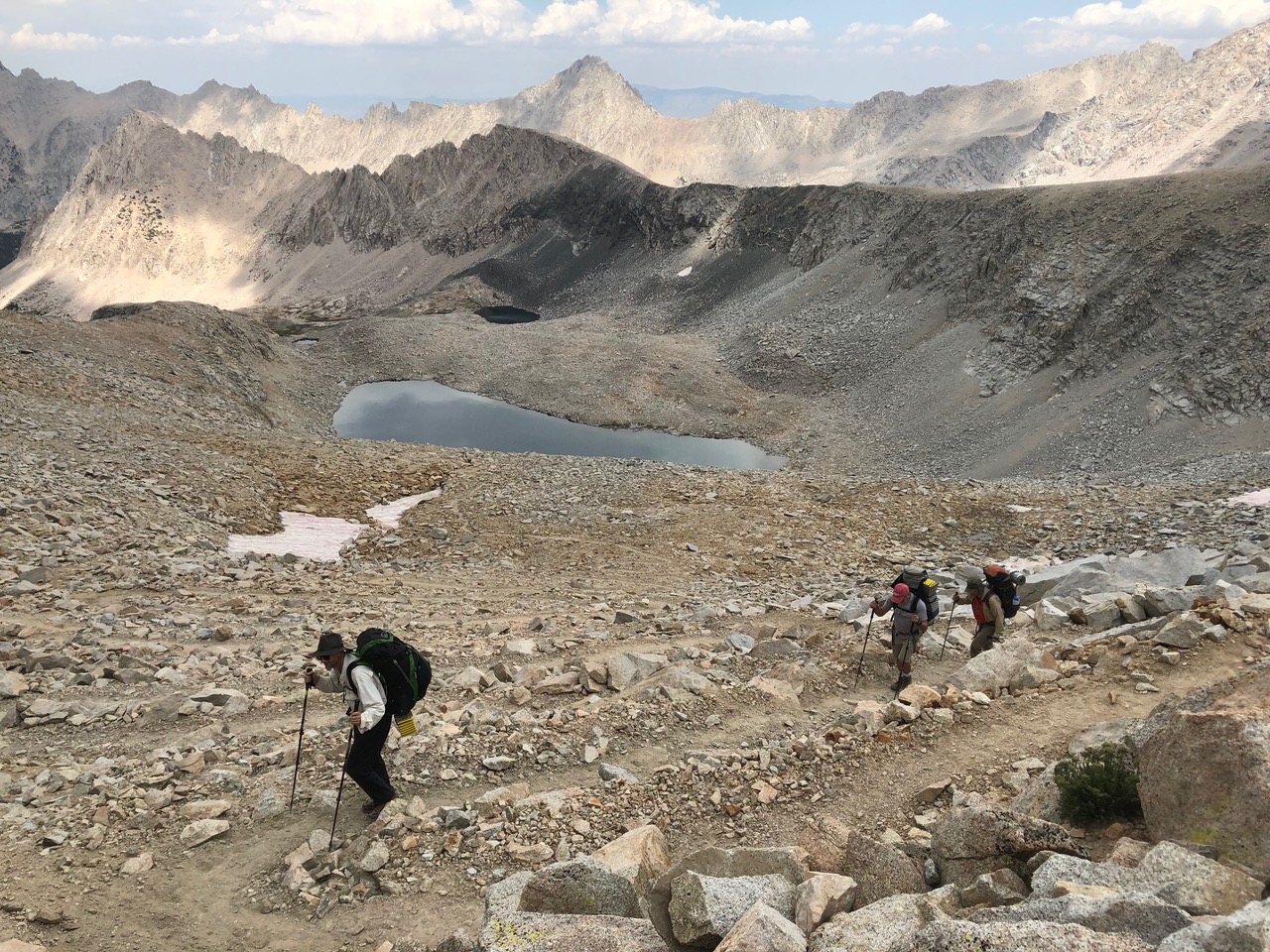
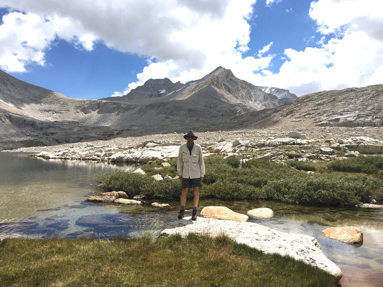
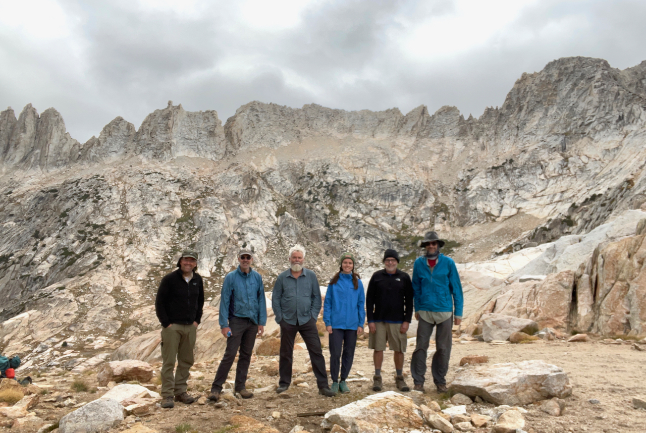
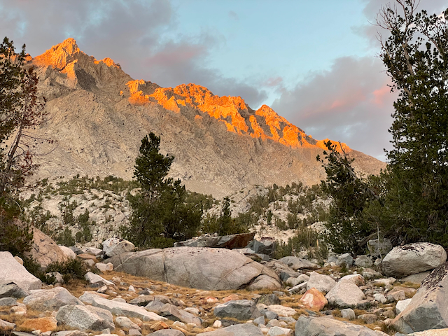
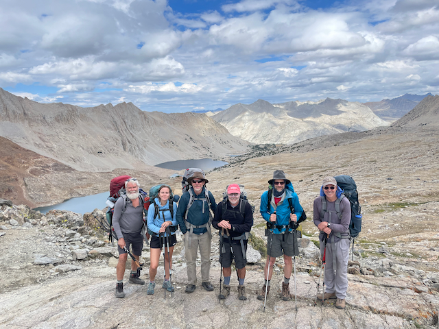
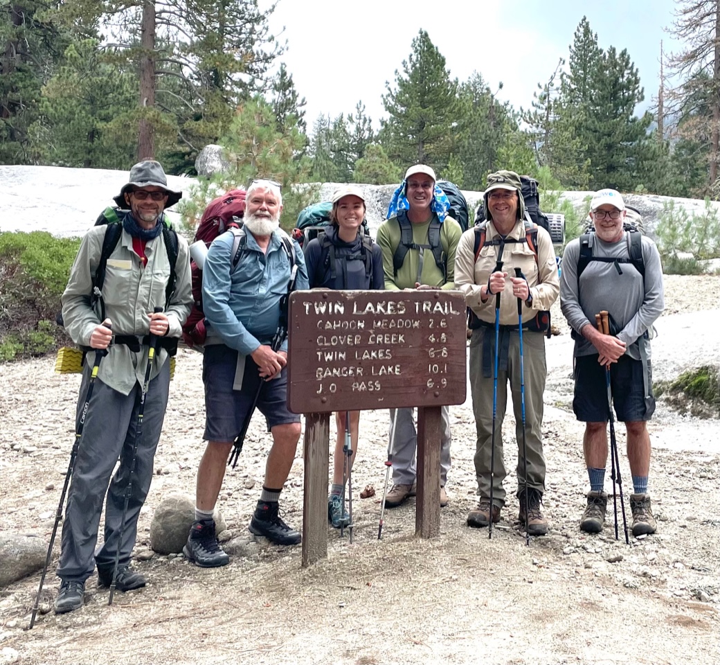
Onion Valley to Taboose Creek
From August 14-20, 2022, I hiked with Jeff Gee, Tim Parker and his daughter Cassie, Rick Aster, and David Sandwell for seven days for a one-way trip along part of the JMT. We started at Onion Valley and camped at Kearsarge Lakes the first night, then Rae Lakes, Twin Lakes, two nights at Bench Lake, and Taboose Creek at about 8400 feet on our last night. We had beautiful weather and no smoke in a really beautiful part of the high Sierra. From Bench Lake (where there were LOTS of ants!), we day-hiked up to Arrow Pass, waiting there a bit while Rick dashed to the summit and back. Total backpacking distance was about 46 miles.
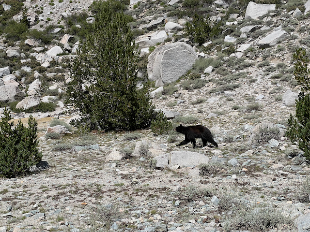 Bear prowling near Flower Lake, looking for unattended food during our lunch break.
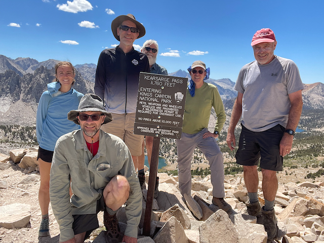 Our gang at Kearsage Pass (11,845 ft, don't believe the sign).
 View from Kearsarge Lake.
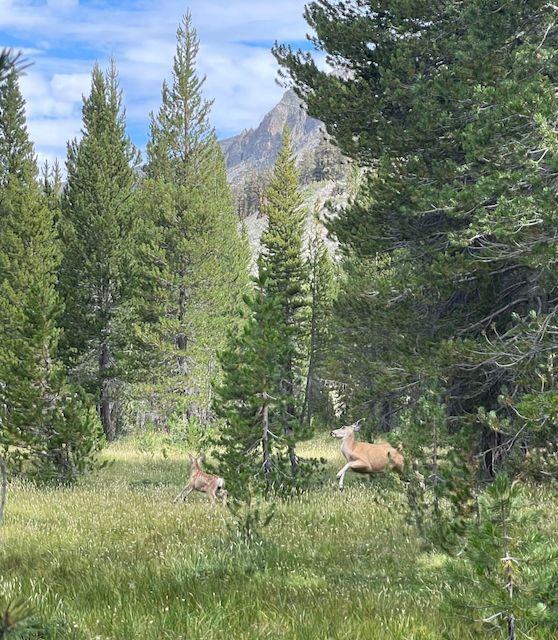 Startled deer.
 Looking north from Pinchot Pass (12,130 ft).
 Camp at Bench Lake, Arrow Peak in background.
 Descending the talus below Arrow Pass.
 Jeff descending the Taboose Creek trail on the final morning.
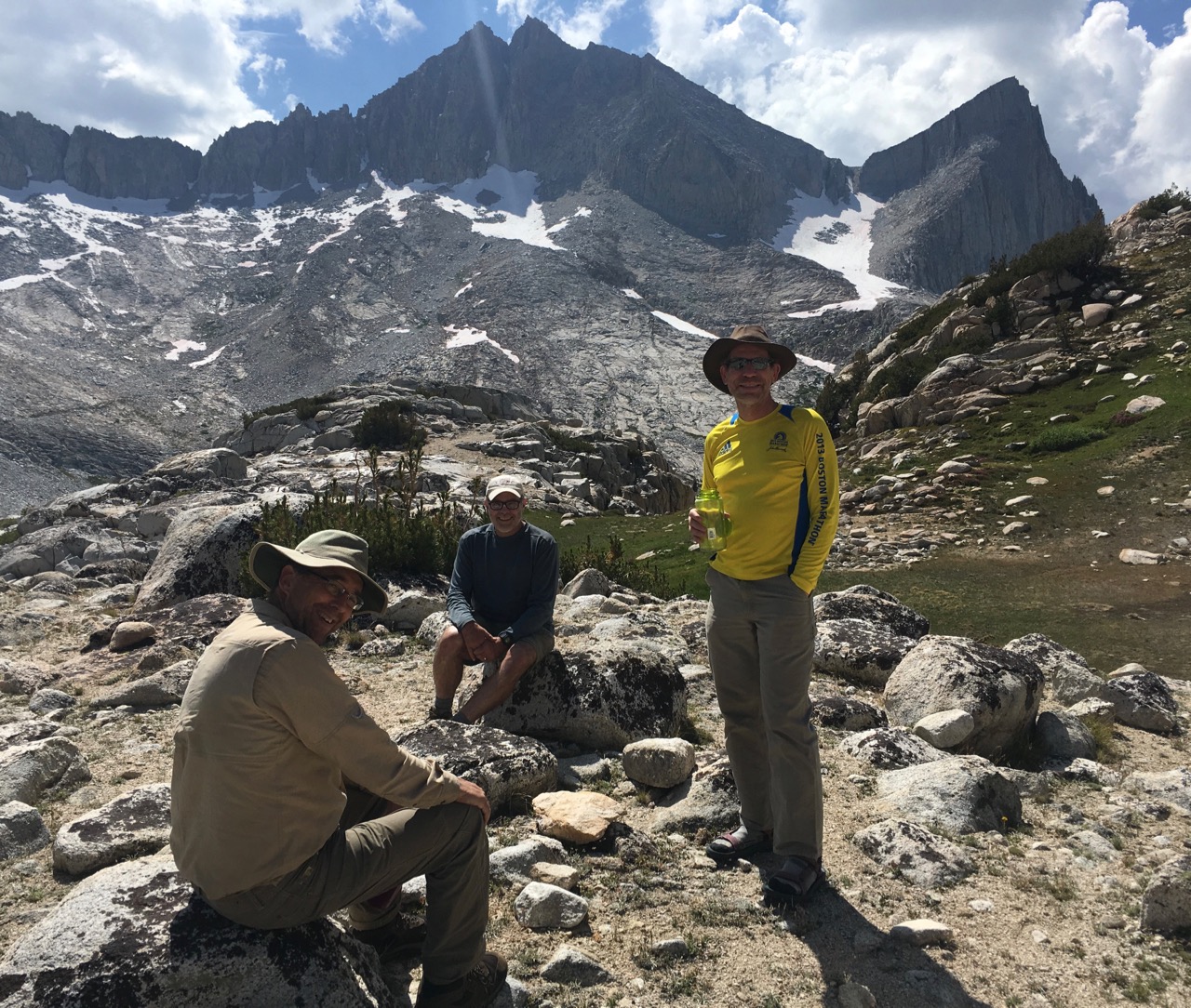
Pine Creek to South Lake
From August 30 to September 4, 2022, I hiked with my daughter Sarah and her husband Jared for six days between Pine Creek and South Lake. This was an alternate approach to the classic North Lake/South Lake near-loop trip, for which I could not get a permit. From Pine Creek, we camped the first night at Upper Pine Lake, then on the JMT at the Piute trail junction, Evolution Lake, Big Pete Meadow, and Bishop Lake. We had warm weather (this was at the start of a record-breaking California heatwave) and no smoke. If anything the scenery appeared more beautiful than I remembered from two previous South Lake to North Lake trips. Total backpacking distance was about 50 miles.
 Sarah and Jared in front of Upper Pine Lake.
 Camp at Evolution Lake.
 The hut at Muir Pass.
 Fun with rocks in LeConte Canyon.
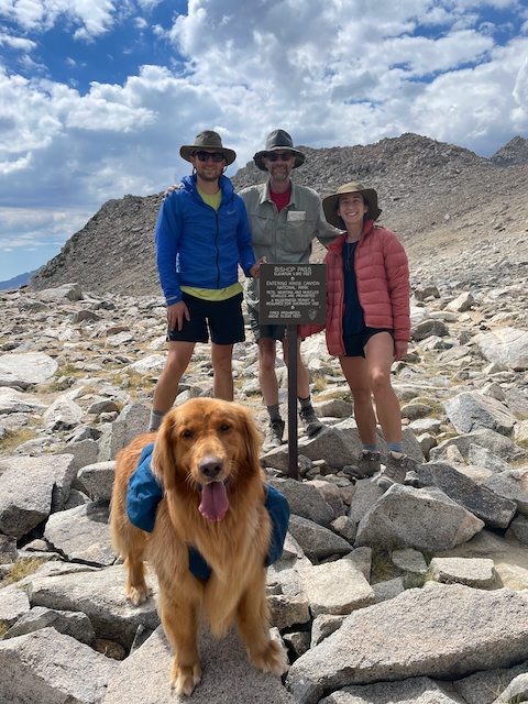 A friendly dog joined us at Bishop Pass (11,972 ft).
 Camp at Saddlerock Lake our final night.
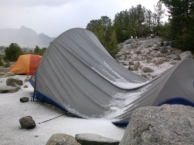
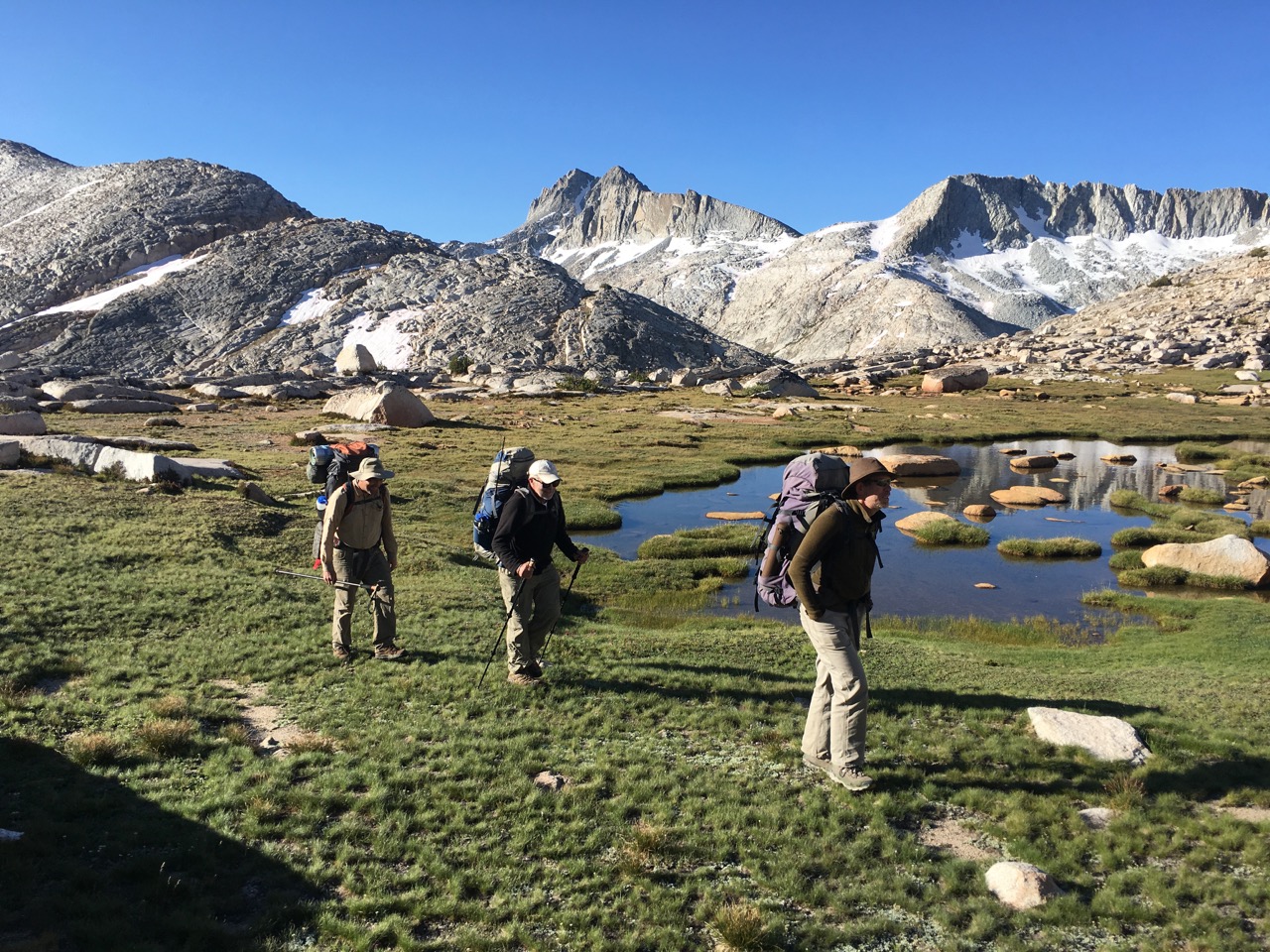
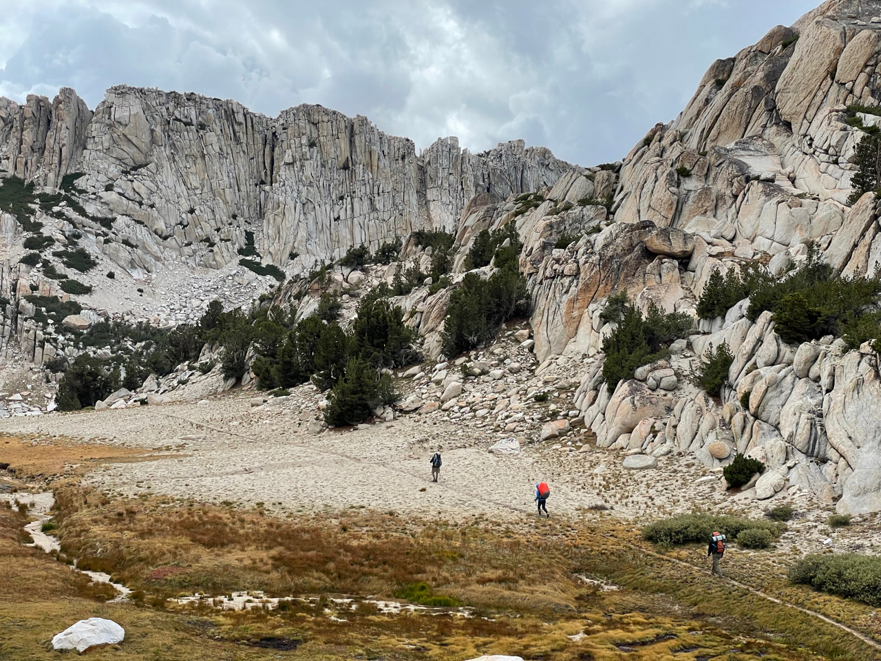
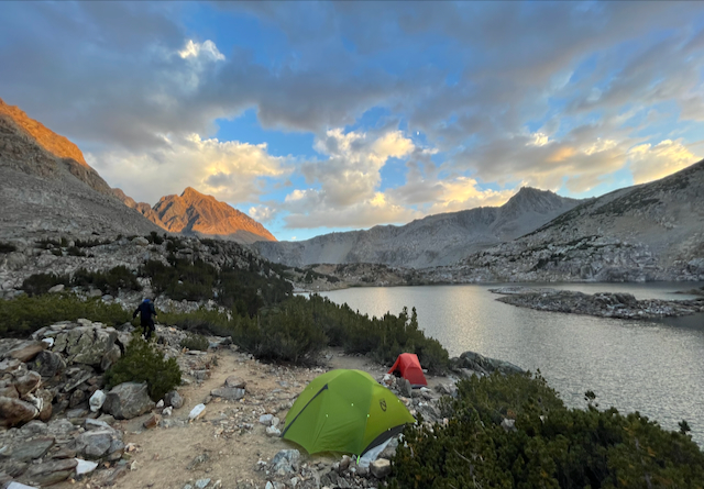
Desolation Wilderness
From August 14 to 17, 2023, I hiked with my son-in-law Jared and his brother Jordan for four days in Desolation Wilderness. We did a lollipop loop starting and ending at Echo Lakes, camping at Tamarack Lake, Dicks Lake, and Clyde Lake. There was still snow in places, owing to the huge winter accumulation. We had occasional showers and mosquitoes that were annoying but tolerable. This was my first good view of Desolation Wilderness and it certainly lived up to its reputation for beauty. It was crowded with campers around Lake Aloha but we only saw a few hikers elsewhere. Total backpacking distance was about 36 miles.
 Jordan, Jared and me at Echo Lakes trailhead.
 Jared and Jordan at Dicks Pass (9390 feet).
 Me in front of Lake Doris.
 Jared and Jordan with rain gear out for a brief shower.
 Lake Aloha from the north.
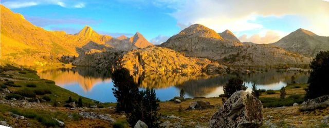
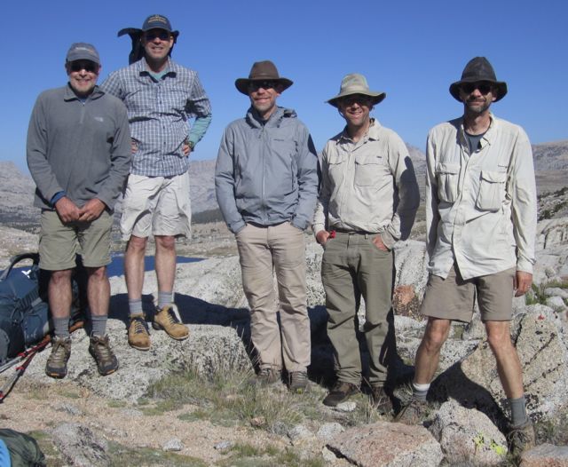
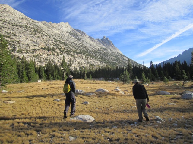
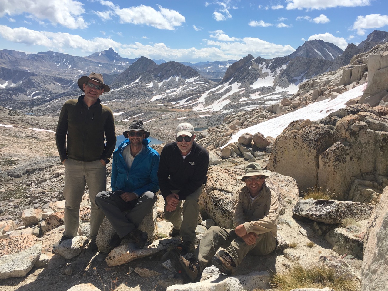
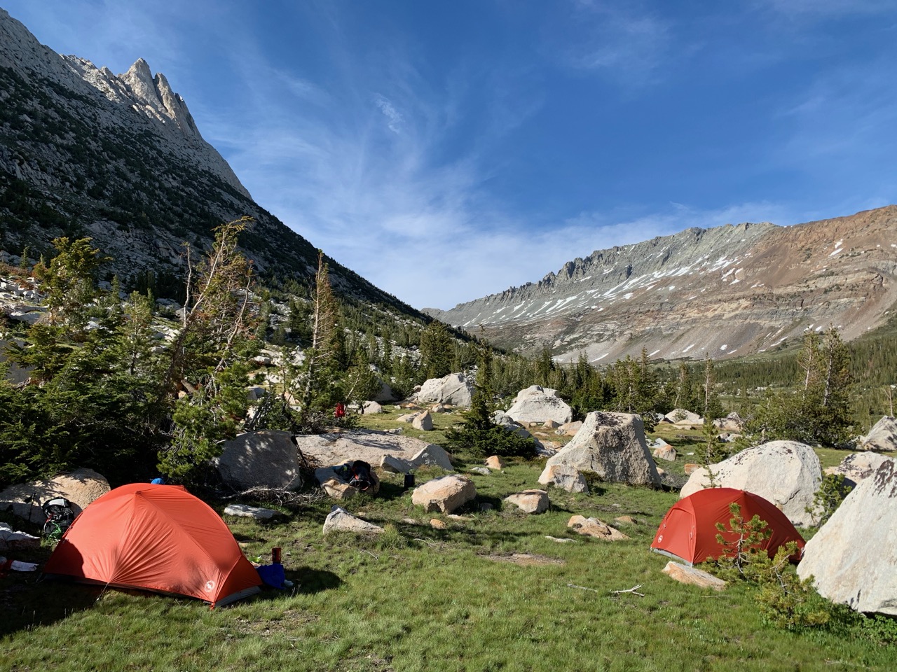
Sequoia Elizabeth Pass Loop
From September 3 to 9, 2023, I hiked with Jeff Gee, Tim Parker, and his daughter Cassie for a seven day loop trip, starting at Sequoia Park's Lodgepole Campground and ending at Crescent Meadow. We camped at Twin Lakes, Seville Lake, Roaring River, upper Deadman Canyon, Tamarack Lake, and Mehrten Creek. David Sandwell and Rob Mellors joined us for the first two camps. There was still some snow at higher elevations, owing to the 3x normal winter accumulation. This made for beautiful scenery, abundant wildflowers, and occasional mosquitoes. There were many uncleared fallen logs accross the trail from winter avalanches, which slowed us down at times. But Deadman Canyon, Elizabeth Pass, and the granite walls seen from the High Sierra Trail were stunning. Total backpacking distance was about 55 miles.
 Me, Tim, Cassie, Jeff, Rob and David setting out.
 Me at Seville Lake camp.
 Heading up beautiful Deadman Canyon.
 Flowers, rocks, and snow in Deadman Canyon.
 Camp at upper Deadman Canyon.
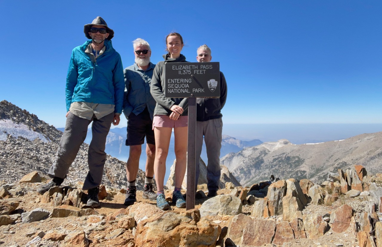 Me, Tim, Cassie, and Jeff at Elizabeth Pass (11,375 feet).
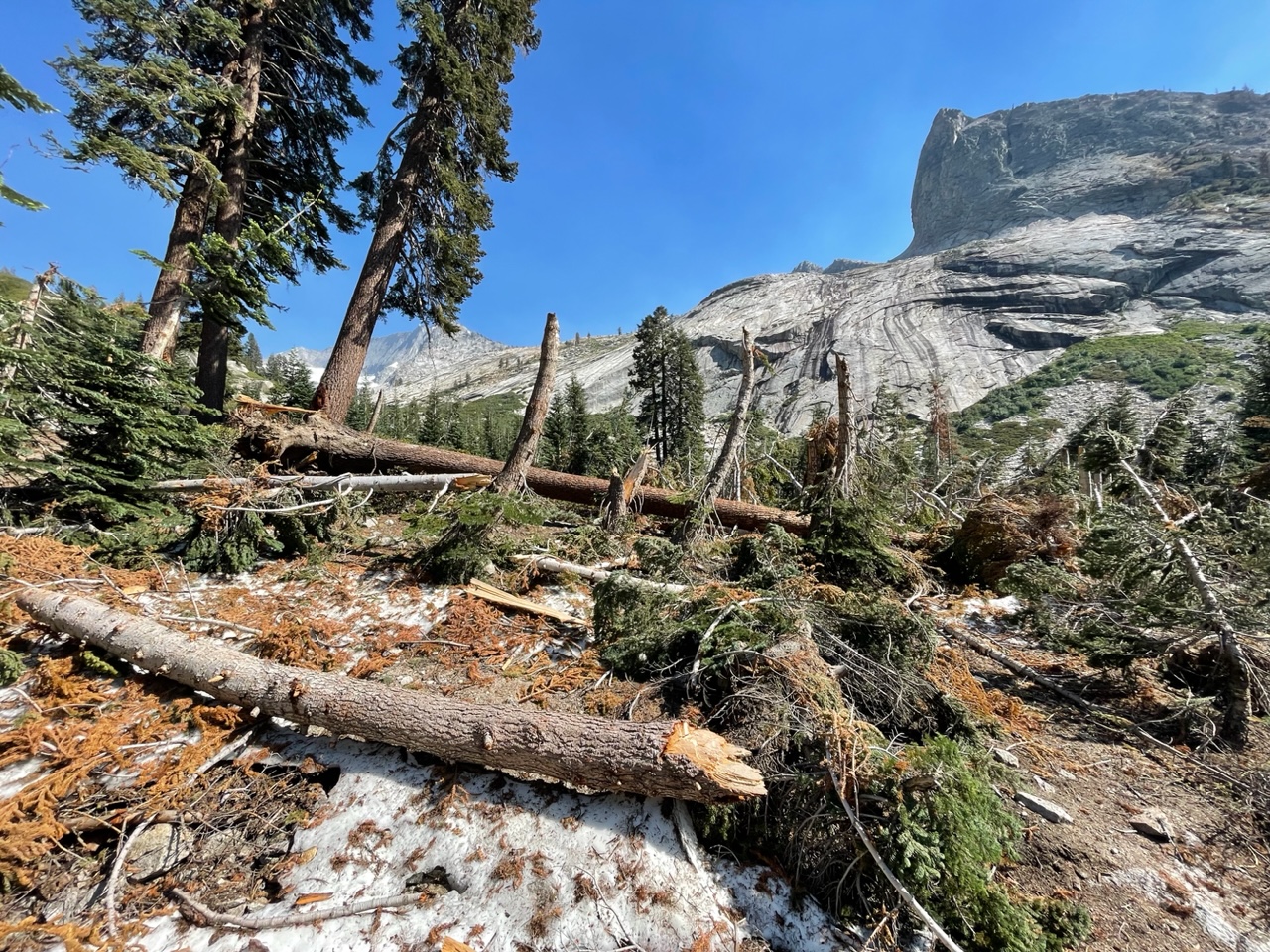 Avalanche debris on trail to Tamarack Lake.
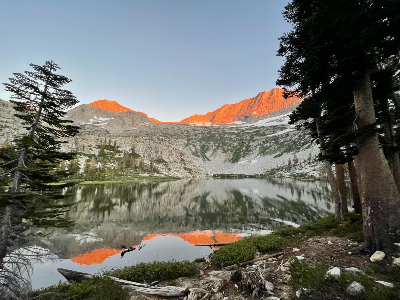 Tamarack Lake at sunset.
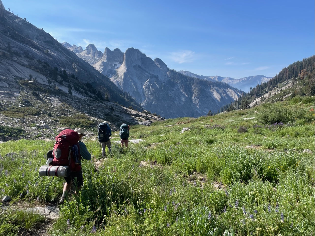 Descending toward the High Sierra Trail.
Emigrant Wilderness
From July 9 to 12, 2024, I hiked with sons-in-law Rob Little and Jared Hanson (with dog Tabby) for 4 days in the Emigrant Wilderness, just north of Yosemite. We started at the Gianelli Cabin trailhead and visited Y Meadow Lake, Deer Lake, Buck Lakes, Wood Lakes, Gem Lake, and Camp Lake, exiting at the Crabtree trailhead. Total distance was about 30 miles. Despite hotter than ideal conditions and occasional mosquito swarms, we had a great time, seeing many scenic lakes, granite domes, and very few people. This was my first trip to the Emigrant Wilderness and I would definitely come again, particularly because permits are freely given out with no trailhead quotas.
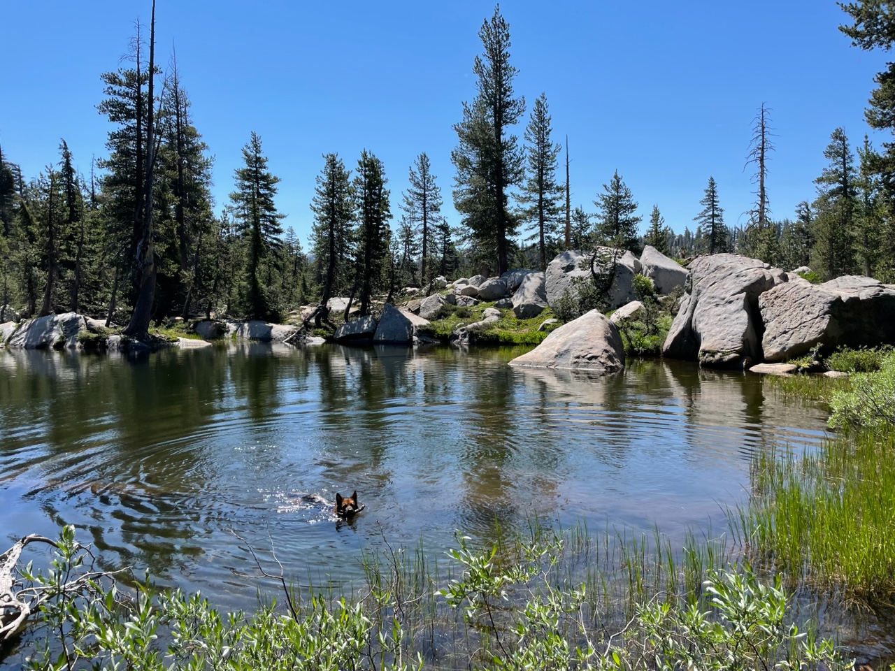 Tabby cooling off.
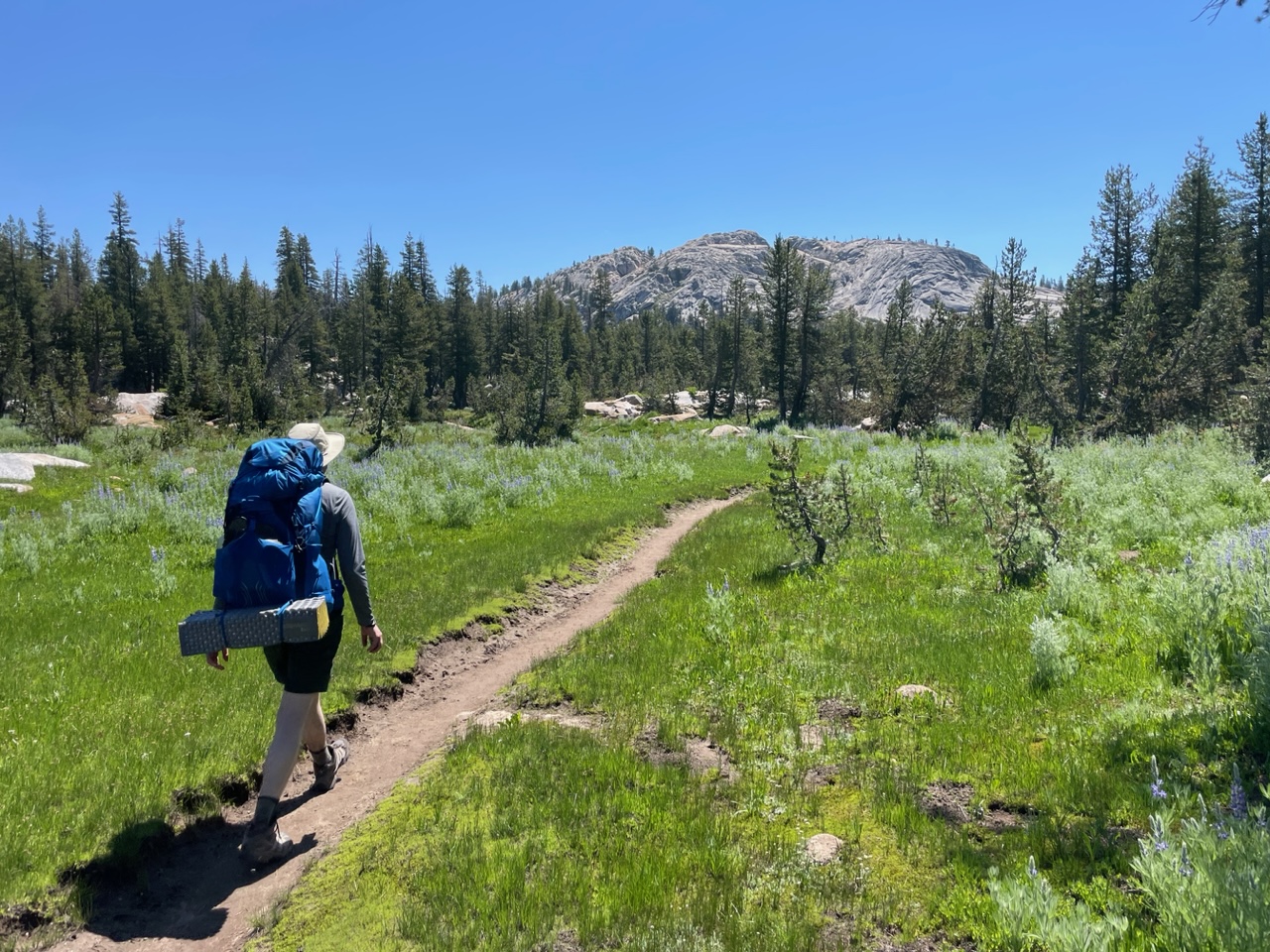 Rob on the trail.
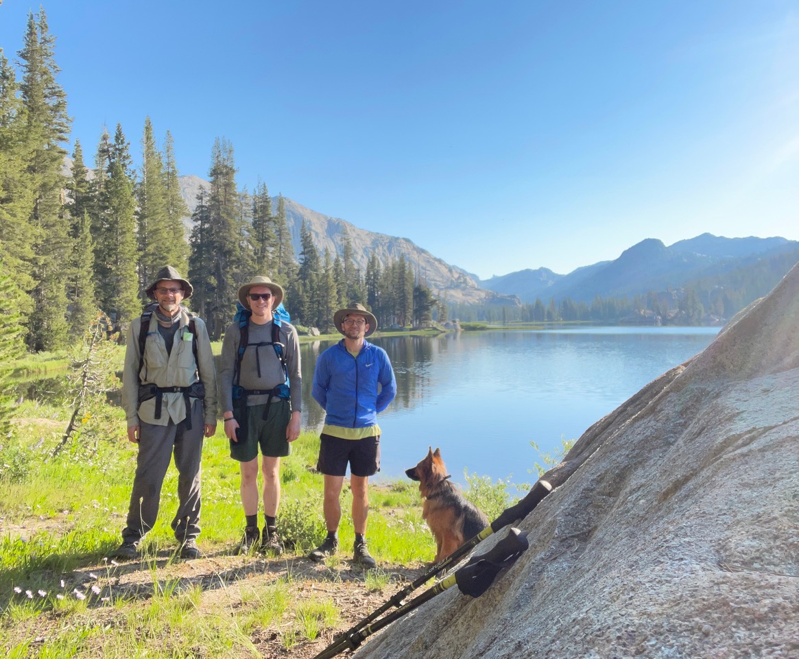 Me, Rob, Jared, and Tabby at Buck Lake.
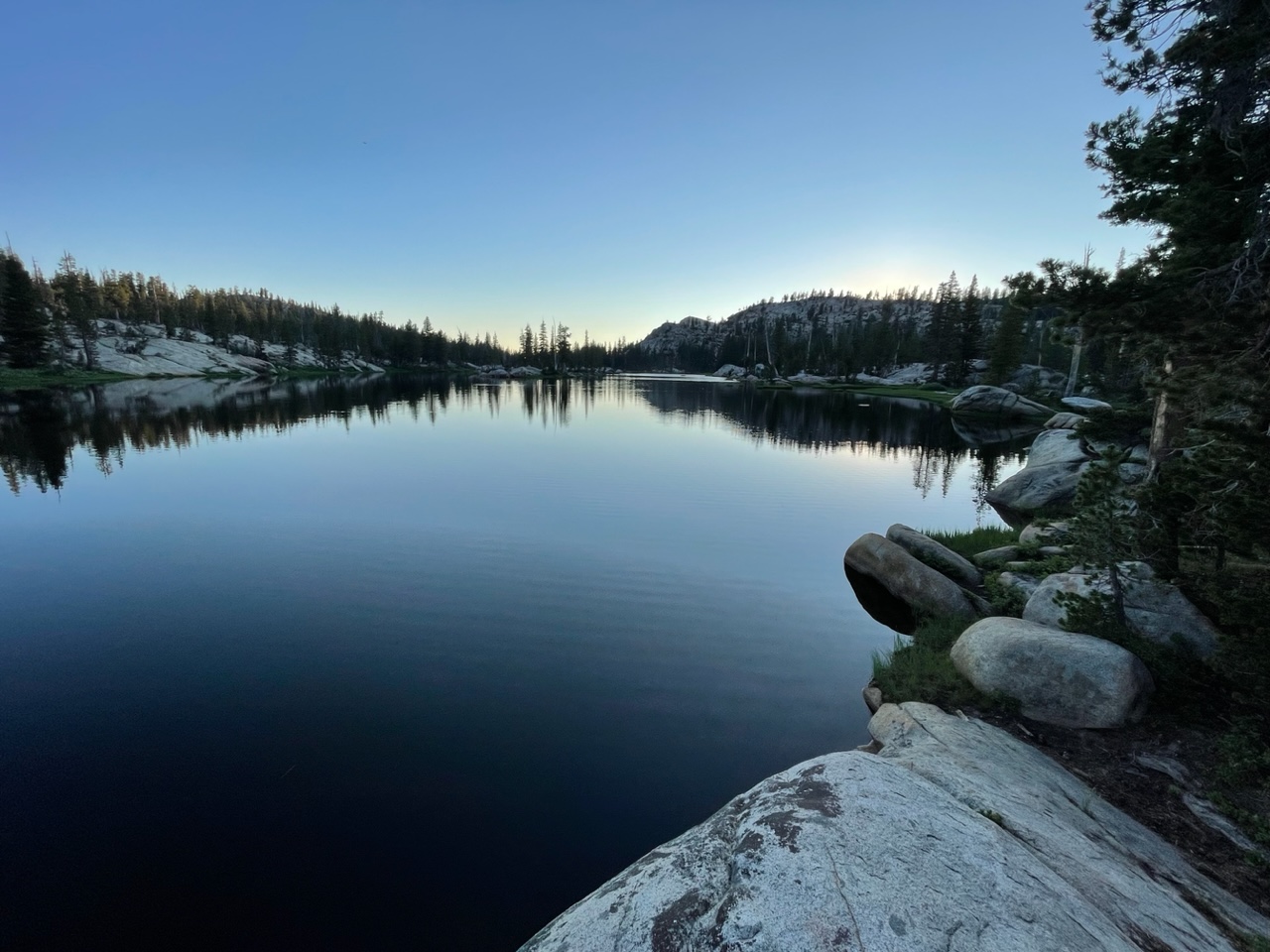 Dusk at Deer Lake.
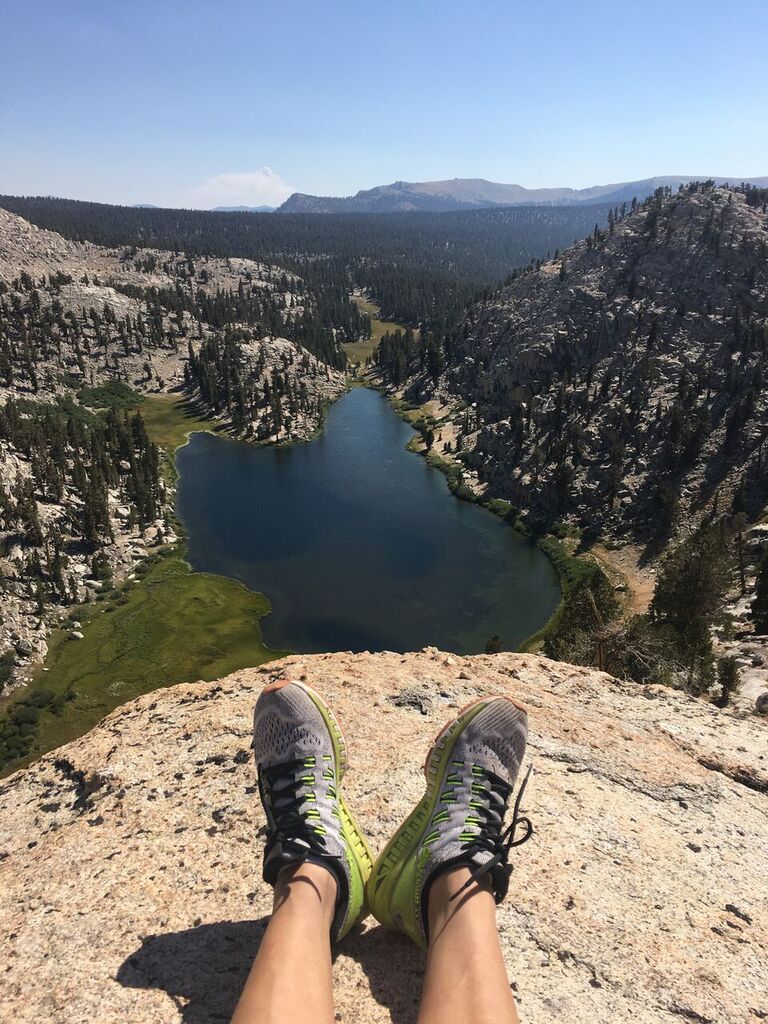
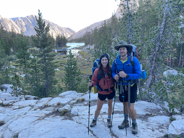
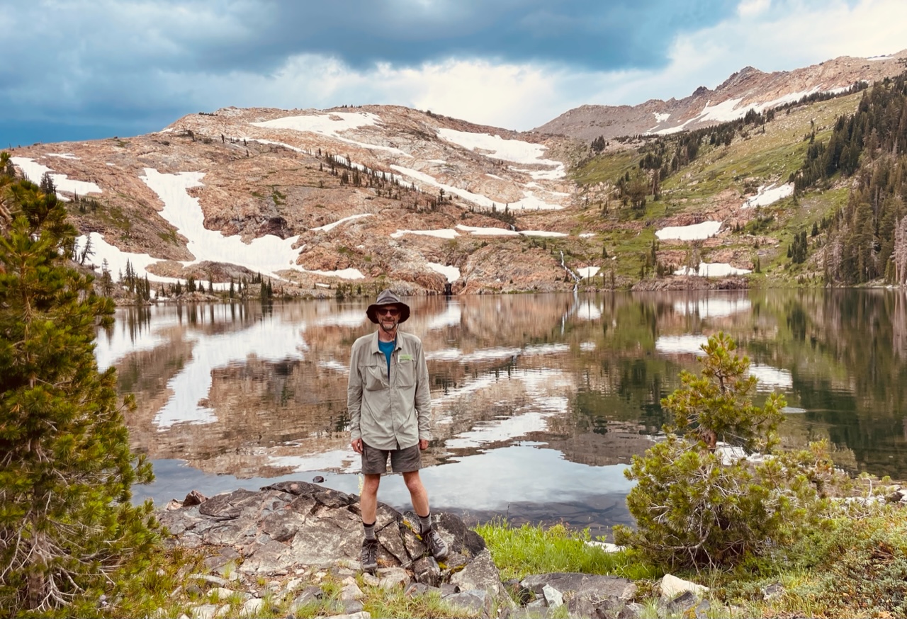
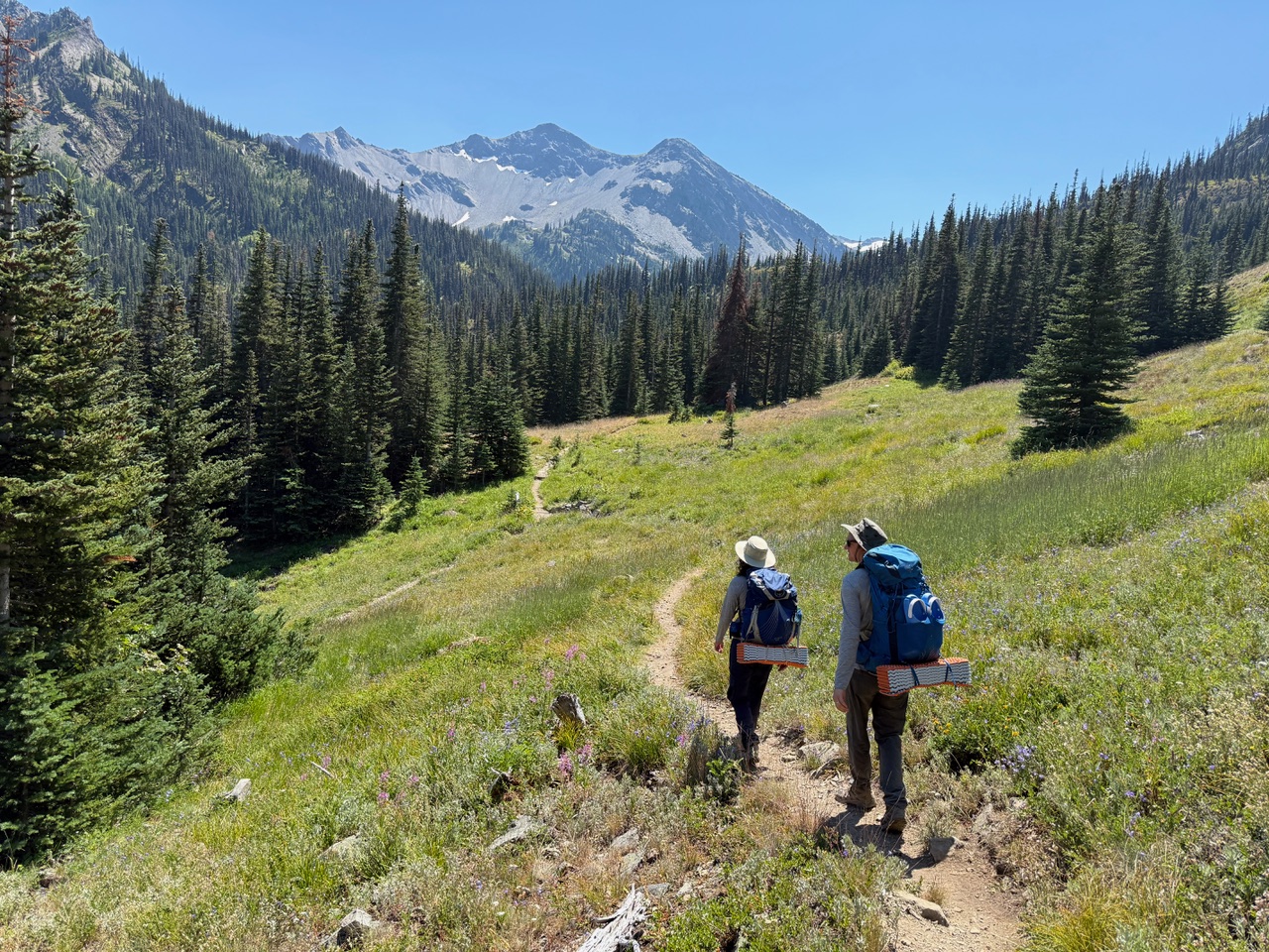
Olympics Grand Valley Trail
On July 28 to 29, 2025, I hiked with my daughter Rachel and her husband Rob for two days in Olympic National Park in Washington state.
We started at the Obstruction Point Trailhead and hiked south on the Grand Pass Trail to camp at Gladys Lake. The next morning we hiked up to Grand Pass, where the views were unfortunately obscured by smoke that had blown in overnight. We then backtracked and took the Badger Valley trail back to our car. The weather was good and the mosquitos were tolerable. This was my first visit to the Olympics, which are very beautiful but different-looking than the Sierra granite of my typical mountain hiking trips.
 Rachel and Rob at start of hike, glaciated Mount Olympus in background.
 Heading out.
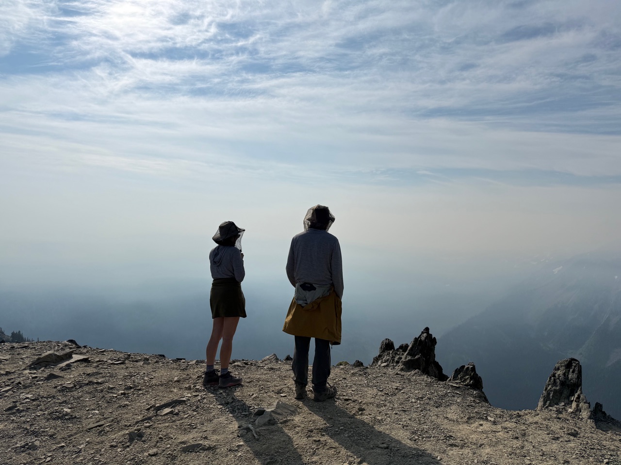 The stunning view from Grand Pass.
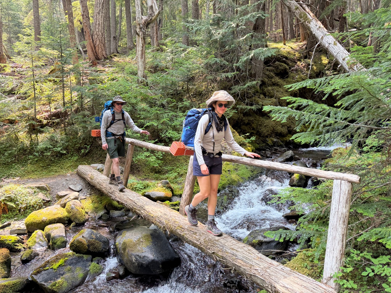 Crossing Grand Creek.
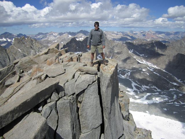
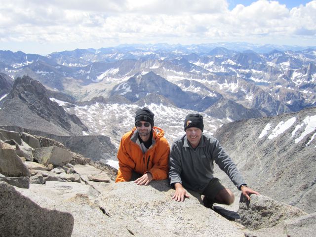
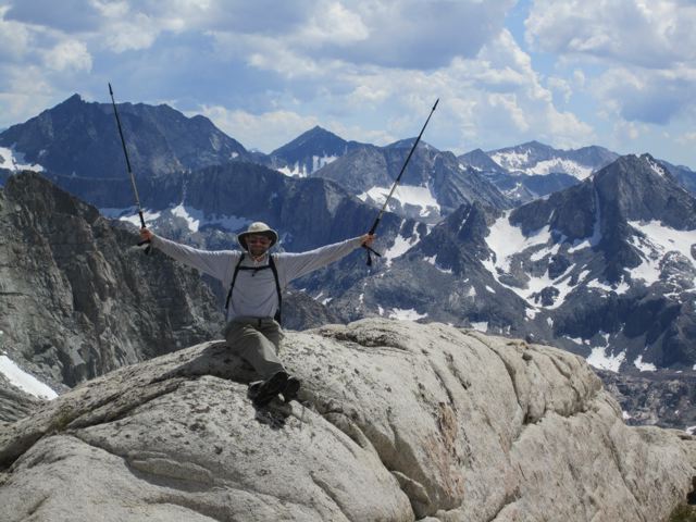
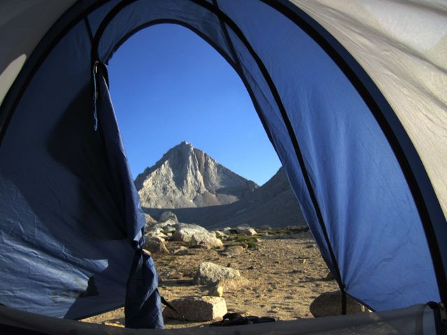
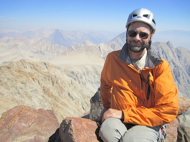
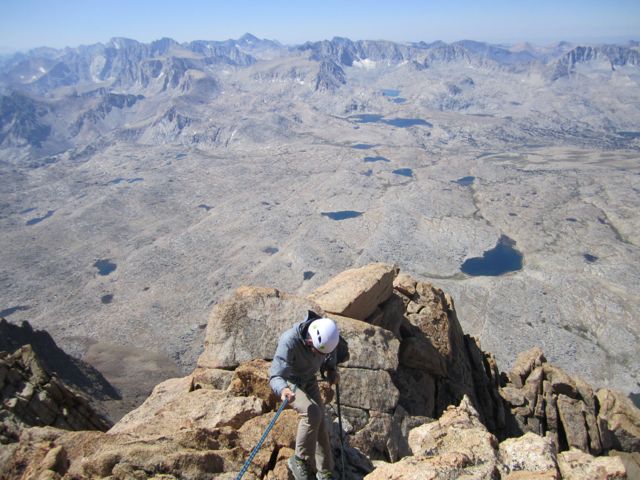
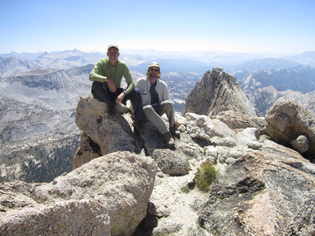
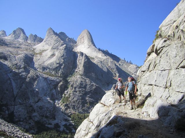
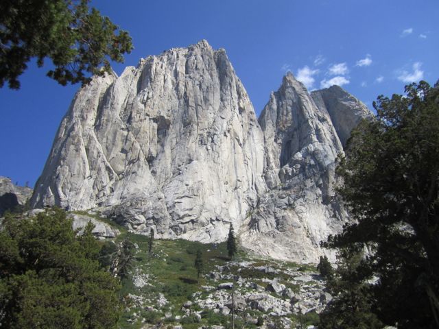
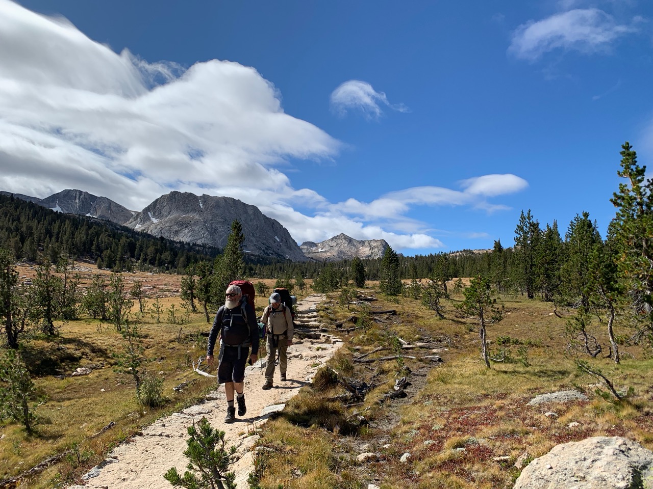
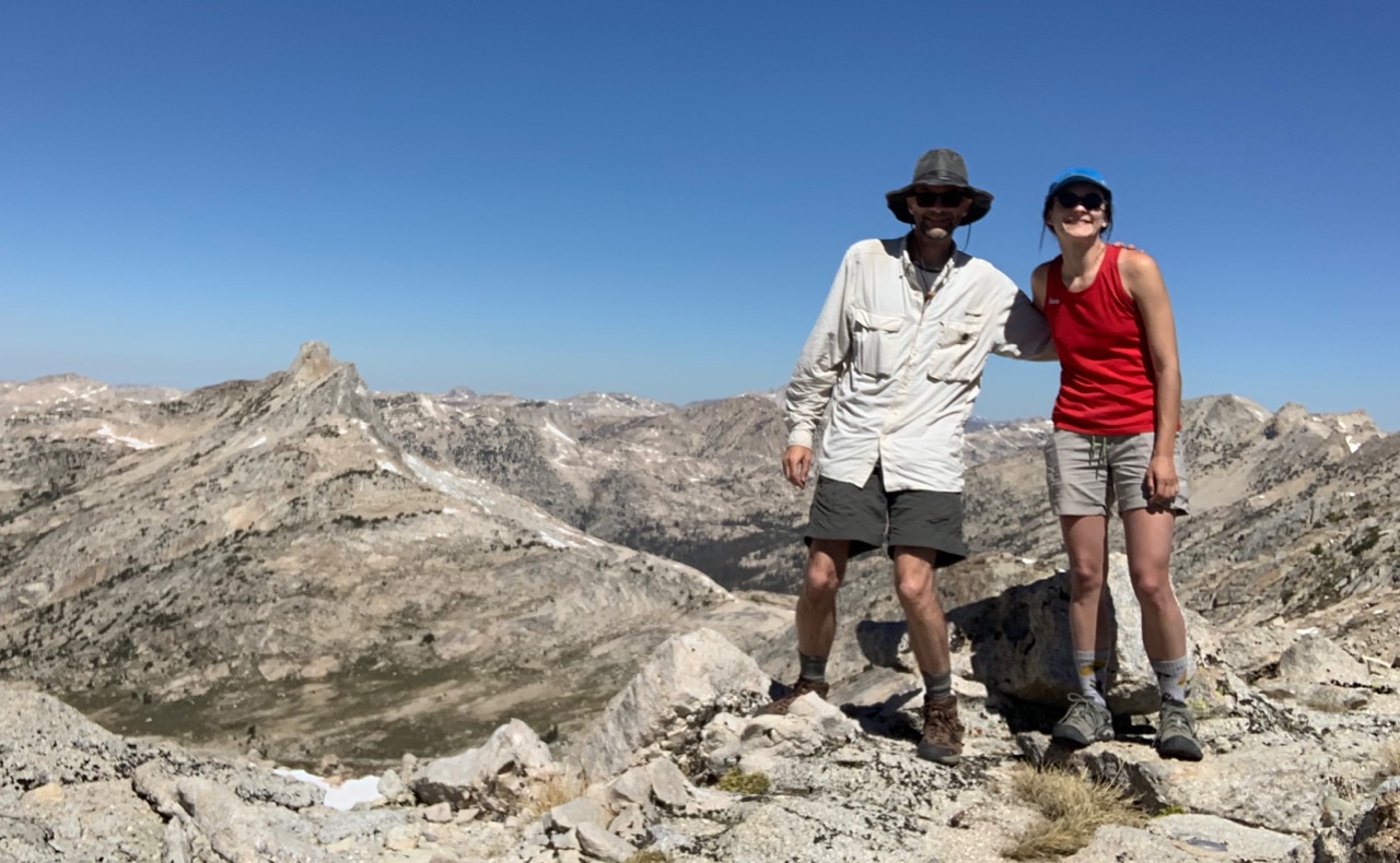
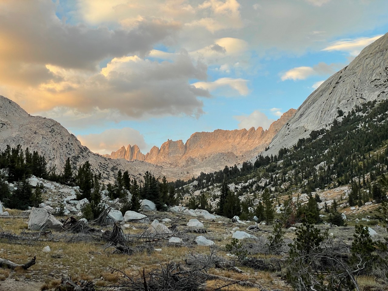
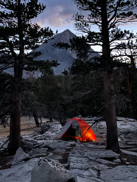
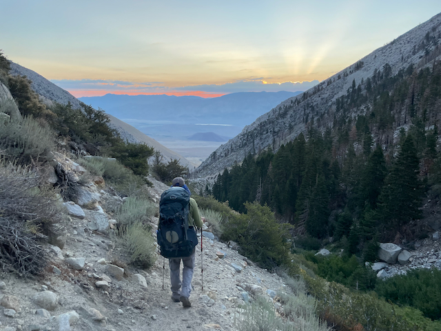
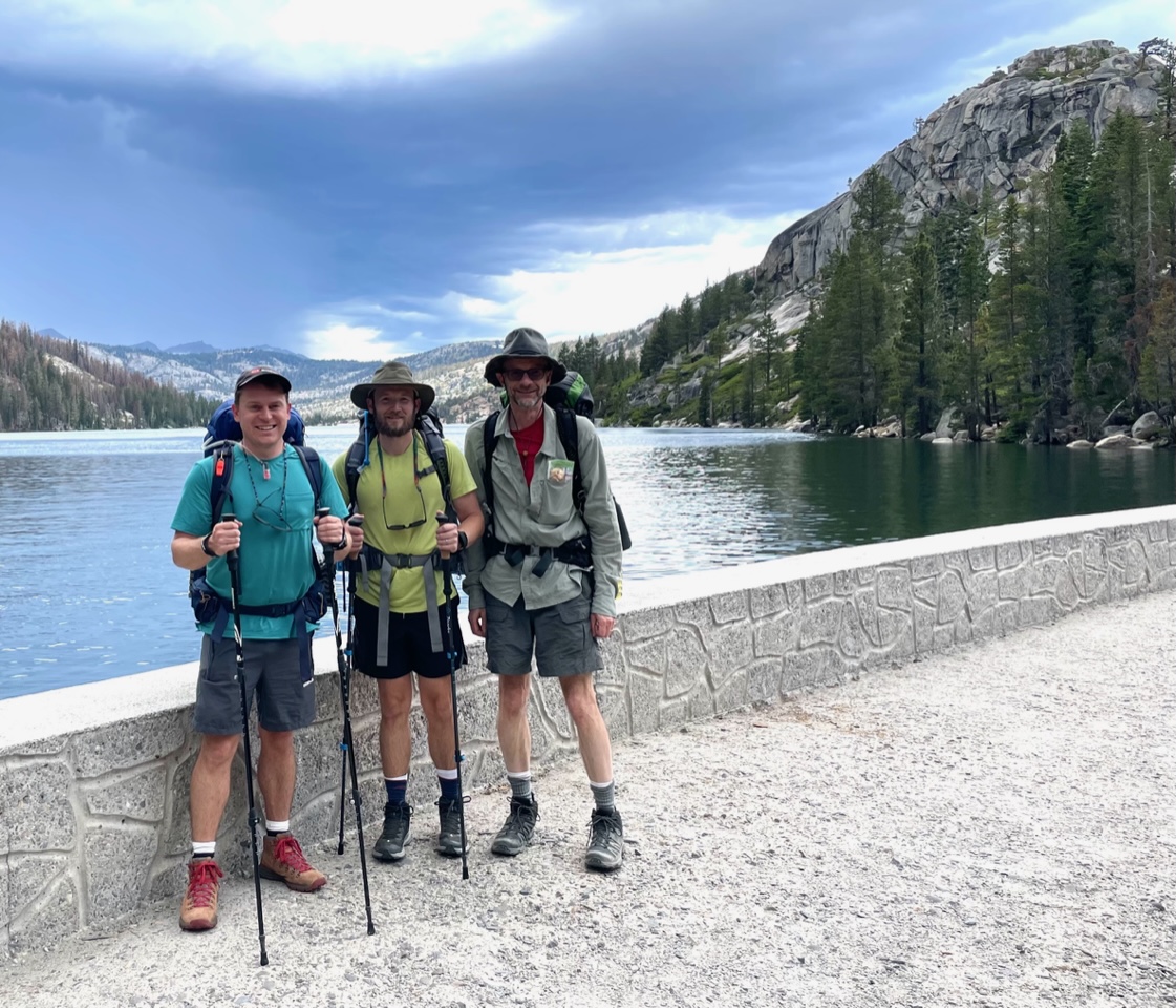
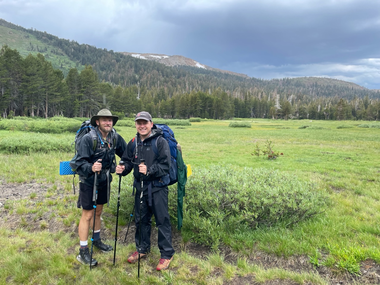
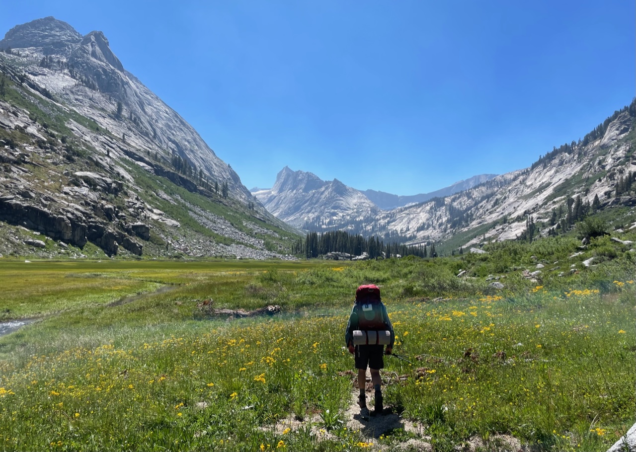
Matterhorn Peak Climb
On September 14 to 16, 2025, Jeff Gee and I climbed the North Arete of Matterhorn Peak in northern Yosemite. We left a car at Twin Lakes and camped for two nights at the recommended lake at 9850 feet. We completed the climb but did not get back to camp until 10 pm, completely exhausted. Our progress was slowed by a horrendous expanse of unstable talus below the peak, a final pitch that seemed notably harder than the 5.7 rating, and confusion regarding the best descent route. Advice to future parties: (1) Go in July, not September, so that hopefully snow covers the talus. (2) Simply descend off the back side of the peak, then traverse over to the gully that leads back to the start of the climb.
 Matterhorn peak at dusk from approach campsite (telephoto view).
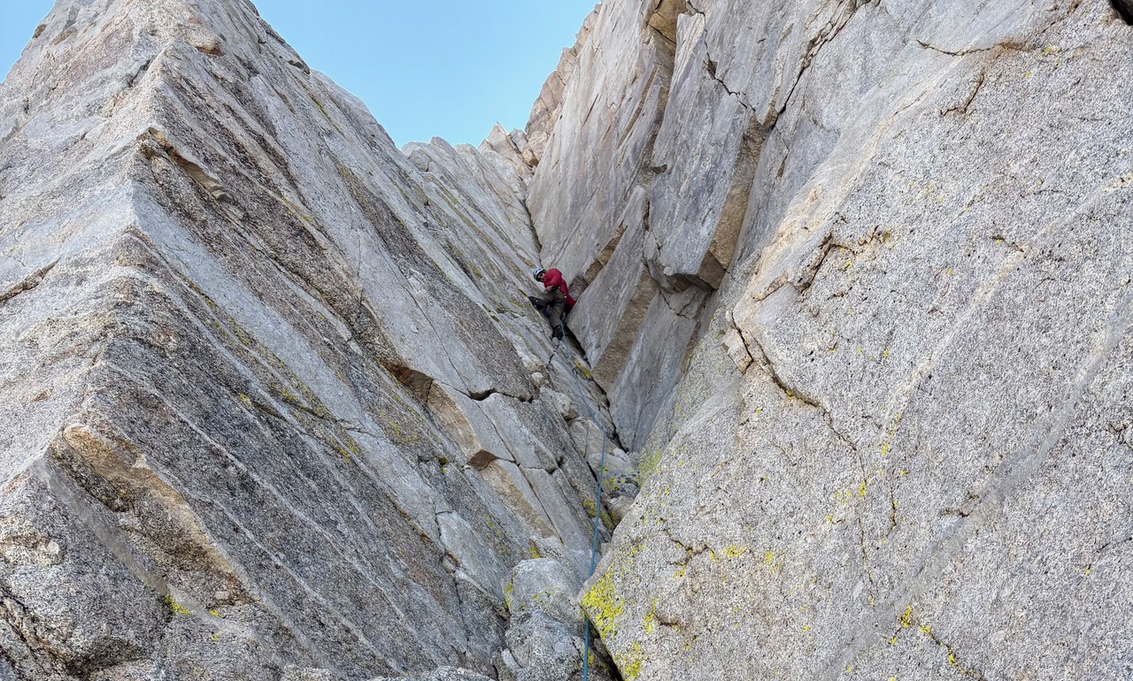 Peter approaching the crux on the final pitch.
 Success!
 Looking down at the evil scree slope during the descent.
 Our camp at dawn after the climb, Matterhorn Peak in background.
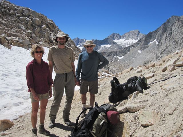
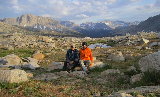
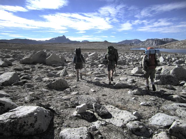
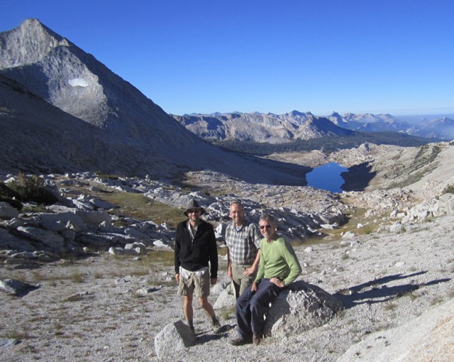
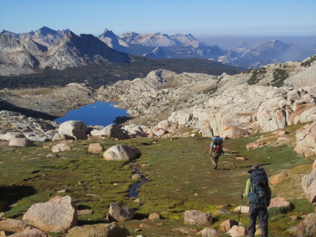
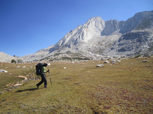
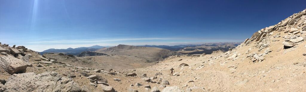
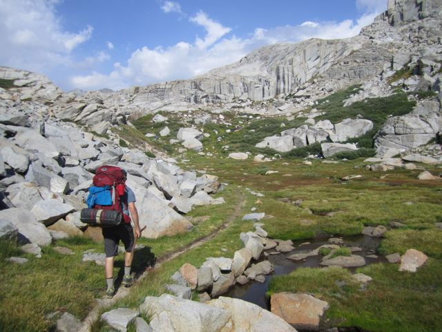
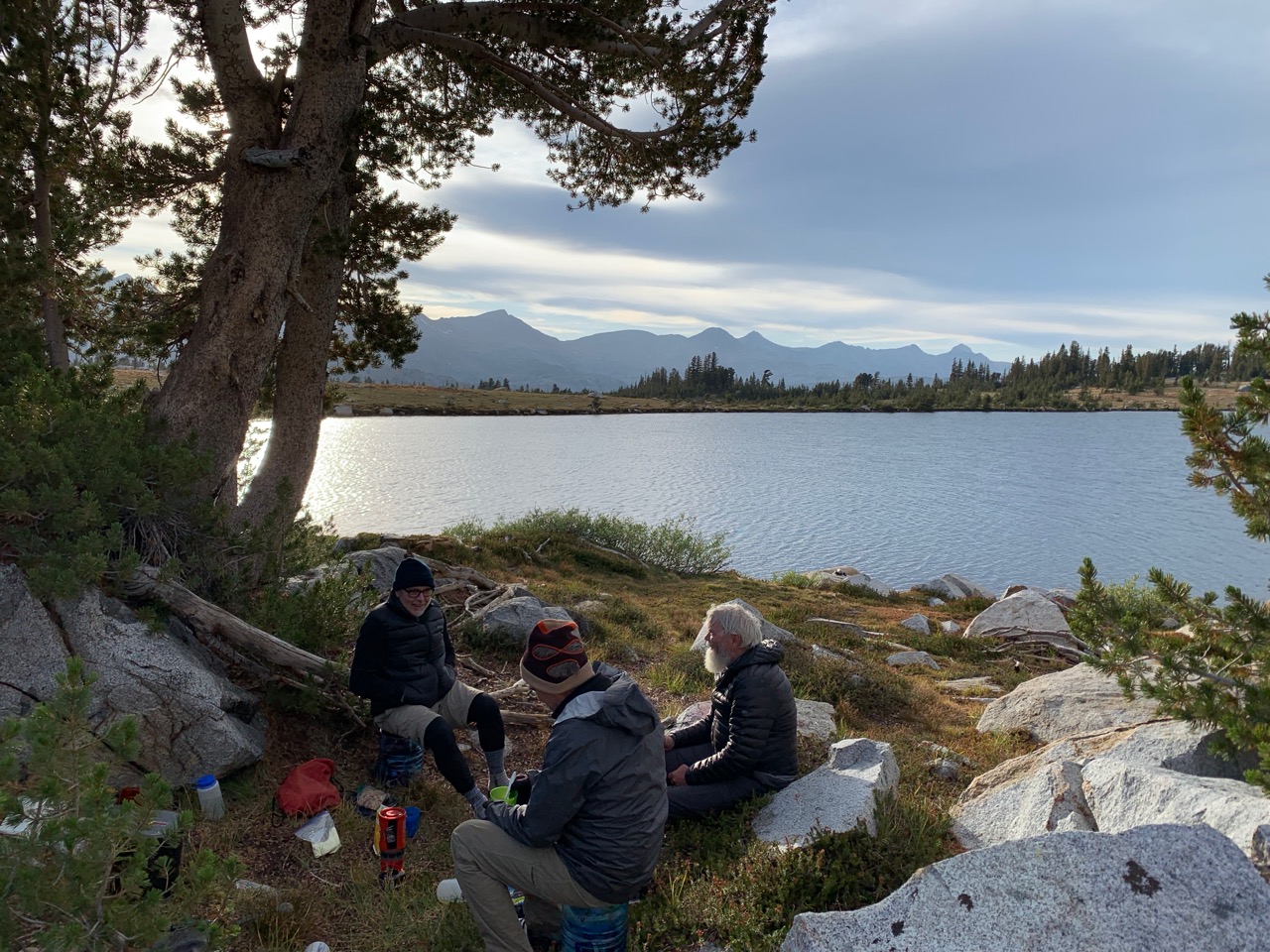
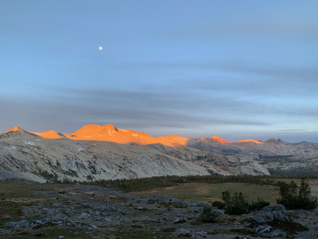
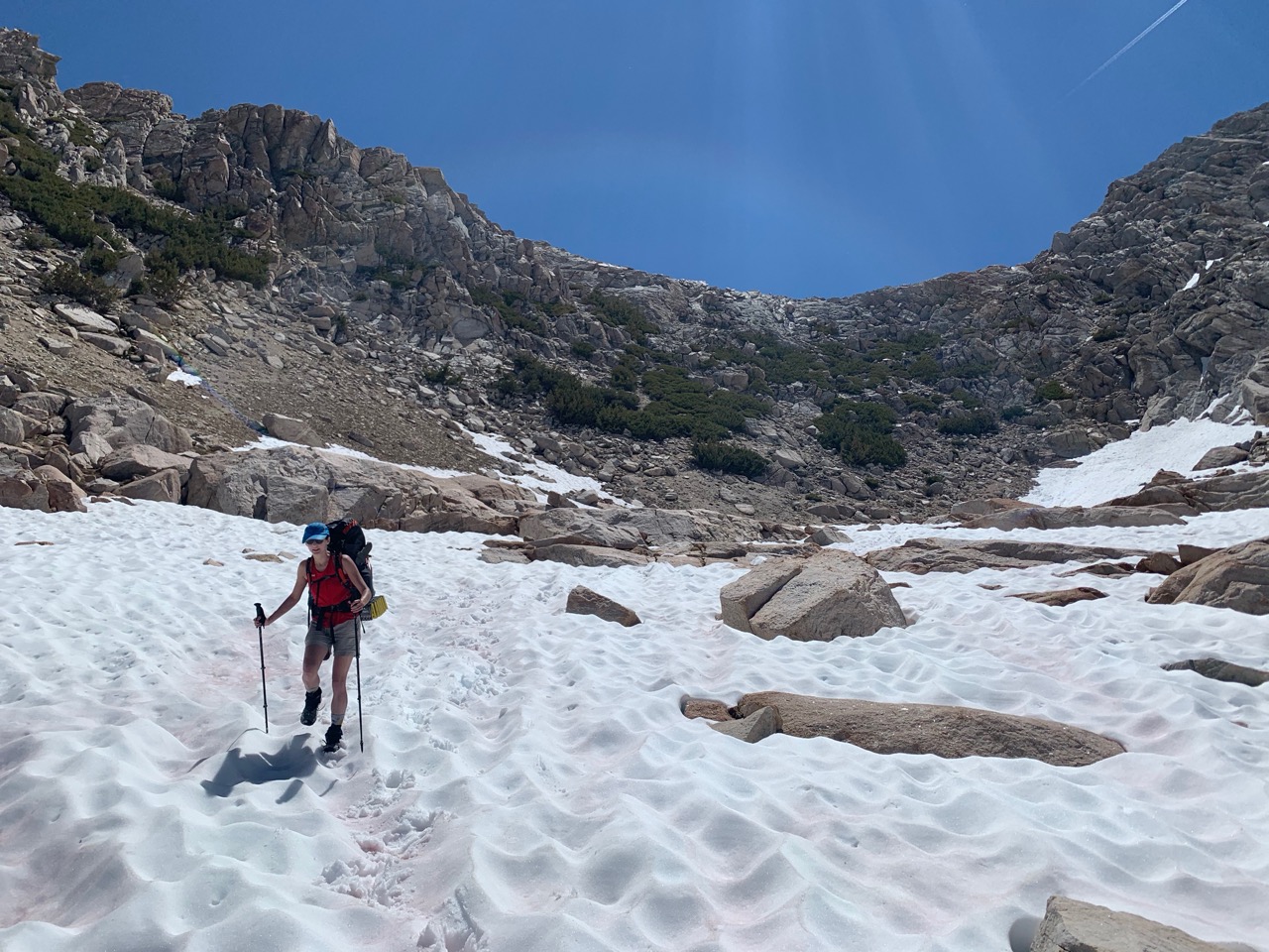
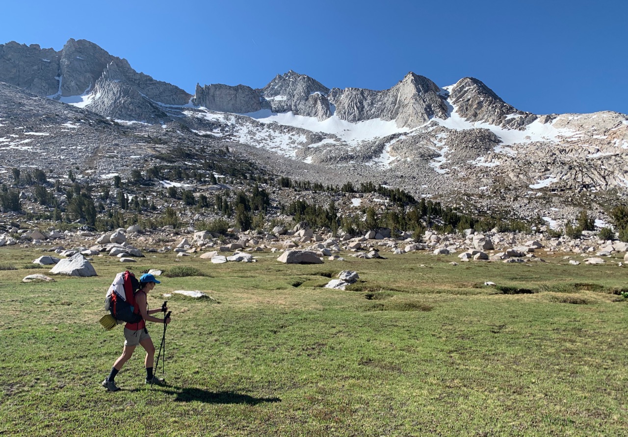
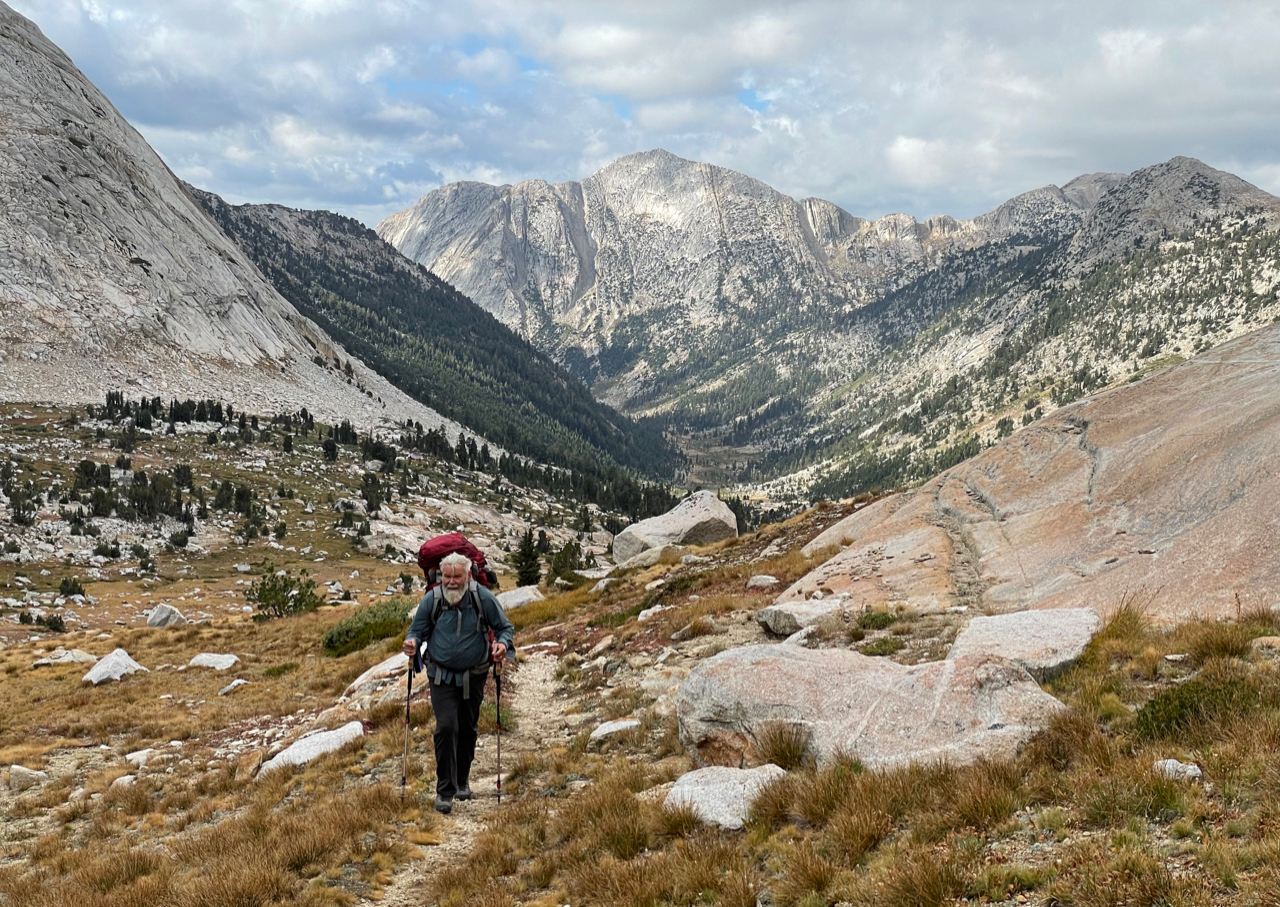
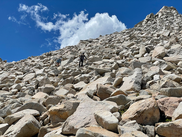
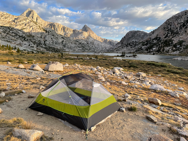
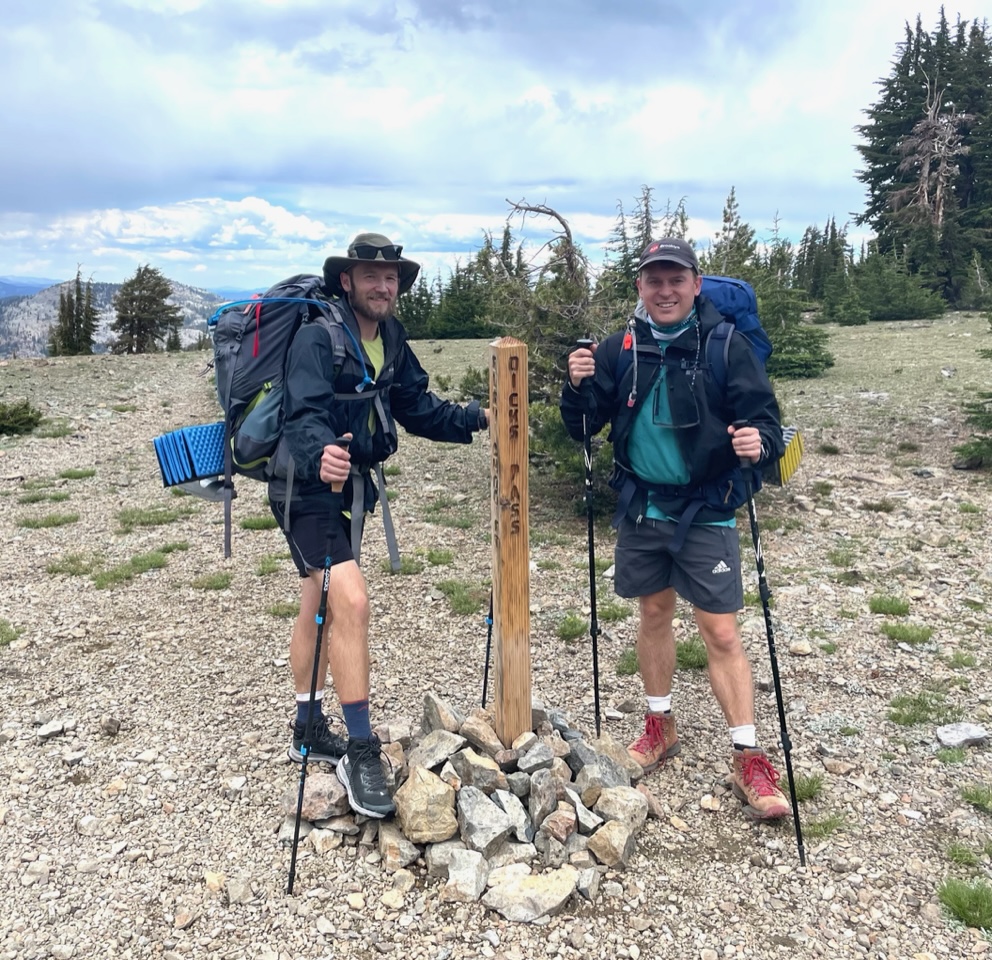
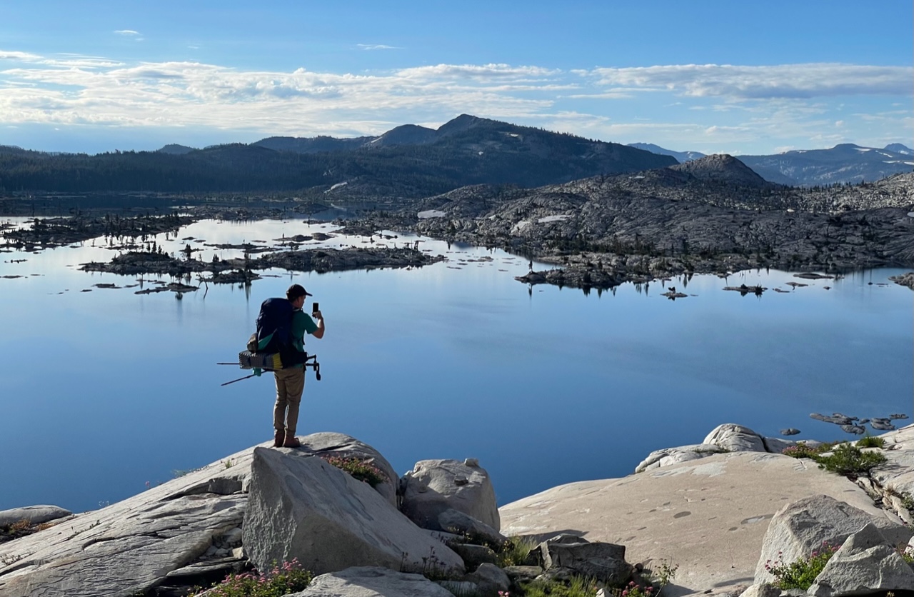
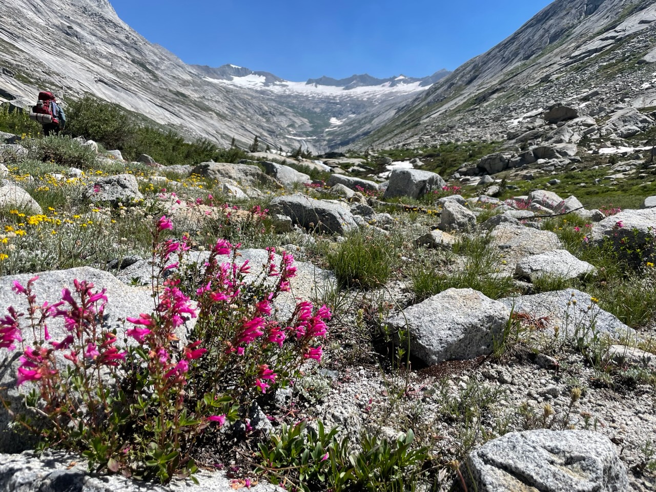
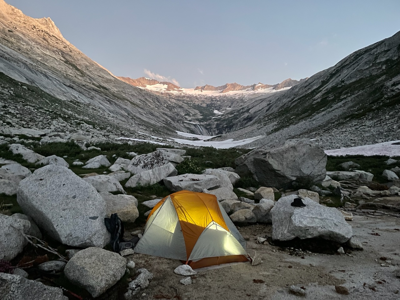
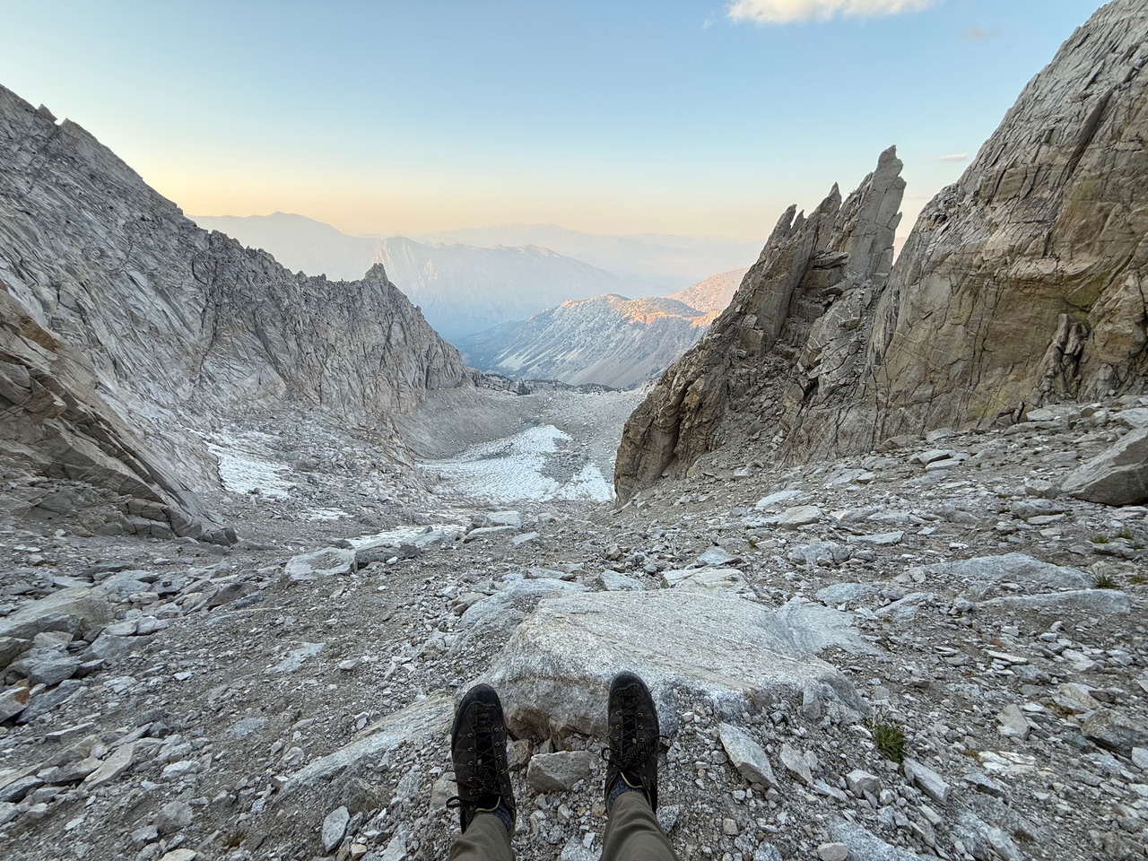
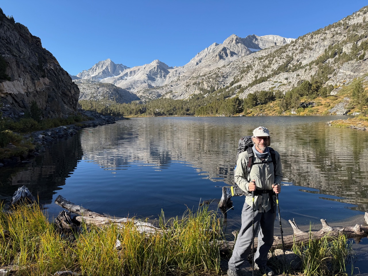
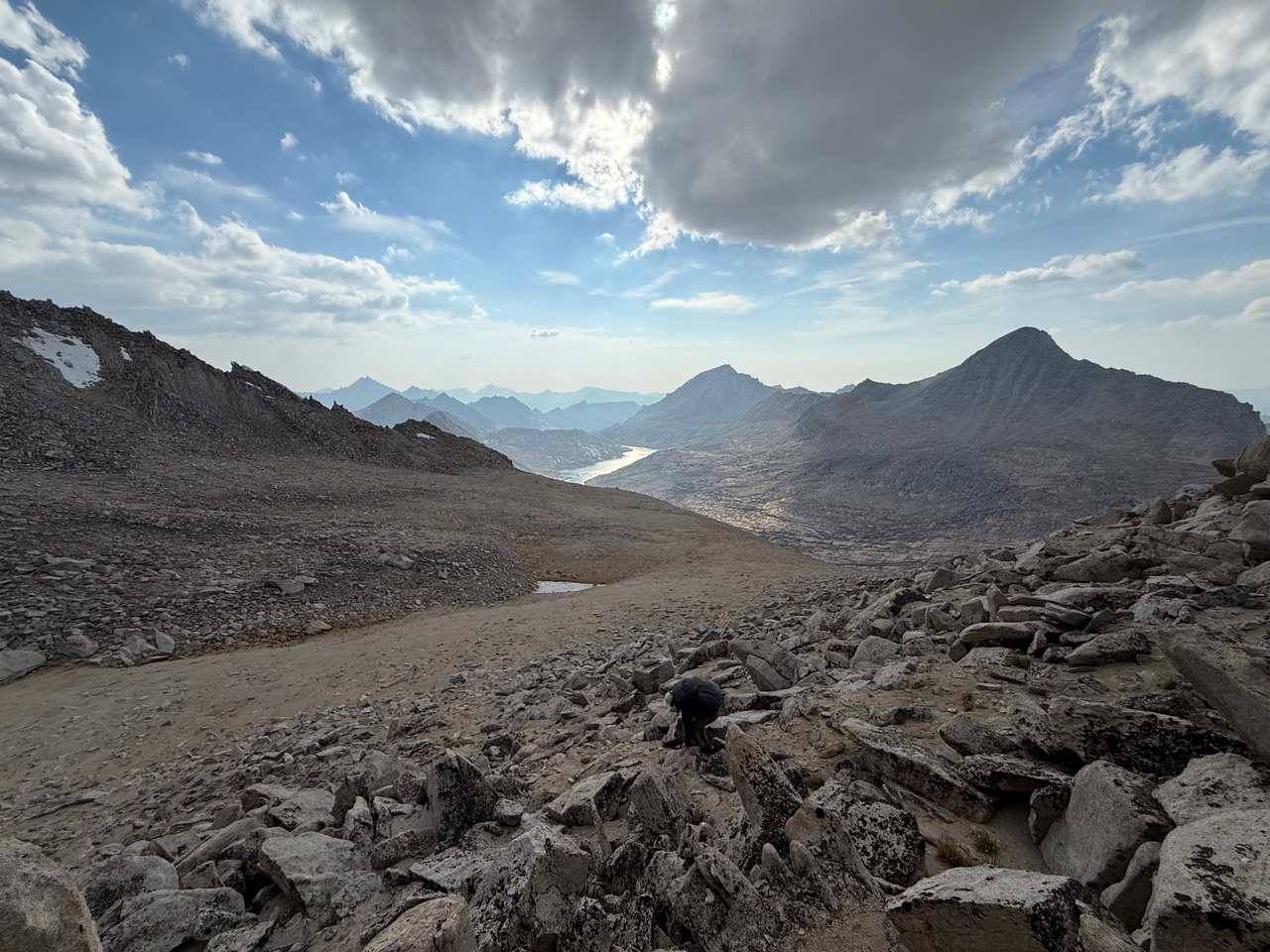
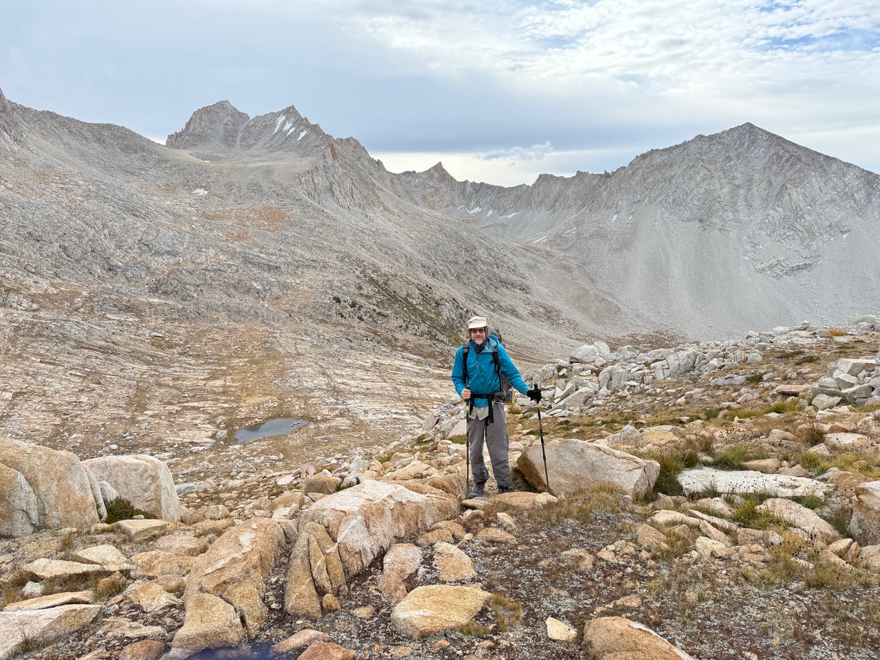
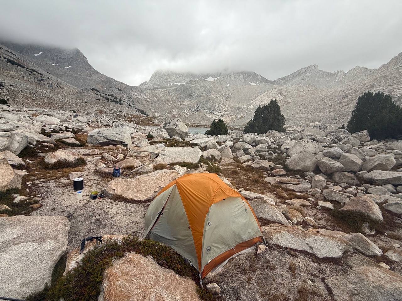
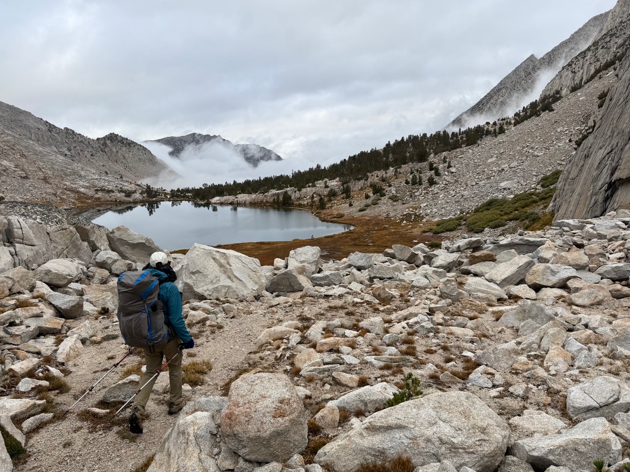
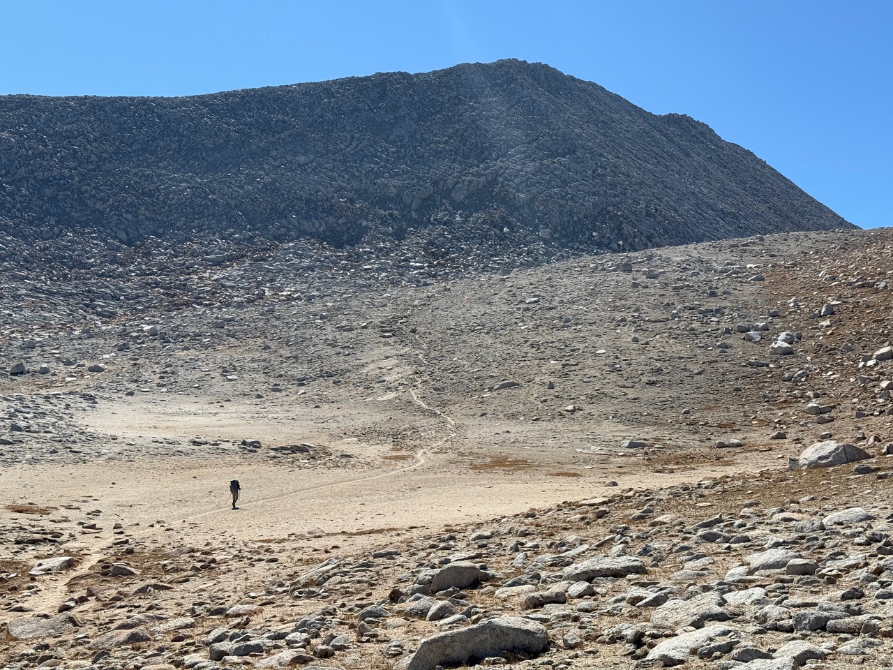
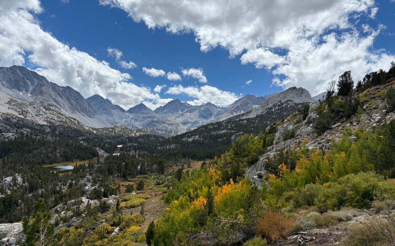
North Col and Gabbott Pass Loop
On September 16 to 20, 2025, Jeff Gee and backpacked for 5 days out of Mosquito Flat. We hiked up Little Lakes Valley and camped at Box Lake, then continued to Gem Lakes and cross-country to Dade Lake and over North Col and Gabbott Pass, descending to the Mills Creek Lakes and the Second Recess, before returning via Mono Pass. We endured rain late on day 3, continuing through day 4, during which time I learned my jacket had lost its waterproofing. But we dried out on the last day and had beautiful weather over Mono Pass. It was a great trip, although we found the talus below North Col more annoying than usual, given our Matterhorn Peak experience a few days before.
 At Long Lake. North Col is along the sunlit ridge to the right of Bear Creek Spire, the leftmost peak.
 The view west toward Lake Italy from North Col.
 Ascending Gabbott Pass. We camped the night before at the lake to my right. North Col is along the ridge at the upper left.
 Our camp at Upper Mills Creek Lake.
 Descending toward Lower Mills Creek Lake.
 Jeff traversing the moonscape near Mono Pass.
 Beautiful Little Lakes Valley.