Imaging the Sumatra rupture with Hi-Net seismic data
Miaki Ishii, Peter Shearer, Heidi Houston and John Vidale
University of California, 15 February 2005
We have imaged the high-frequency radiation from the 2004 Sumatran earthquake using seismograms from the 700 element Hi-Net array in Japan. Our approach makes no a priori assumptions regarding the fault location or geometry, nor the event timing. Our main results so far include:
-
The rupture progressed steadily from south to north during the 8-minute-long event.
-
The rupture extended for about 1300 km, coinciding closely with the aftershock zone.
-
The rupture velocity averaged 2.8 km/s, with similar velocities across the northern and southern parts of the fault.
-
Bursts of high-frequency radiation occurred about 80 s and 300 s after the earthquake started.
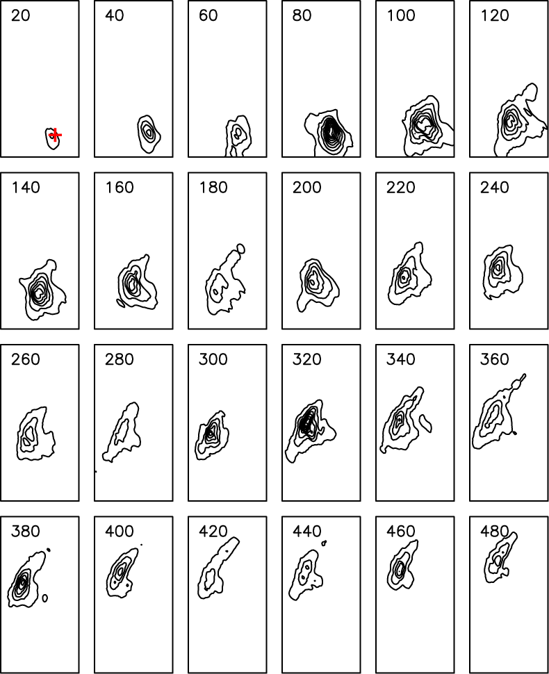 Figure 1. Maps of radiated energy at 20 s intervals. Each frame is 1000 km wide by 2000 km high. The epicenter is shown as the red "+" in the first frame. Note the steady progression of rupture from south to north and the bursts of energy near 80 and 300 seconds.
Miaki Ishii and Peter Shearer
U.C. San Diego
mishii@ucsd.edu, pshearer@ucsd.edu
Heidi Houston and John Vidale
U.C. Los Angeles
heidi@moho.ess.ucla.edu, vidale@moho.ess.ucla.edu