Rupture characteristics of M7.1 Hector Mine earthquake from inversion of InSAR and GPS data
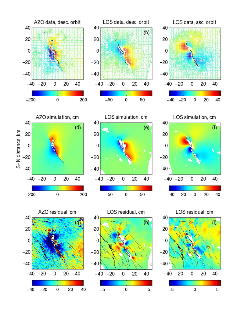
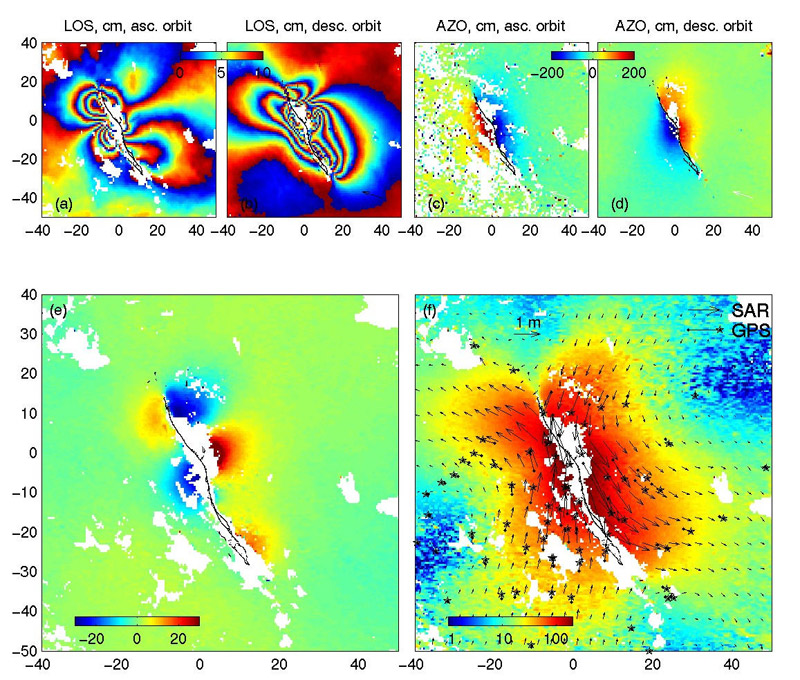
The October 16, 1999 magnitude 7.1 Hector Mine earthquake occurred in the Mojave desert, southern California. It ruptured several faults having total lenght of ~45 km. (Some results of seismological and geological investigations of this event are available here). The Hector Mine earthquake was the first earthquake for which the complete 3-D surface displacement field was derived from the SAR data. First panel shows the observed satellite line-of-sight (LOS) displacements, and azimuthal offsets (AZO), in cm, from the descending and ascending orbits (top row), and three-component surface displacements (vertical and horizontal) obtained from inversion of the SAR data (bottom row).
For more details please see this paper.
Colors show the displacement amplitude (note the logarithmic scale in case of horizontal displacements), and arrows show a sub-sampled set of displacement vectors obtained from the SAR data. For comparison, the available co-seismic GPS data are denoted by starred arrows.
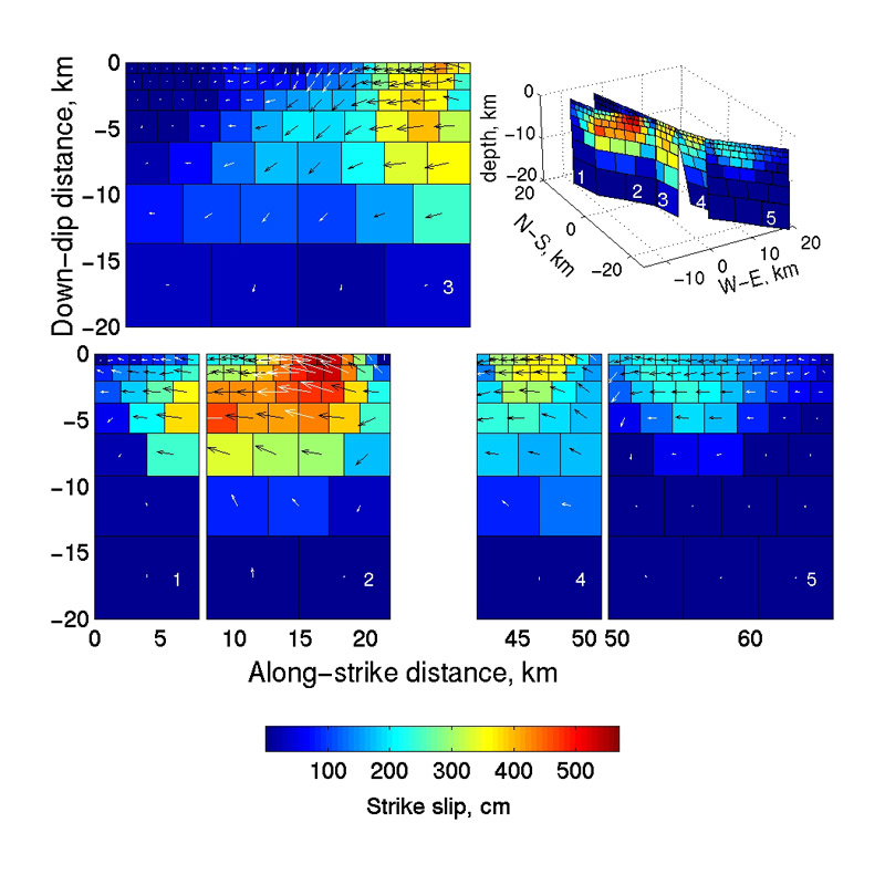
We use the surface displacement data to deduce the rupture geometry and slip distribution through a non-linear least square minimization. Results of our inversion are shown in the bottom figure . Colors denote strike-slip component of fault displacement in cm, and white arrows show the sense of slip (on the western side of the fault, viewed from the west). An inset in the upper right corner is a perspective view from the South-West showing the geometry of sub-faults.
The InSAR data, the best-fitting model, and the residual are shown below.